
- ✓ This is a go/no-go road, not a sightseeing route: winter tires or chains are mandatory November 1 to March 31, there is no fuel and no cell service between Lake Louise and Jasper, and ploughing stops at 3:30 PM. If any one of those worries you, don’t go that day.
- ✓ The Columbia Icefield Centre and Skywalk are closed all winter (2026 season: May 1 to October 12) — but the roadside viewpoint still delivers the glacier view, free, from the pullout.
- ✓ The payoff is Abraham Lake: a short detour east from Saskatchewan Crossing to a frozen reservoir full of trapped methane bubbles, best from mid-January to mid-February. That’s the photo you came for.
Here’s the deal with the Icefields Parkway in winter: it’s the same 232 kilometres of jaw-dropping road you’ve seen in every summer photo, except now it’s empty, it’s −25°C, and there’s nobody out there to help you if you get it wrong. I’ve driven it twice in winter now — once in late January, once in early March — and both times it was the best drive of the trip and the one I thought hardest about beforehand. That’s the honest shape of it. Worth it. But only on the right day, in the right rig, with a full tank.
My first winter run taught me the fuel lesson the expensive way. I left Lake Louise with the gauge at just over half, figuring I’d fill up at Saskatchewan Crossing like I had in July. There is no fill-up at Saskatchewan Crossing in winter. There is no fill-up anywhere until Jasper. I spent the last 100 kilometres doing mental arithmetic on a gauge that kept dropping faster than the kilometres did, and I rolled into Jasper with the low-fuel light on and a new personal rule: the Parkway starts with a full tank or it doesn’t start. I’ve made this mistake so you don’t have to.
This guide is the one I wish I’d read before that first run. It’s a go/no-go safety guide first and a sightseeing list second: the tire rule, the fuel rule, the daylight rule, the avalanche reality — then the seven stops that make the drive worth it, including the Abraham Lake bubbles at the end. Every fact about closures, tires, and ploughing hours was checked against Parks Canada’s winter driving pages in November 2026, and I’ve linked the official pages so you can check them again the morning you drive. Conditions change daily up there. This guide doesn’t.
The go/no-go test: should you drive it at all?
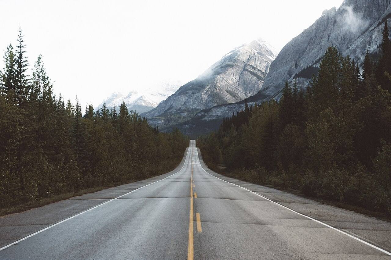
Before the scenery, the decision. The Parkway in winter is a 232-kilometre stretch of Highway 93 North between Lake Louise and Jasper, through Banff and Jasper national parks. Parks Canada keeps it open year-round, but “open” is doing a lot of work in that sentence. Here’s the test I run the morning of, in order. One “no” and I don’t go.
| Go/no-go check | What “go” looks like |
|---|---|
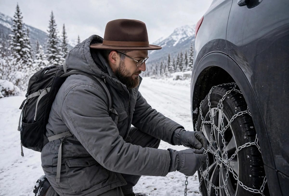
| 1. Tires | Winter tires (mountain-and-snowflake symbol) or M+S tires, or chains in the car. Mandatory November 1 to March 31, or whenever the road is snow- or ice-covered. Rental cars usually come with M+S all-seasons — those qualify legally, but proper winter tires are what I’d want on compact snow. |
| 2. Fuel | Full tank leaving Lake Louise or Jasper. No fuel, no food, no services of any kind between the two towns in winter. Bring extra windshield washer fluid — road spray eats it. |
| 3. Conditions | Check 511 Alberta the morning you drive, and Parks Canada’s road reports. If avalanche control closures are posted, or a storm is forecast mid-drive, wait a day. The road can close for avalanche work with little warning. |
| 4. Daylight | Leave early enough to finish in daylight. Ploughing runs 7:00 AM to 3:30 PM daily, and the road is not heavily salted — it’s compact snow most of the way. Driving it after dark, in blowing snow, with no cell service, is a different trip. Don’t. |
| 5. You | You’ve driven on snow and ice before and you’re comfortable with it. Parks Canada says it plainly: if you are not comfortable driving in winter conditions, do not drive the Parkway in winter. No shame in that. Take the summer trip instead. |
Two more facts that shape everything else. First, there is no cell service along the Parkway — signal at each end only. Tell someone your plan and your expected arrival time before you leave. Second, you need a valid national parks pass to drive the Parkway, even if you never stop. I double-checked the pass requirement and the tire dates on Parks Canada’s Icefields Parkway winter page before my last run — do the same the night before yours, because dates and rules are the kind of thing that quietly changes between seasons. → Parks Canada — Icefields Parkway in winter
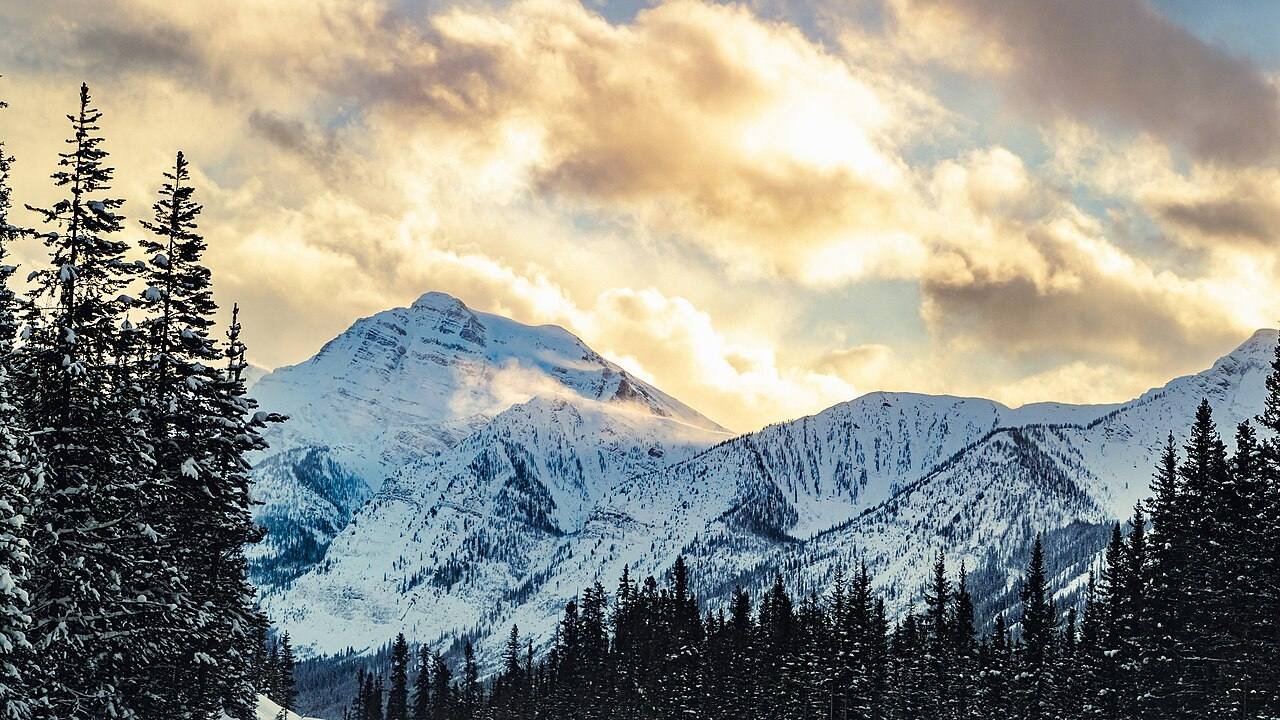
Avalanche paths cross the road in several places, and the Parkway is sometimes closed for avalanche control work. The worst of it clusters around the Icefield Centre area — about 105 km south of Jasper — where high wind and blowing snow are routine. If 511 Alberta shows a closure, believe it. There is no alternate route that saves the day; the alternate is waiting.
Pack like the car might have to sit for a few hours, because it might: water, energy bars, candles, extra clothing and blankets, a charged phone (even without signal, it’s your camera, map, and flashlight), and a shovel if you’ve got one. I carry all of that now. On my January run I used exactly none of it, and I was glad to have every piece. That’s the deal with winter driving kit — you pack it hoping it’s dead weight.
Practice fitting your chains once, somewhere warm and flat, before you need them. I did mine in the Lake Louise parking lot the evening before, hands going numb, and it took me twenty minutes. On the road, in the dark, in a storm, it would have taken an hour — and I would have been the guy blocking the pullout. Twenty minutes of practice buys you that hour back.
For the full tire-law picture — rental-car traps, what M+S actually means, and what to do when a storm hits mid-drive — my winter driving in Canada guide covers it in detail. Read it before you book the rental car, not after.
The 7 stops, on a map
Seven stops, northbound from Lake Louise to Jasper, with the Abraham Lake detour east from Saskatchewan Crossing at the end. Tap any stop to jump the map straight to it. Distances are approximate kilometres from Lake Louise.
Map data © OpenStreetMap contributors. Open the full map
1. Lake Louise — start full, start early
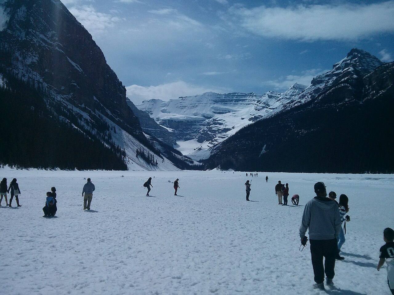
Lake Louise is the launch pad, and the whole trip is decided here. Fuel up the night before if you can — the village has fuel and beds, and in winter that’s not a given, it’s the whole plan. I left at 7:30 in the morning on my January run, which gave me a full day of light and a ploughed road for the first leg. By 9 AM I was already at Bow Lake with the place to myself. That’s the rhythm: early start, slow driving, long stops.
The lake itself is worth the early alarm. It freezes solid, and when conditions allow there’s a cleared skating area in front of the Fairmont. I walked out onto the ice in my boots, not skates — my skating is a public safety issue — and just stood there while the light came up over Victoria Glacier. No crowd. No noise. Just the sound of the ice ticking underfoot. Check the lake’s ice conditions before you skate, and stay inside the cleared area: a frozen lake is not a sidewalk.
If you’re staying over, my Lake Louise in winter guide covers the skating, the Ice Magic festival, and snowshoeing in detail. For this drive, Lake Louise is logistics: full tank, full thermos, checked forecast, gone by 8 AM.
The village is small and winter hours are short. Don’t count on buying winter gear, chains, or a decent breakfast at the last minute — sort all of that the day before, in Banff or Calgary, where the shops are.
2. Bow Lake — the first real winter

Thirty-five kilometres north of Lake Louise, Bow Lake is where the drive stops feeling like a highway and starts feeling like the backcountry. The lake freezes flat and white, Crowfoot Glacier hangs above the far shore, and the wind comes straight down the valley with nothing to slow it. I stood at the shoreline for maybe ten minutes before my face told me to get back in the rig. That’s Bow Lake in January: beautiful, and not interested in your comfort.
The pullout is right on the Parkway, and the short walk to the shore is packed snow — slippery, but flat. Bring traction aids if you’ve got them; I watched a guy in smooth-soled boots do the full cartoon slide on his way back to his car, and he was lucky the snowbank caught him. The Num-Ti-Jah Lodge sits at the north end of the lake, a red-roofed landmark that makes the whole scene look like a postcard that forgot to mention the wind chill.
This is also where the road starts to feel remote in earnest. From here to the Icefield Centre there’s nothing but pullouts and peaks, and the cell signal you lost after Lake Louise isn’t coming back. I like that. I also respect it. Keep the stops short, keep the thermos full, keep moving north while the light holds.
3. Peyto Lake viewpoint — the wolf’s head, frozen
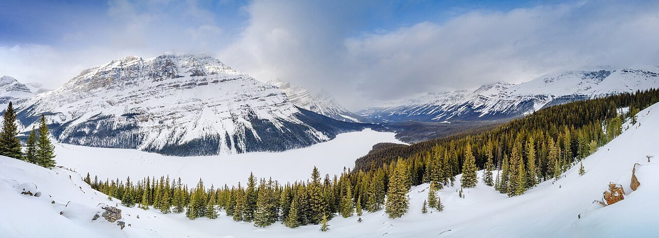
Peyto Lake is the shape everyone knows — the wolf’s head, the turquoise water — except in winter the turquoise is gone, frozen under snow, and what you get instead is a white wolf’s head in a white valley, which is somehow better. The viewpoint sits above Bow Summit, a short uphill walk from the parking area. In winter that short walk is a snow-packed trail, steep in places, and icy where a hundred boots have polished it. Take it slow. I used my hands on the rail more than I’d like to admit.
Here’s the thing about Peyto in winter: almost nobody is there. In July the viewpoint is a crowd scene. In January I shared it with two other people and a raven that looked like it owned the place. The silence up there is the real attraction — the kind of quiet where you hear your own boots in the snow and nothing else for a full minute.
The upper viewpoint gets the photos, but the lower viewpoint — a minute down the trail — frames the lake with the trees, and in winter the snow on the branches does half the composition for you. If the upper platform is iced over and sketchy, the lower one is the better shot anyway.
4. Columbia Icefield viewpoint — look, don’t go

Let’s be blunt about this one, because it’s the stop most winter travellers get wrong. The Columbia Icefield Discovery Centre is closed in winter. The Ice Explorer glacier tours are closed. The Glacier Skywalk is closed. The 2026 season ran May 1 to October 12, and outside that window the whole site shuts down. Do not drive 125 kilometres expecting a tour, a ticket, or a coffee. There is a shuttered building and a very big glacier. That’s it.
But here’s what’s still worth the stop: the roadside viewpoint. The Athabasca Glacier is right there, spilling down from the icefield toward the road, and from the pullout you get the full scale of it — a river of ice between two walls of rock, with Mount Athabasca behind it. I spent forty minutes here on my March run doing absolutely nothing except watching the light move across the ice. No joke, best forty minutes of the trip. The glacier is retreating — Parks Canada has markers along the roadside showing where the ice used to reach — and standing there looking at how far it’s pulled back is sobering in a way no interpretive panel can match.
Do not walk onto the glacier. The Ice Explorer route is a guided, crevassed glacier, and in winter it’s closed for good reason. The viewpoint is the experience. The wind here is also the worst on the whole Parkway — high wind, blowing snow, and snowdrifts are common near the Icefield Centre, and I double-checked that warning on Parks Canada’s winter maintenance page before my run. Believe it.
Want the full summer version — Ice Explorer, Skywalk, the whole operation? My Icefields Parkway itinerary covers the Centre in season. In winter, take the photo, feel small, and keep driving.
5. Athabasca Falls — winter does the decorating
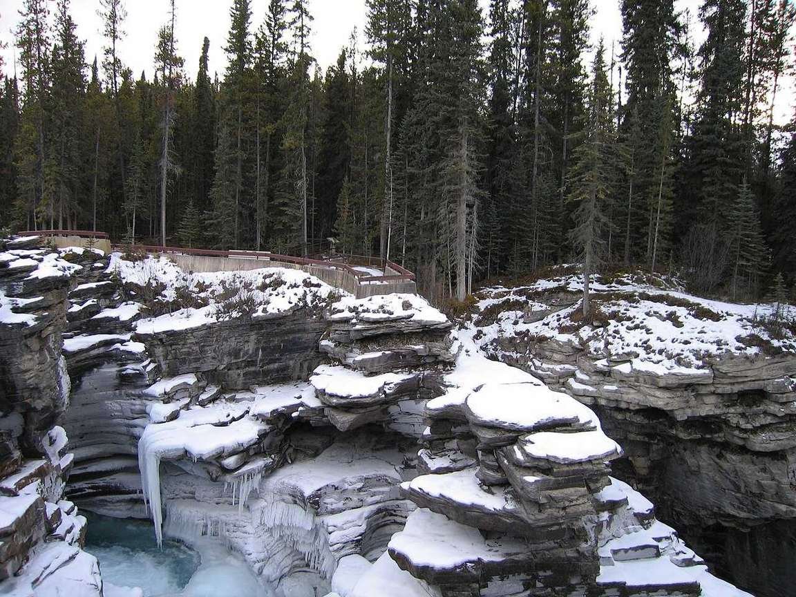
Thirty kilometres south of Jasper, Athabasca Falls is the last big stop before town, and in winter it’s a different waterfall entirely. The river keeps moving under the ice, the spray freezes onto the canyon walls in thick white curtains, and the whole gorge looks like it’s been carved out of glass. The short trails from the parking lot are paved in summer and an ice rink in winter — I wore traction cleats and still held the railing like it owed me money.
It’s a short stop — twenty minutes, maybe thirty if the light is good — but it’s the one that resets your brain after three hours of driving. The roar of the water under the ice is the loudest thing you’ll have heard since Lake Louise, and after all that windshield quiet it hits like a song you forgot you liked. Stay on the marked trails and behind the railings: the ice on the canyon edges is not a viewing platform, and every year somebody finds that out the hard way. I’m not going to be that somebody, and neither are you.
Athabasca Falls is also your signal that Jasper is close. Fuel, food, a bed, cell service — all of it is about half an hour north. If you’ve been nursing the tank since Lake Louise, this is where you stop doing maths and start relaxing. My Jasper in winter guide picks up from here: icewalks, dark skies, and the quietest Rockies town you’ll ever visit.
6. Sunwapta Falls — the detour that earns it
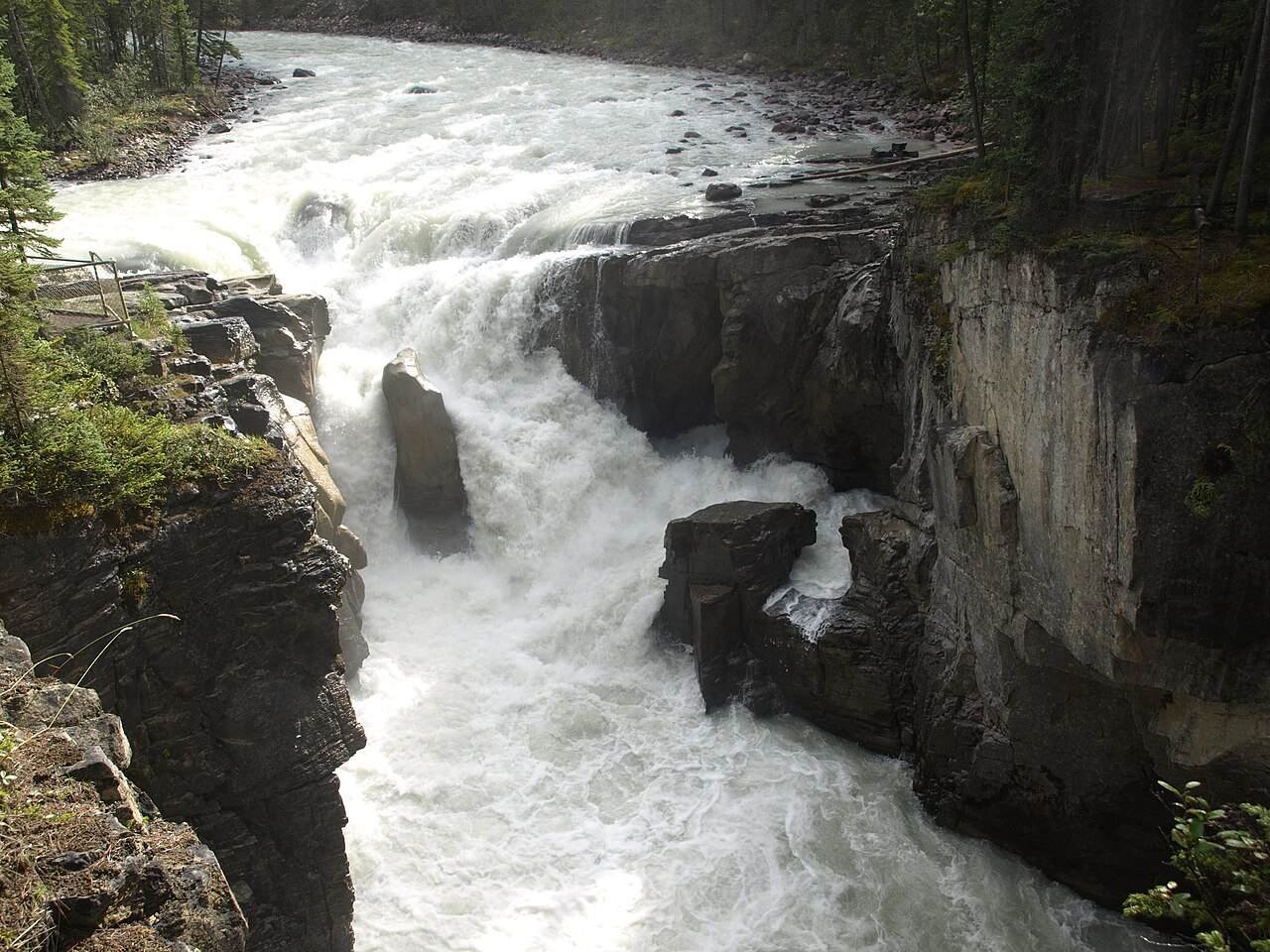
Sunwapta Falls is the stop I almost skipped, and I’m glad I didn’t. It’s a short detour off the Parkway south of Athabasca Falls, down a side road to a parking area, then a short walk to the viewpoint. In winter the upper falls are partly frozen at the edges with the river still pushing through the middle, and the lower falls drop into a canyon that holds the cold like a fridge. It’s quieter than Athabasca — fewer people, less infrastructure, more of the feeling that you found something rather than visited something.
A word of honesty about the photo above: it’s a summer shot. I couldn’t verify a winter photo of Sunwapta Falls on Wikimedia Commons, and I’m not going to dress a summer picture up as January. The falls themselves are worth the detour in any season — the canyon, the drop, the sound — but if you’re picturing green walls and open water, reset your expectations to white, blue, and frozen at the edges. The shape is the same. The mood isn’t.
The side road to Sunwapta is ploughed less often than the Parkway itself. If it’s freshly snowed and the road looks untouched, skip it — the falls will be there in summer, and a stuck car on an unploughed side road is how a good day goes sideways. Check the tire tracks before you commit.
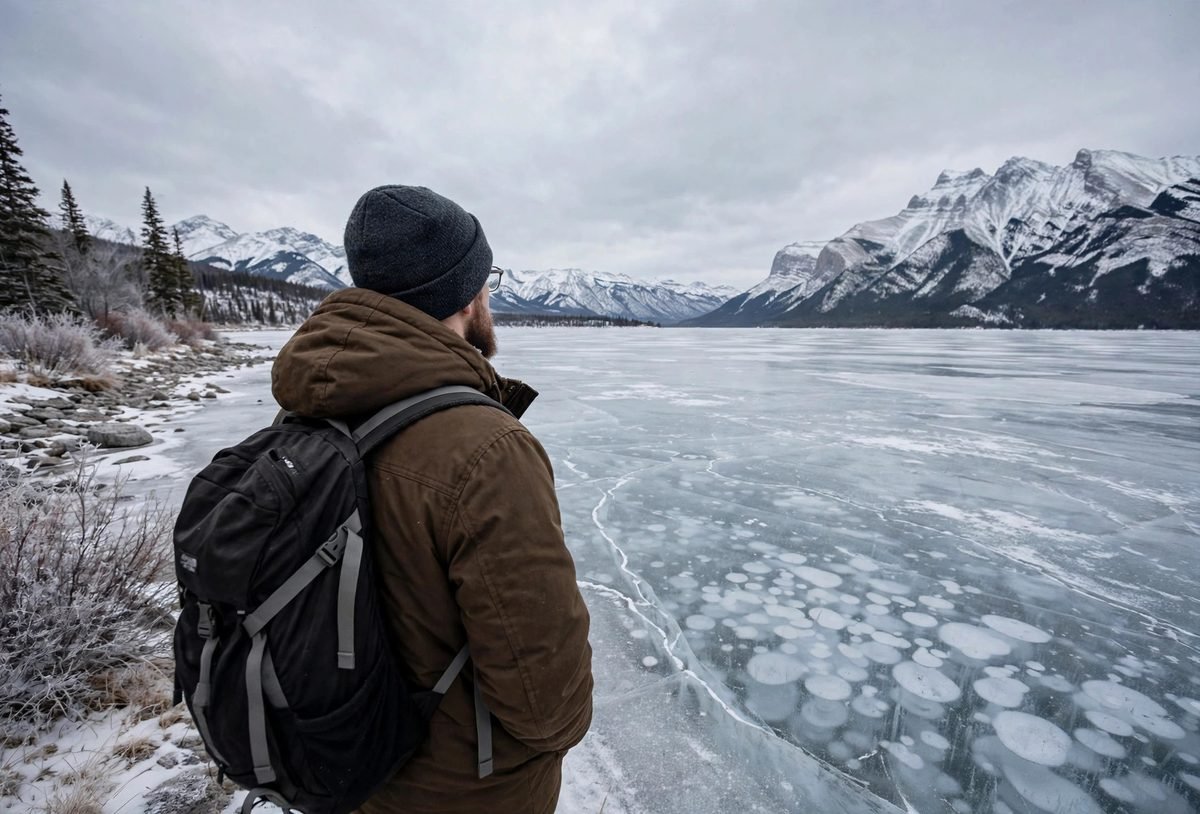
7. Abraham Lake — the payoff
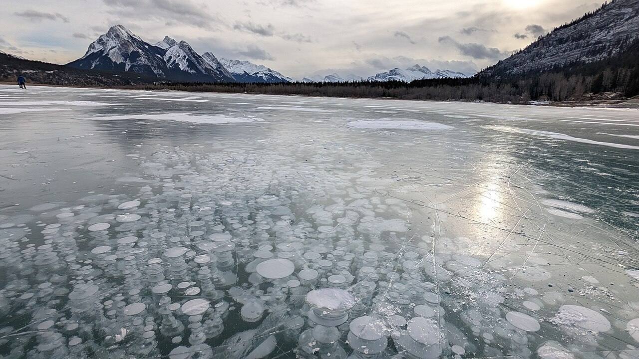
Here’s the payoff, and it’s worth every kilometre of white-knuckle driving. Abraham Lake isn’t on the Parkway itself — it’s a detour east from Saskatchewan Crossing on Highway 11, the David Thompson Highway, about half an hour to the lake’s western shore. In winter, the lake freezes into a sheet of clear ice, and trapped underneath it are thousands of white discs: methane bubbles, released by decaying plants on the lakebed, frozen in place as the ice thickened. They stack in layers, like a frozen fireworks display, and they’re the single strangest, prettiest thing I’ve seen in the Rockies.
Abraham Lake is a man-made reservoir — the Bighorn Dam, built in 1972, flooded the valley — and that’s exactly why the bubbles are so dense here: all that drowned vegetation feeds the methane. The lake is about 32 kilometres long, and the best bubble-spotting is along the western shore. Preacher’s Point is the classic early-season spot, and it’s where I went first. I walked out maybe twenty metres from shore, crouched down, and just stared at the ice under my boots. The bubbles were there, stacked three and four deep, and I forgot about the cold for a solid ten minutes. That doesn’t happen often.
Timing matters more here than anywhere else on this trip. The lake usually freezes by late December, and the bubbles are at their best from mid-January to mid-February, once the ice has had a few weeks to thicken and layer the bubbles. Travel Alberta’s local guides put the season at roughly December 15 to the end of February. By late February and into March, repeated thaw-and-freeze cycles turn the ice hazy and opaque, and the bubbles fade behind the frost. I double-checked the window against Travel Alberta’s Nordegg winter guide and a couple of local bubble reports before planning my run — and even then, a warm winter can push the freeze into mid-January. Go in the window, but check the ice reports the week you go.
Abraham Lake ice is wild ice — nobody maintains it, nobody guarantees it. Stay near shore, avoid river inflows and the dam end, and check local ice-condition reports (Nordegg Adventures posts regular updates through the winter) before you walk out. As a rule of thumb, ice should be at least 15 cm thick for walking. If you’re not sure, stay on the shore and photograph the bubbles from there — they’re visible from the edge, and the shore is where the smart money stands.
The wind at Abraham Lake is famous — it’s what keeps the ice swept clear of snow, which is why you can see the bubbles at all — but it’s also why you’ll want every layer you own. I wore everything I brought and still cut my visit short at the point where my fingers stopped working the camera properly. Bring gloves you can shoot in, a thermos, and a windproof shell. And go for sunrise or sunset if you can manage it: low light through clear ice is when the bubbles look three-dimensional, like they’re floating.
One more thing: the lake is a detour, not a drive-through. Budget two to three hours for the round trip from Saskatchewan Crossing, including the time you’ll spend standing on the ice saying nothing. Then drive back to the Parkway and finish the run to Jasper, or loop back south to Banff — my Banff in winter guide covers the other end of the trip if you’re heading back that way.

What does it cost?
Prices below are planning ranges I put together from my own winter runs — fuel, food, and a parks pass, per person per day. Pick your travel style, tell the calculator how many days you’re staying, and it does the rest. (Accommodation not included — see the table below for that.) The big winter variable is fuel: the Parkway itself has none, so your fuel cost is whatever you burn driving 232 km plus the Abraham Lake detour, on top of getting to Lake Louise in the first place.
Budget calculator
Per person, in Canadian dollars. Excludes accommodation.
Budget ≈ $105/day · Mid-range ≈ $165/day · Luxury ≈ $295/day. Parks pass extra: a day pass is about $11 per adult. Rates are planning ranges checked November 2026.
| Expense (per person / day) | Budget | Mid-range | Luxury |
|---|---|---|---|
| Accommodation | $60 (hostel dorm, Lake Louise / Jasper) | $220 (hotel, Lake Louise / Jasper) | $450+ (Fairmont room) |
| Food & drink | $40 | $65 | $120 |
| Sights (parks pass share, viewpoints) | $10 | $20 | $45 |
| Getting around (fuel share + rental) | $45 | $60 | $90 |
| Coffee, treats & souvenirs | $10 | $20 | $40 |
| Daily total | ~$165 | ~$385 | ~$745 |
The honest truth about winter costs: the driving itself is cheap — the viewpoints are free, the parks pass is about $11 a day per adult, and there’s nothing to buy between Lake Louise and Jasper even if you wanted to. The money goes on the car (winter tires, rental, fuel) and the hotel at each end. A winter rental with proper tires costs more than a summer one, and it’s worth every dollar. Skimp on the hotel if you must. Don’t skimp on the tires.
Suggested 2-day plan
| Time | Day 1 — Lake Louise to Jasper | Day 2 — Abraham Lake bubbles |
|---|---|---|
| Morning | Fuel up in Lake Louise, check 511 Alberta, leave by 8 AM. Lake Louise frozen lake walk, then Bow Lake. | Early start south to Saskatchewan Crossing, then east on Highway 11 to Abraham Lake. Preacher’s Point at sunrise if you can manage it. |
| Midday | Peyto Lake viewpoint, then the Columbia Icefield roadside viewpoint. Packed lunch in the car — there is nowhere to buy one. | Walk the shoreline, photograph the bubbles, check the ice before stepping out. Thermos lunch in the car. |
| Afternoon | Sunwapta Falls detour, then Athabasca Falls. Arrive Jasper before dark, fuel up, proper dinner. | Drive back to Jasper (or Banff) in daylight. If the weather turns, cut the lake visit short — the bubbles will be there tomorrow. |
| Evening | Jasper evening: walk the town, check the next day’s forecast, charge everything. | Sort photos, warm up properly, plan the next leg — Jasper in winter has more to give if you stay. |
FAQs about the Icefields Parkway in winter
Is the Icefields Parkway open in winter?
Yes — it’s open year-round, and it’s never closed for the season. But it can close temporarily for avalanche control work or severe weather, and ploughing runs only from 7:00 AM to 3:30 PM daily. Check 511 Alberta the morning you drive, and have a backup day in your plan. If it closes, the alternate is waiting, not another road.
Do I need winter tires to drive the Icefields Parkway?
Yes. Winter tires or chains are mandatory from November 1 to March 31, or whenever the road is snow- or ice-covered. Tires need the mountain-and-snowflake symbol or an M+S marking. Rental cars usually come with M+S all-seasons, which qualify legally — but on compact snow, proper winter tires are the safer choice, and I’d ask the rental company for them specifically.
Is there gas on the Icefields Parkway in winter?
No. There are no fuel stations, restaurants, hotels, or services of any kind between Lake Louise and Jasper in winter — 232 kilometres. Fill up in Lake Louise or Jasper before you leave, and carry extra windshield washer fluid. Saskatchewan Crossing has services in summer only.
Is the Columbia Icefield Centre open in winter?
No. The Columbia Icefield Discovery Centre, the Ice Explorer glacier tours, and the Glacier Skywalk are all closed in winter. The 2026 season ran May 1 to October 12. You can still stop at the roadside viewpoint and see the Athabasca Glacier from the pullout — which is free and, honestly, the best part — but there are no tours, tickets, or facilities.
When is the best time to see the Abraham Lake ice bubbles?
Mid-January to mid-February, once the lake has frozen solid and the ice has had a few weeks to thicken and layer the bubbles. The season runs roughly December 15 to the end of February, but the lake doesn’t always freeze on schedule — in a warm winter it can stay open into mid-January. Check local ice-condition reports the week you go, stay near shore, and avoid river inflows.
Is there cell service on the Icefields Parkway?
No — there’s no cell service between Lake Louise and Jasper, with signal only at each end. Download offline maps before you leave, tell someone your route and expected arrival time, and carry a paper backup of the essentials: 511 Alberta’s phone number, the Jasper Information Centre (780-852-6176), and the Lake Louise Visitor Centre (403-522-3833).
Keep exploring
The Parkway is the spine — here’s where I’d go next:
- Icefields Parkway itinerary — the summer version: the Icefield Centre in season, 1-day and 2-day plans
- Banff in winter — SkiBig3, frozen lakes, and hot springs at the southern end of the drive
- Lake Louise in winter — skating the frozen lake, Ice Magic, and snowshoeing
- Jasper in winter — icewalks, dark skies, and the quiet Rockies at the northern end
- Winter driving in Canada for tourists — tire laws, rental traps, and storm protocol
Drive it on the right day, in the right rig, with a full tank — and the Parkway in winter will give you the Rockies with nobody else in the frame. Get any one of those three wrong, and it’ll teach you instead. I’ve had both versions. Take my word for it: the first one is better.