
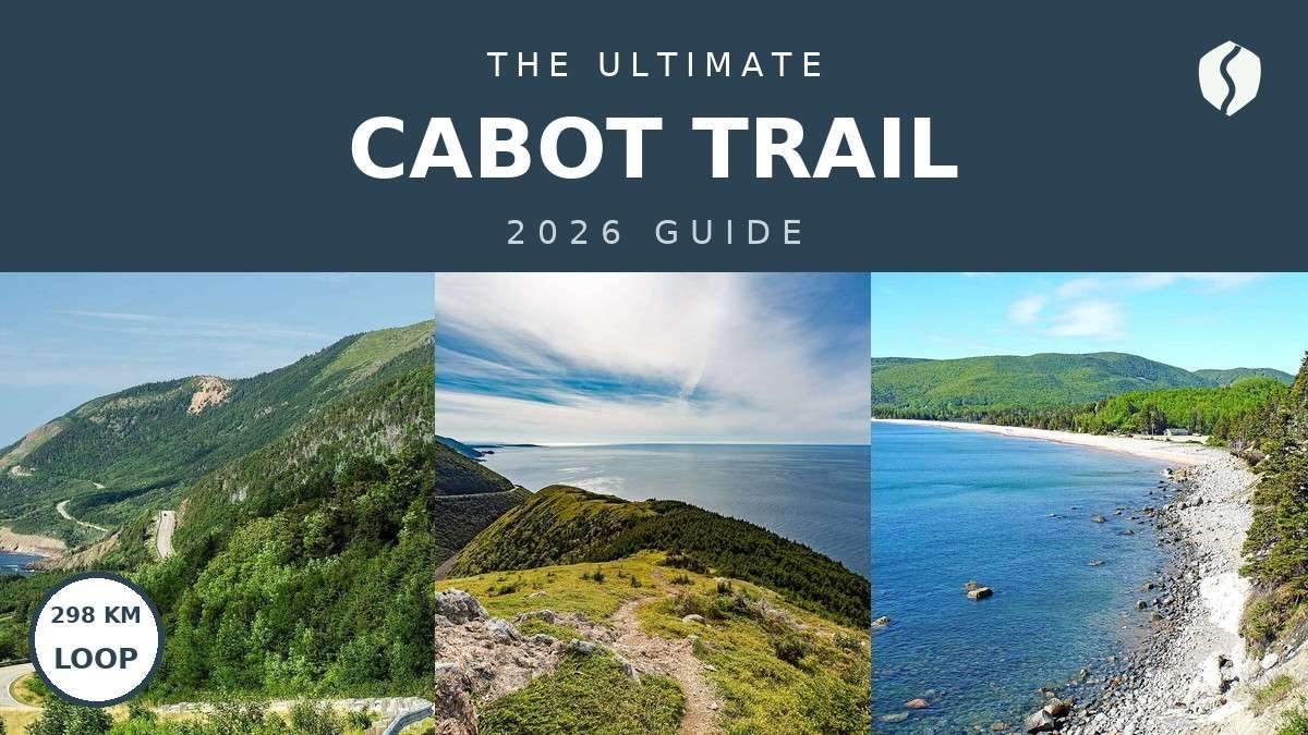
- ✓ Drive it clockwise from Baddeck. The east coast climbs first, the big park stretch lands mid-trip, and the Acadian west coast brings you home.
- ✓ Gas up in every town that has a pump. There is no fuel inside the national park stretch, and the gaps are longer than they look on the map.
- ✓ Three days is the sweet spot; five is the luxury version. One day is a windshield tour. The loop deserves at least three.
Here’s the deal with the Cabot Trail: everyone calls it one of the best drives in the world, and then everyone tries to do it in a day. I tried that once. I took a wrong turn out of Baddeck before I had even cleared the Bras d’Or Lakes, hit fog so thick on Cape Smokey that I could not see the headland I had driven up there to see, and rolled into Chéticamp at dusk with the fuel light on and the best viewpoints still ahead of me. No joke — the fog cost me the whole first leg. The loop runs about 298 km around northern Cape Breton Island, through Cape Breton Highlands National Park, and it is the single best coastal drive I have done in Canada. It is also a drive that punishes a lazy plan: fog, moose, long fuel gaps, and a national park that takes its own sweet time.
I have driven it twice now, once in a rush and once properly, and the difference was not the scenery — that was ridiculous both times — it was the fuel gauge, the fog, and the number of nights. The second time I gave it five days, booked my Skyline Trail parking ahead, and let the weather decide the order of things. This guide is the plan I wish I had the first time: the stops in driving order, the distances, the honest seasonal warnings, and the 3-day and 5-day versions that actually work.
The 8 best stops, on a map
Eight stops, clockwise from Baddeck, in driving order. Tap any stop to jump the map straight to it. Every pin below was checked against its real location — no guessed coordinates.
Map data © OpenStreetMap contributors. Open the full map
Stop-by-stop distances and drive times
Pure driving time for the whole loop is roughly 4.5 to 5 hours with no stops. You will stop. A lot. Budget a full day just for the driving if you rush it, and three to five days if you do it right. Leg distances below are routed road distances, rounded, and they add up to the loop’s established ~298 km total — the road winds, the viewpoints multiply, and your odometer will disagree. Times are wheels-turning estimates at normal Trail speeds, not counting stops, fog, or moose.
| Leg | Distance (approx.) | Drive time | Allow at the stop |
|---|---|---|---|
| Baddeck → Cape Smokey | ~72 km | ~1 hr 10 min | 30–60 min |
| Cape Smokey → Ingonish | ~21 km | ~25 min | Half a day (beaches) |
| Ingonish → Neil’s Harbour | ~18 km | ~20 min | 45–60 min |
| Neil’s Harbour → White Point | ~11 km | ~15 min | 20–30 min |
| White Point → Pleasant Bay | ~45 km | ~50 min | Half a day (whales, harbour) |
| Pleasant Bay → Chéticamp | ~43 km | ~40 min | Overnight + Skyline Trail |
| Chéticamp → Margaree Harbour | ~25 km | ~25 min | 30–45 min |
| Margaree Harbour → Baddeck | ~63 km | ~1 hr | End of loop |
| Full loop | ~298 km | ~4.5–5 hrs driving | 3–5 days with stops |
There is no fuel inside the national park stretch of the Trail. The gaps between pumps — Baddeck, Ingonish, Chéticamp, Margaree — are long, and the climbs eat fuel faster than flat-highway math suggests. I rolled into the park stretch on a quarter tank once, doing optimistic arithmetic about the distance to Chéticamp, and spent the whole leg watching the gauge instead of the coastline. I found this out the sweaty way, and I have made this mistake so you don’t have to: top up in every town that has a pump, even if the gauge says you don’t need to yet.
1. Baddeck — the start line

Baddeck is the obvious start because it is the last real town before the loop gets serious, and the first place you can properly stock up. It sits on the Bras d’Or Lakes, it is home to the Alexander Graham Bell National Historic Site, and its main street has the last big grocery and fuel stop you will see for a while. Start here, not in Sydney — Sydney adds an hour of highway and nothing you need. Fuel up, buy water and snacks, and get on the road before 9 AM. The first leg climbs out of the lakes and into the highlands, and morning light on that climb is worth the early alarm.
One confession: my first time out of Baddeck I followed a sign I misread and added twenty minutes of lakeside wandering before I found the actual Trail turnoff. It was pretty. It was also not the plan. The Trail is well signed once you are on it — trust the Cabot Trail shields, not your memory of the map you glanced at over breakfast.
2. Cape Smokey — the fog lottery
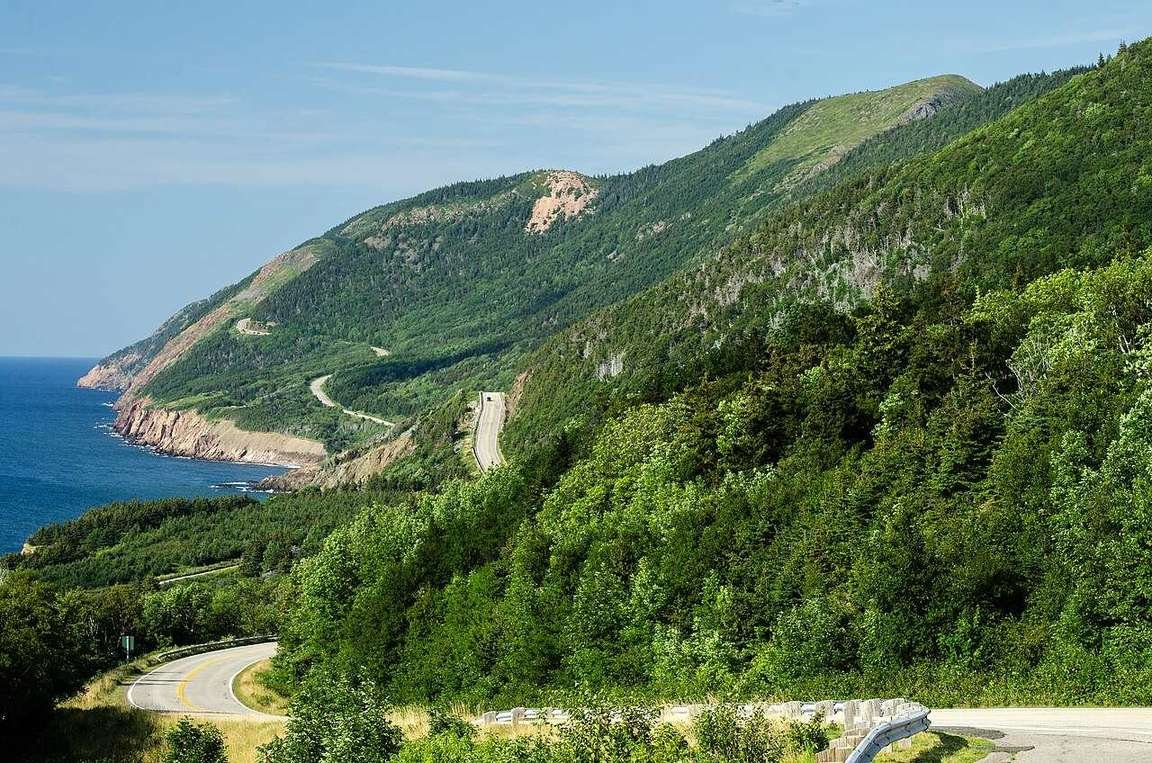
Cape Smokey is a headland climb with a provincial park at the top and a view that is either the best on the east coast or completely invisible, depending on the cloud. I found this out the foggy way: first trip, I drove up in a whiteout, stood at the viewpoint staring at grey, and drove back down annoyed. Second trip, I waited a day, came back on a clear morning, and the whole coastline unrolled below me like somebody had pulled a curtain. Here’s the deal: if Smokey is socked in, do not force it. Drive on to Ingonish, do the beaches, and try Smokey again on the way back or the next morning. The mountain is not going anywhere, and the fog usually burns off by late morning.
The climb itself is the first real taste of Trail driving — steep grades, tight curves, and pullouts that fill fast. Use low gear on the descent, not your brakes. Worth the detour? It is not a detour. It is the road. Just bring patience for the weather.
Drive Cape Smokey in the morning when you can. The fog that sits on the headland at dawn usually lifts by 10 or 11 AM, and the afternoon light puts the sun in your eyes on the descent. If you wake up to fog in Ingonish, have a slow breakfast — the mountain will sort itself out.
3. Ingonish — beaches and the east gate

Ingonish is where the Trail stops being a road and starts being a holiday. The village sits at the park’s east gate, and its two beaches — Ingonish Beach and the quieter stretch at North Bay — are the best swimming on the loop. The water is Atlantic-cold even in August, which did not stop me from going in up to my knees and regretting it loudly. The sand is pale, the hills behind it are green, and on a sunny day it looks like somewhere much further south, until the wind reminds you where you are.
This is also where you enter Cape Breton Highlands National Park from the east. You need a Parks Canada park pass for the park stretch of the Trail — I double-checked the current pass details on Parks Canada’s page before my second trip, since pass rules change, so do the same before you go. The Ingonish visitor centre is a good first stop for trail conditions and the day’s weather in the highlands, which can be completely different from the coast. → Parks Canada — Cape Breton Highlands National Park
Stay a night in Ingonish if you can. It splits the loop nicely, and the village has enough food and fuel to reset the rig before the northern stretch.
4. Neil’s Harbour — the lighthouse village

Neil’s Harbour is small, working, and photogenic in the way that only a fishing village with a lighthouse can be. The lighthouse sits on a rocky point at the edge of the village, the boats come and go below it, and the whole stop takes under an hour unless you sit down for seafood — which you should. This is a village that fishes for a living, not for the postcard, and that is exactly why the postcard works.
Walk out to the lighthouse, look back at the village from the point, and then keep moving. The northern shore from here to White Point is short, quiet, and easy to rush. Do not rush it. The pullouts between the two villages are some of the least crowded on the loop, and the sea stacks along this stretch are worth every stop.
5. White Point — the quiet turn
White Point is barely a village — a scatter of houses, a shore road, and a turn in the Trail where the coast swings west toward the Gulf side. There is no big attraction here, and that is the point. The north shore between Neil’s Harbour and Pleasant Bay is the least developed stretch of the loop, and White Point is where you feel it: no tour buses, no gift shops, just the road, the water, and the occasional fishing boat. I stopped here for ten minutes on my second drive and stayed forty, doing nothing more ambitious than watching the light move across the water.
From White Point the Trail turns inland and climbs toward the highlands again, then drops to Pleasant Bay. Watch for moose on this stretch, especially at dusk — I had one step out of the trees near the top of the climb on my way west, and the only reason it is a good story instead of a bad one is that I was going slowly. The highlands are moose country. Drive like it.
6. Pleasant Bay — whale country

Pleasant Bay sits in a bowl at the foot of the highlands, and it is the whale-watching capital of the loop. Boats go out from the harbour through the summer and into early fall, and the Gulf waters here are where pilot whales, minkes, and the occasional fin whale show up. I did not see a whale on my first visit — the sea was up, the boat stayed in, and I ate lunch in the harbour watching the fog instead. Second visit, flat calm, and a pod of pilot whales surfaced close enough to the boat that the whole deck went quiet. No joke — that silence is the sound of twenty people forgetting to take photos.
Book whale tours ahead in July and August, and build a spare morning into your plan: if the sea is rough, tours cancel, and a cancelled tour with no backup day is just a missed whale. Pleasant Bay also has fuel and food, so top up the rig here before the run south to Chéticamp. The next stretch is park road, and the next pump is a long way off.
The harbour-side fish shack in Pleasant Bay does a seafood chowder that a local at the dock told me about — no sign worth noticing, just a line of fishermen at lunch. I took his word for it, and it was the best meal of the trip. Ask at the harbour, not at the hotel desk: the dock knows where lunch is.
Skyline Trail — the one hike to plan around

Between Pleasant Bay and Chéticamp, the Skyline Trail is the single most famous hike on the loop, and it earns it. A boardwalk trail crosses a grassy headland high above the Gulf of St. Lawrence, and on a clear day the view runs for miles along the coast. It is also the busiest trailhead in the park, and Parks Canada now runs parking reservations for Skyline Trail in peak season — I double-checked on Parks Canada’s page before my second trip, and the reservation requirement is real, so check the current season’s rules and book before you drive out there. Turning up without a reservation in July and hoping for the best is a plan for disappointment.
Go early or late in the day. The boardwalk is exposed, there is no shade, and the midday sun on a headland in July is no joke. I did the late-afternoon version: fewer people, softer light, and a moose standing in the meadow near the trailhead on the way back, completely unbothered by all of us. Allow two to three hours return, wear proper shoes, and carry water — the headland gives you the view, but it does not give you a tap.
7. Chéticamp — the Acadian harbour

Chéticamp is the biggest village on the west side of the loop and the park’s west gate, and it feels different from everything east of the highlands: Acadian flags, French on the signs, a working harbour full of fishing boats, and a main street with real services. This is where you refuel, resupply, and sleep after the Skyline Trail day. A ranger at the Chéticamp visitor centre told me the Acadian Trail, the shorter hike right behind the visitor centre, is the one locals do when they want the highlands view without the Skyline crowds — and she was right. If Skyline is booked out, do that one instead and skip the regret.
Chéticamp is also the rug-hooking capital of the region, and the village’s hooked-rug tradition is worth an hour if you like craft with a story behind it. Even if you do not, the harbour at sunset is worth the walk: boats, gulls, and the light going gold over the water while the village winds down. Stay a night here. The loop’s west side deserves a slow morning.
8. Margaree Harbour — range lights and the run home
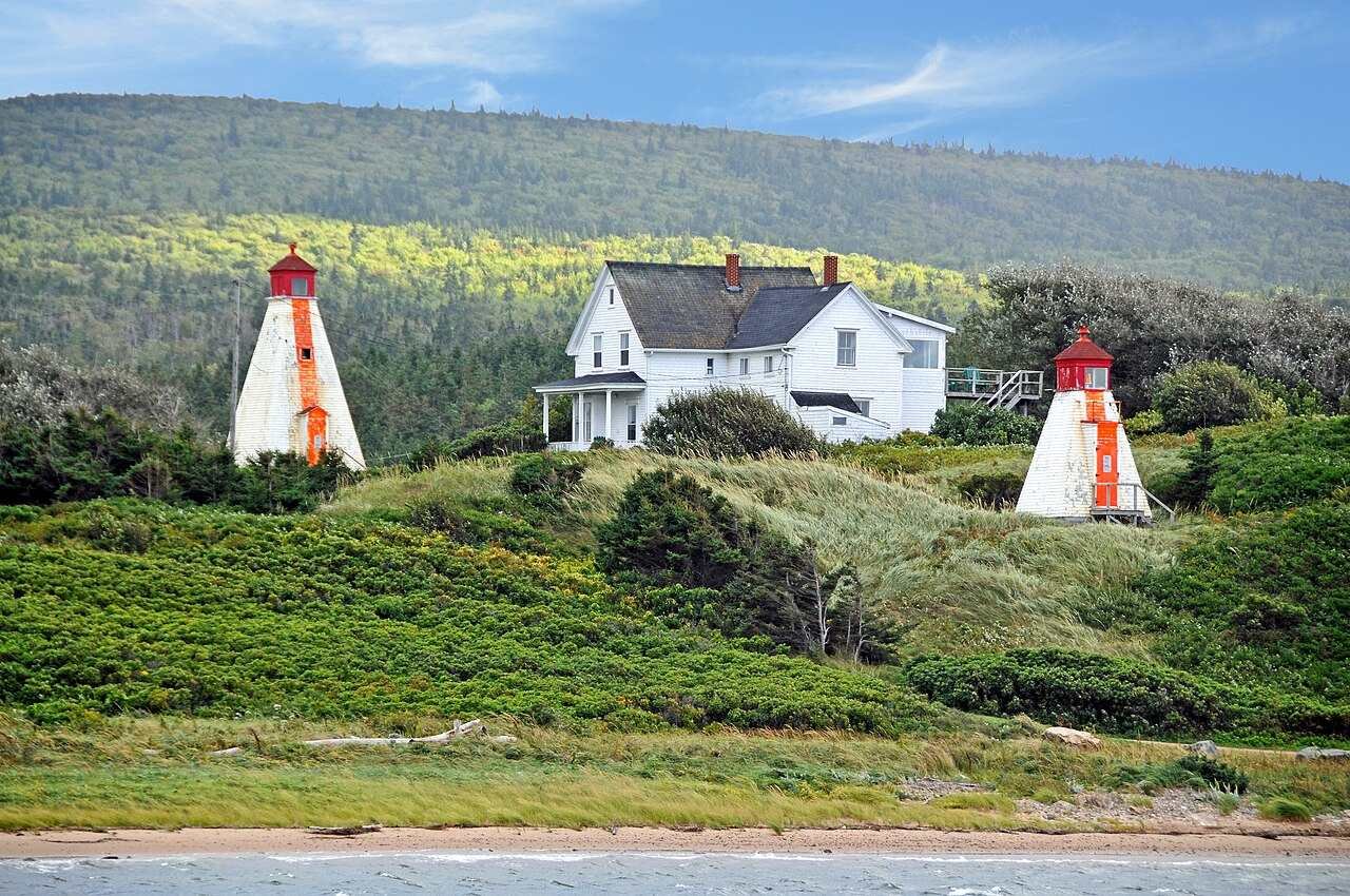
Margaree Harbour is the last stop before the loop turns back toward Baddeck, and it is a gentle one: two range lights on a grassy point, a harbour where the Margaree River meets the Gulf, and a village that smells faintly of salt and spruce. The Margaree River is famous salmon water, and the harbour is where the river gives up and joins the sea. Walk out to the lights, look back up the river valley, and take the photo — everyone does, and everyone is right to.
From here the Trail runs inland through the Margaree Valley, which is farm country after a day of coastline, and then back to Baddeck. Fuel up in Margaree Harbour or Chéticamp before this leg if the gauge is anywhere near a quarter — the valley is lovely and pump-free. Roll into Baddeck with the loop closed, park the rig, and eat a real dinner. You earned it.
Pullouts worth the detour

Beyond the eight named stops, three pullouts earned their place in my notes. Black Brook Beach, on the park stretch north of Ingonish, is a cobble beach with a waterfall dropping onto the sand at one end — I stopped for five minutes and stayed half an hour, watching the waves sort the stones. Green Cove, a signed viewpoint on the east side, is a short boardwalk to a rocky shore where the geology does the talking. And French Mountain, the high point of the park road between Pleasant Bay and Chéticamp, is where the Trail climbs highest and the views open widest — pull over, get out, and look both ways. The road between the stops is the trip, not the gap between attractions.
Cell service comes and goes through the highlands, and it is gone for long stretches inside the park. Download your maps offline before Baddeck, screenshot your accommodation addresses, and tell someone your rough plan. It is not the wilderness, exactly — it is a well-travelled highway — but it is the kind of road where a dead phone and a wrong turn cost you an hour, and I know because I have paid that hour.
3-day plan vs. 5-day plan
| Day | 3-day plan (Baddeck loop) | 5-day plan (the slow version) |
|---|---|---|
| Day 1 | Baddeck departure by 9 AM; Cape Smokey viewpoint; Ingonish beaches in the afternoon; overnight Ingonish | Day 1: Baddeck morning + slow drive to Ingonish; overnight Ingonish. Day 2: full beach day in Ingonish + Black Brook and Green Cove pullouts |
| Day 2 | Neil’s Harbour + White Point in the morning; Pleasant Bay harbour and whale tour in the afternoon; overnight Pleasant Bay or Chéticamp | Day 3: Neil’s Harbour, White Point, Pleasant Bay; overnight Pleasant Bay. Day 4: Skyline Trail in the morning, Chéticamp in the afternoon; overnight Chéticamp |
| Day 3 | Skyline Trail in the morning (booked ahead); Chéticamp lunch; Margaree Harbour range lights; back to Baddeck by late afternoon | Day 5: slow Chéticamp morning, Margaree Harbour, Margaree Valley drive, back to Baddeck — with a spare morning if fog or weather stole a viewpoint earlier |
Which one? Here’s the deal: three days works, but it works because you keep moving. Five days is the trip the Trail actually wants you to take — a beach day, a whale day, a hike day, and two slow mornings built in for fog. If you only have three days, protect the Skyline booking and the Ingonish beach afternoon; everything else can flex. My best time to visit Cape Breton guide will help you pick the month, and my Nova Scotia road trip itinerary covers the wider province loop if you are turning this into a longer trip.
Seasons: when the Trail changes character
June through September is the straightforward season: all facilities open, whale tours running, beaches swimmable (in the Atlantic sense of the word), and every village awake. July and August are the busiest and the most expensive; June and September are my pick — fewer people, same scenery, cheaper beds. Late September through mid-October is fall-colour season, and the highlands go red and gold in a way that makes the whole loop feel like a different road — my Cape Breton in fall guide and fall foliage guide cover the timing. Late October through May is the quiet season: many seasonal businesses close, park visitor services wind down for winter, and the road can be a serious proposition in snow and ice. The Trail is a mountain-coastal highway, not a winter sightseeing cruise — check road conditions the morning you leave, carry winter gear in the rig, and do not plan on stopping at viewpoints that are not plowed. If the forecast turns, wait it out in Baddeck or Chéticamp. The highlands will still be there tomorrow.
What does the Cabot Trail cost?
Prices below are per person per day, including fuel share for a car shared by two people. Pick your travel style, tell the calculator how many days you’re staying, and it does the rest. Accommodation not included — see the table below for that.
Budget calculator
Per person, in Canadian dollars. Includes fuel. Excludes accommodation.
Budget ≈ $105/day · Mid-range ≈ $180/day · Luxury ≈ $300/day. Park pass, Skyline parking reservation, and whale tour tickets not included in the daily rate — see below.
| Expense (per person / day) | Budget | Mid-range | Luxury |
|---|---|---|---|
| Accommodation | $70 (basic motel / B&B) | $180 (village inn / lodge) | $350+ (resort / waterfront lodge) |
| Food & drink | $40 | $65 | $110 |
| Sights (park pass share, tours) | $10 | $25 | $50 |
| Getting around (fuel share) | $45 | $70 | $105 |
| Coffee, treats & souvenirs | $10 | $20 | $35 |
| Daily total (excl. accommodation) | ~$105 | ~$180 | ~$300 |
On top of the daily rate, budget for the Parks Canada park pass (per vehicle, per day, or an annual Discovery Pass if you are doing a longer parks trip — I double-checked the current pass options on Parks Canada’s page before my second drive), the Skyline Trail parking reservation in peak season, and a whale tour ticket if you take one. For the wider trip budget, see my Canada trip cost guide, and if you are renting rather than bringing your own rig, my renting a car in Canada guide covers the one-way rental question.
FAQs about the Cabot Trail itinerary
How long does it take to drive the Cabot Trail?
Pure driving time is about 4.5 to 5 hours for the ~298 km loop. With the stops in this guide, plan three days at minimum or a full five days for the slow version with beach time, a whale tour, and the Skyline Trail. Anyone who tells you they “did it in a day” drove past everything worth seeing — I know, because I tried.
Which direction should you drive the Cabot Trail?
Clockwise from Baddeck is my pick and the route in this guide: east coast first (Cape Smokey, Ingonish), the north shore second (Neil’s Harbour, Pleasant Bay), and the Acadian west coast last (Chéticamp, Margaree Harbour). The other direction works too — the views are the same road in reverse — but clockwise puts the ocean on your side for the pullouts and lands the Skyline Trail at the right point in the trip.
Where can you get gas on the Cabot Trail?
Fuel up in Baddeck before you leave, and again in Ingonish, Pleasant Bay, and Chéticamp as you pass through. There is no fuel inside the national park stretch, and the gaps between towns are long. I have made this mistake so you don’t have to: top up in every town that has a pump, even when the gauge says you could skip one.
Do you need a park pass for the Cabot Trail?
You need a valid Parks Canada park pass for the portion of the Trail that runs through Cape Breton Highlands National Park — roughly a third of the loop. A daily pass covers the day; an annual Discovery Pass pays off if you are spending several days in the parks. I double-checked the current pass options on Parks Canada’s page before my last trip — check before you go, since prices and purchase points change. → Parks Canada — official site
Do you need a reservation for the Skyline Trail?
In peak season, yes — Parks Canada runs parking reservations for the Skyline Trail, and the lot is the bottleneck, not the trail. I double-checked on Parks Canada’s page before my second trip: book your parking slot before you drive out there, and go early or late in the day for fewer people and better light. Outside peak season the rules differ, so check the current season’s details before you go.
What is the best time of year to drive the Cabot Trail?
June through September for the full experience: all facilities open, whale tours running, and the beaches at their best. I prefer June and September — fewer crowds, lower prices, same scenery. Late September to mid-October is fall-colour season and spectacular, but book beds early. Late October through May brings closures and winter driving conditions — the road can still be driven when open, but it is a serious coastal highway in a storm, not a sightseeing cruise. See my best time to visit Cape Breton guide for the month-by-month picture.
Keep exploring
The Trail is one leg of a bigger Nova Scotia trip — here’s where I’d go next:
- Nova Scotia road trip itinerary — the wider province loop this drive sits inside
- Best time to visit Cape Breton — picking your month
- Cape Breton in fall — the autumn-colour version of this trip
- Cape Breton in summer — beaches, whales, and long days
- Best road trips from Halifax — how to get to the Trail from the city
- Best time to visit Nova Scotia — the full seasonal picture
- Canada trip cost guide — budgeting the wider trip
- Renting a car in Canada — rig, insurance, and one-way questions
Buckle up. Gas up. The Trail will do the rest.