

- ✓ Drive it northbound, in the morning: Vancouver to Whistler puts the signed pullouts on your right shoulder — no crossing the highway — and your passenger gets the Howe Sound postcards.
- ✓ Leave Vancouver by 8–9 AM: it’s 120 km and about two hours of actual driving, but with nine stops you will use every minute of daylight. I know because I didn’t.
- ✓ Winter tires are mandatory Oct 1–Mar 31 on this corridor — M+S or the mountain-snowflake symbol, rental cars included. I double-checked the dates on DriveBC’s official page before writing this.

I left Vancouver at ten in the morning figuring I’d roll into Whistler by lunch. I got there at half past four, sunburned in October, with 400 photos of waterfalls and a new theory: this highway is a trap, and it’s a beautiful one. The Sea to Sky Highway — Highway 99 from Horseshoe Bay to Whistler — is 120 kilometres of road that refuses to be just a road. Every curve opens up another pullout, another waterfall, another reason to kill the engine.
Here’s the deal: the drive itself is about 1.5 to 2 hours if you keep the wheels rolling. You won’t. Plan a full day. The nine stops below run south to north in the order you’ll hit them, with the real distances and drive times from my dashboard — timed on a clear Tuesday in October 2026. Gas up in Squamish. Trust me on that one; I’ll explain later.
The drive, by the numbers
| Leg (northbound) | ~Km from Vancouver | Wheels-rolling time | Stop time I’d allow |
|---|---|---|---|
| Vancouver → Horseshoe Bay | ~21 km | 25 min | 20 min |
| Horseshoe Bay → Porteau Cove | ~38 km | 20 min | 30 min |
| Porteau Cove → Britannia Beach | ~47 km | 15 min | 1.5 hrs (museum) |
| Britannia Beach → Shannon Falls | ~60 km | 15 min | 45 min |
| Shannon Falls → Sea to Sky Gondola | ~60 km (same exit) | 2 min | 2–3 hrs (summit) |
| Gondola → Squamish | ~67 km | 10 min | 1 hr (fuel + lunch) |
| Squamish → Garibaldi pullouts | ~72 km | 10 min | 20 min |
| Garibaldi → Brandywine Falls | ~101 km | 25 min | 30 min |
| Brandywine Falls → Whistler Village | ~121 km | 25 min | Arrive. Dinner. |
Add it up: roughly 2 hours driving, 8–9 hours total. That’s the full-day version, and it’s the one worth doing. If you’re pairing this with time in the city first, my things to do in Vancouver guide and the 4-day Vancouver itinerary stack neatly before a Whistler run.
The 9 stops, on a map
Nine pins, south to north. Tap any stop to jump the map straight to it.
Map data © OpenStreetMap contributors. Open the full map
1. Horseshoe Bay — where the pavement gets serious

Horseshoe Bay is where Highway 99 stops pretending to be a city street and starts being a proper mountain road. The BC Ferries terminal here runs to Nanaimo and Bowen Island — I wasn’t taking either, but I pulled in anyway for the view across the bay and a coffee. Twenty minutes, tops, and you’re back on the highway with the good stuff ahead.
This is also your last easy turn-back point. Past here the road narrows, the cliffs start, and the shoulders get shy. Buckle up.
2. Porteau Cove — the pullout that eats your schedule
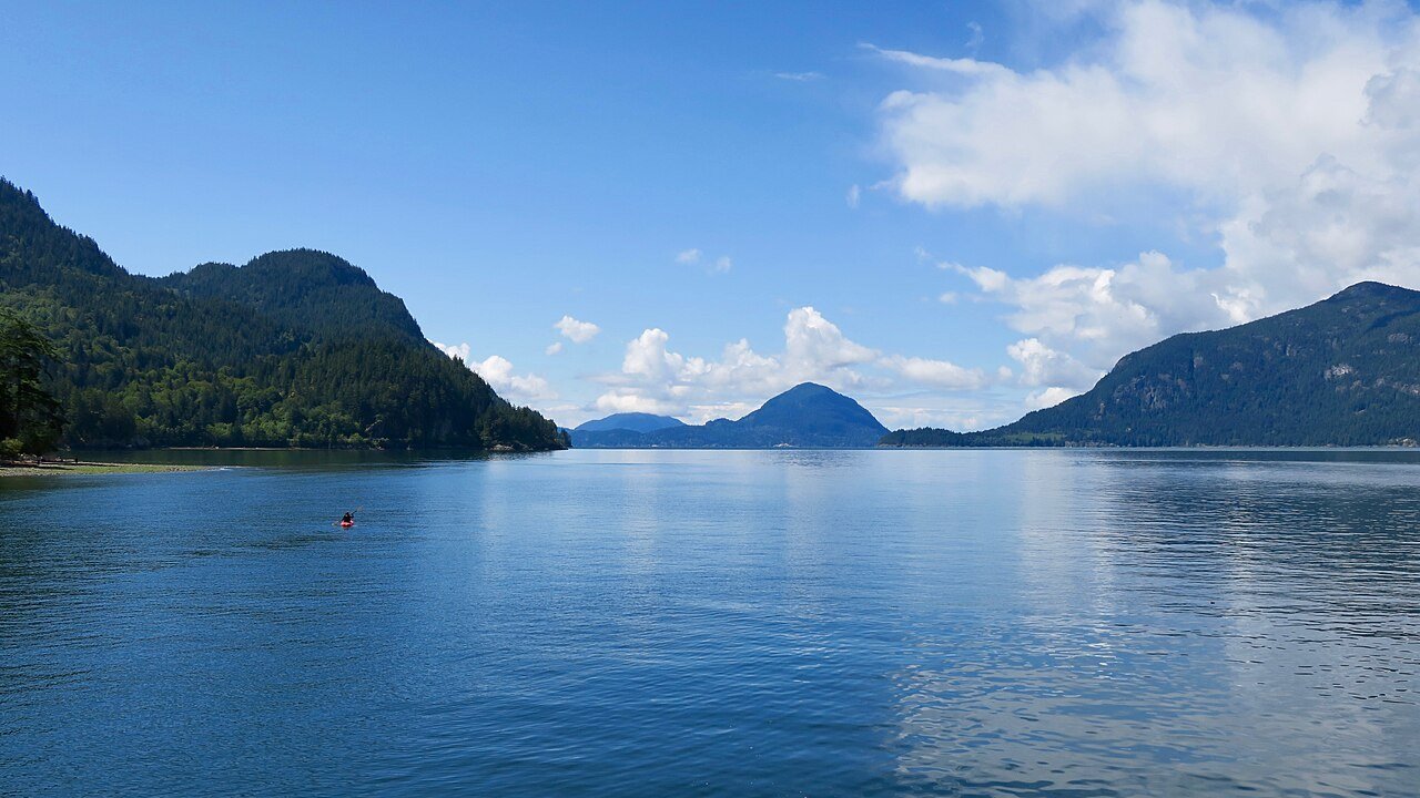
Porteau Cove sits right on the water, about 20 minutes past Horseshoe Bay, and it is the first place this drive tries to keep you. The day-use area looks straight down Howe Sound, and on a clear morning the light does something unreasonable on the water. I’d budgeted fifteen minutes. I stayed forty. The wind off the sound is no joke — hold onto your hat, literally; I watched a very nice ball cap achieve liftoff.
BC Parks manages this one, so check whether a day-use parking pass is required before you go — the rules shift by park and season, and I double-checked the current setup on the BC Parks official site before my trip. There’s also a small campground here if you’re the type to sleep where the view is.
A Squamish barista told me the real Porteau Cove move is sunset on the way back south — the sun drops behind the mountains across the sound and the whole pullout goes quiet. Coming home from Whistler in the evening, stop here instead of driving straight through. You’ll thank her.
3. Britannia Beach — the copper giant

You can’t miss the Britannia Mine Museum — a twenty-storey concrete mill building climbs out of the hillside right beside the highway like something out of a dieselpunk novel. This was once the largest copper mine in the British Empire, and the museum runs an underground train tour into the old workings plus a multi-sensory show inside Mill No. 3 itself. Adult admission runs about $37; I checked current prices on the museum’s official site before going — they run seasonal hours, so do the same.
I’ll be honest: I almost drove past this one. A mining museum did not sound like my kind of stop. I’m glad the building shamed me into pulling over. The underground train ride is genuinely fun — dark, damp, loud in all the right ways — and standing inside that mill gives you a proper sense of what industrial scale actually meant in 1923. Worth the detour. No joke.
4. Shannon Falls — the loud one
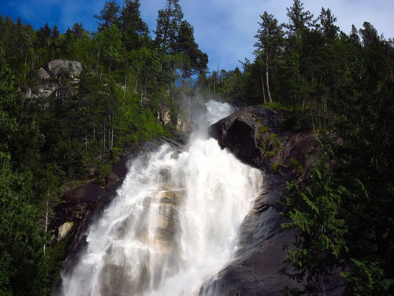
At 335 metres, Shannon Falls is the third-tallest waterfall in BC, and it announces itself before you see it — you can hear the thing from the parking lot. The walk to the main viewpoint is a flat, easy ten minutes on a boardwalk, which makes this the best effort-to-payoff ratio on the whole drive. Spring runoff is the loudest; by late summer it thins out but still puts on a show.
I found this out the soggy way: stand on the lower viewing platform for more than a minute and the mist will soak your jacket. Worth it. The falls share their parking area with the gondola next door, so do Shannon first — it’s free, it’s quick, and it buys you a parking spot before the gondola crowds roll in.
5. Sea to Sky Gondola — ten minutes to the top of the world
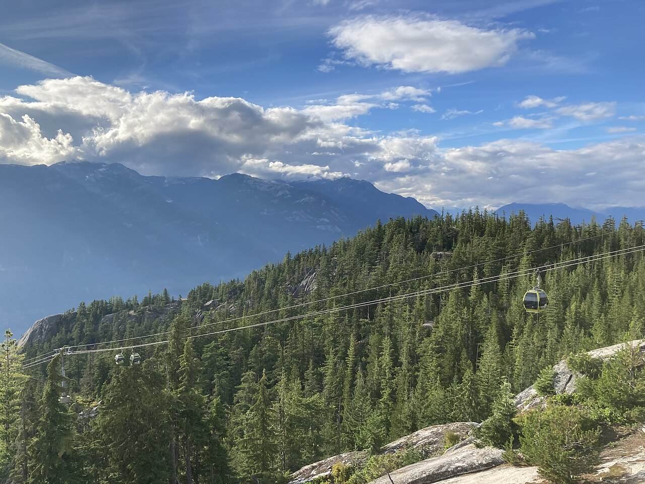
The gondola base sits practically in Shannon Falls’ parking lot, and the ten-minute ride climbs to 885 metres above Howe Sound. Up top there’s the Sky Pilot suspension bridge, the Summit Lodge, and a set of short alpine trails — plus the Chief Overlook, which frames the Stawamus Chief like it was placed there on purpose. Tickets run about $70 for adults; I double-checked current prices and hours on the official Sea to Sky Gondola site before I went.
The suspension bridge wobbled under my feet in a way I did not enjoy and will absolutely do again. The Panorama Trail past the lodge is an easy loop with the kind of views that make you stop mid-sentence. I got up there at 11 AM into a proper line; on the way back down I watched the afternoon crowd thin to nothing. Go early, or go late.
Do Shannon Falls first, then the gondola — same parking area, and the falls lot fills by mid-morning in summer. If the gondola line looks long, buy your ticket for a late-afternoon slot, grab lunch in Squamish, and come back. The summit light at 4 PM is better anyway.
6. Squamish — fuel, food, and the halfway mark
Squamish is the working town in the middle of the postcard — and the most useful stop on the drive. This is where you gas up. Fuel here runs noticeably cheaper than in Whistler, and I’ve made this mistake so you don’t have to: I once rolled into the corridor on a quarter tank thinking “it’s only 120 km.” It’s 120 km of mountain road with exactly one more town. Don’t be clever. Fill the rig in Squamish.
The Squamish Adventure Centre on Loggers Lane has washrooms, trail info, and staff who actually know the conditions — worth a five-minute stop if you’re hiking anything. And if you’re doing this drive in a rental, the renting a car in Canada guide covers the winter-tire question and the one-way fee traps before you sign anything.
7. Stawamus Chief — the granite wall
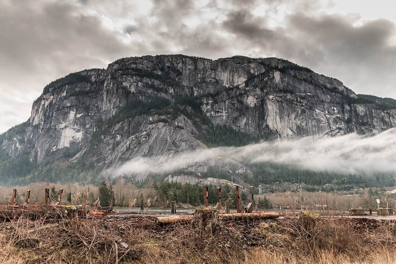
You’ve been staring at it since the gondola. The Chief is a 700-metre granite monolith standing guard at Squamish’s southern edge — one of the largest granite monoliths in the world, and the reason this town smells faintly of chalk and ambition. The serious climbers go straight up the face. The rest of us have options: the Sea to Sky Gondola’s Chief Overlook (see above) or the short walk to the viewpoint pullouts along the highway, where the whole wall fills your windshield.
I am not a climber. I stood at the base pullout, looked straight up until my neck hurt, and felt very small in the best possible way. Deadpan reverence is about all I’ve got for a rock that size. If you want the hike, the trail to the first peak is a serious half-day grunt — start from the Chief parking area early, bring water, and don’t trust the weather you left behind in Vancouver.
8. Garibaldi viewpoints — the quiet pullouts

North of Squamish, the highway climbs toward the Garibaldi ranges and the signed viewpoints start stacking up — Tantalus View and the Garibaldi pullouts, each one a five-minute leg-stretcher with a panorama that has no business being free. At 8 AM I had the Tantalus pullout entirely to myself: the range across the valley still holding snow, not another engine running. This is the part of the drive the tour buses skip, which is exactly why you shouldn’t.
These are signed, paved pullouts — use them. Do not invent your own shoulder stop on a blind curve; the highway patrol has opinions about that, and so do the logging trucks.
9. Brandywine Falls — the short walk with the big payoff

About 20 minutes south of Whistler, Brandywine Falls drops 70 metres into a canyon you can’t see coming until you’re at the railing. The walk from the parking lot is fifteen minutes on an easy trail — doable in whatever shoes you’re wearing — and the viewing platform hangs right over the edge. It’s the last proper stop before Whistler, and it’s the one that makes people say “okay, one more photo” three times.
BC Parks looks after this one too, so the same day-use parking pass rules may apply — check bcparks.ca the night before, especially on summer weekends when the lot fills by noon.
10. Whistler Village — the finish line
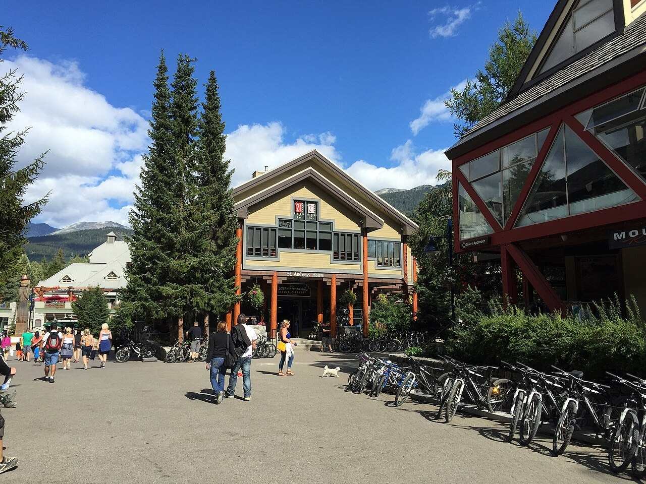
And then you’re there. Whistler Village is car-free in the core, all pedestrian lanes and patios with the mountains leaning over everything, and after a day of pullouts it feels like arriving somewhere on purpose. Park the rig in one of the day lots, walk the Village Stroll, and get dinner — you’ve earned it. If you’re staying over, the official Whistler.com site has the current lodging and lift-ticket picture.
I rolled in at 4:30 PM on my first run, starving and slightly dazed, and the Village did exactly what it’s supposed to do: fed me, showed me a mountain, and made me forget the drive home was still a thing. For the bigger trip-planning picture — costs, seasons, how this fits a wider BC trip — the Canada trip cost guide and Vancouver travel cost breakdown have the numbers.
Which direction should you drive it?
Northbound: Vancouver to Whistler. That’s my answer, and here’s why. The signed pullouts favor northbound traffic — they sit on the right shoulder, so you roll in and out without crossing the highway. Southbound drivers get the ocean on their side of the car the whole way, which sounds great until you’re trying to merge left into a pullout across two lanes of weekend traffic. Drive north in the morning, and if you’re coming back the same day, the evening light on the southbound leg is the consolation prize. Your passenger gets the water views northbound. Pick your passenger accordingly.
Winter driving & seasons on the corridor
The Sea to Sky is a proper mountain highway, and it acts like one from October to March. Winter tires (M+S or the mountain-snowflake symbol) are legally required on this corridor from October 1 to March 31 — rental cars included, so ask the agency what’s on the car before you leave the lot. I double-checked the current designated-route dates on DriveBC’s official site; check the road conditions there the morning you drive, because this road closes for avalanche control more often than you’d think.
May through October is the sweet spot: dry pavement, full waterfall volume in late spring, and the alpine trails at the gondola summit snow-free by July. November brings the rain back and the waterfalls thin out — still dramatic, just wetter. For how August fits the wider travel calendar, see Canada in August.
This corridor has active rockfall and avalanche zones — the signs aren’t decoration. In winter, check DriveBC the morning of, carry chains if you’re in a 2WD rental, and never stop on the shoulder outside a signed pullout. In summer, the danger is simpler: deer at dawn and dusk. I nearly collected one near Daisy Lake. Drive it in daylight if you can.
Driving it electric
You can absolutely do this drive in an EV — it’s 120 km, not the outback. There are DC fast chargers in Squamish (the natural halfway top-up) and in Whistler, plus Level 2 chargers at several trailhead and village lots along the way. I’d still leave Vancouver at 80%+ and top up in Squamish while you eat lunch; mountain grades eat range faster than the flat math suggests, and the heater in winter makes it worse. The HelloBC official site keeps a current list of EV-friendly stops on the corridor.
What does the drive cost?
The road itself is free — no tolls, no park gates on the highway. The money goes to the stops: the gondola and the mine museum are the two paid attractions, plus fuel and food. Pick your travel style, tell the calculator how many days you’re staying (1 = the drive, 2 = overnight in Whistler), and it does the rest. (Accommodation not included — see the table below.)
Budget calculator
Per person, in Canadian dollars. Excludes accommodation.
Budget ≈ $100/day · Mid-range ≈ $190/day · Luxury ≈ $335/day. Admission and fuel checked October 2026.
| Expense (per person / day) | Budget | Mid-range | Luxury |
|---|---|---|---|
| Accommodation (Whistler overnight) | $45 (hostel dorm) | $180 (village hotel) | $350+ (slope-side suite) |
| Food & drink | $40 | $80 | $150 |
| Sights (gondola, mine museum) | $20 | $45 | $85 |
| Getting around (fuel share) | $25 | $40 | $60 |
| Coffee, treats & souvenirs | $15 | $25 | $40 |
| Daily total | ~$145 | ~$370 | ~$685 |
The 1-day drive plan
| Time | Stop | What to do |
|---|---|---|
| 8:00 AM | Leave Vancouver | Full tank, coffee in hand, winter tires confirmed Oct–Mar |
| 8:30 | Horseshoe Bay | Quick harbour look, back on the road |
| 9:15 | Porteau Cove | Waterfront walk, hold your hat |
| 10:15 | Britannia Mine Museum | Underground train + Mill No. 3 (90 min) |
| 12:00 | Shannon Falls, then gondola | Falls boardwalk (30 min), ride up, lunch at the Summit Lodge |
| 2:30 | Squamish | Gas up — cheapest fuel on the corridor |
| 3:15 | Garibaldi pullouts | Tantalus View, leg stretch, silence |
| 4:00 | Brandywine Falls | 15-min trail to the platform |
| 5:00 | Whistler Village | Park, stroll, dinner. Done. |
FAQs about the Sea to Sky Highway
How long does it take to drive the Sea to Sky Highway?
The highway itself is 120 km and takes 1.5 to 2 hours of actual driving from Vancouver to Whistler. But that’s the wrong question — with the nine stops in this guide, plan a full day (8–9 hours). I tried to do it in half a day once. I arrived at dusk and missed two stops I’d wanted. Don’t be me.
Can you do the Sea to Sky Highway without a car?
Not really, no. Buses run between Vancouver and Whistler, but they don’t stop at the pullouts, waterfalls, or the gondola — and the pullouts are the entire point. You need your own wheels: a rental car, a rideshare with a driver who’s in on the plan, or an EV with a Squamish charging stop. If you’re renting, read my renting a car in Canada guide first.
Do you need winter tires on the Sea to Sky Highway?
Yes, from October 1 to March 31. Winter tires (M+S or the mountain-snowflake symbol) are legally required on this corridor, and the rule applies to rental cars too — confirm what’s on the car before you leave the lot. I double-checked the current designated-route dates on DriveBC’s official site. Check DriveBC the morning you drive: the highway closes for avalanche control more often than visitors expect.
Is the Sea to Sky Gondola worth the price?
For me, yes — it’s the only stop that gets you properly above the highway, and the Chief Overlook frames the Stawamus Chief in a way no roadside pullout can. Adult tickets run about $70; go early or late afternoon to dodge the midday line, and pair it with Shannon Falls since they share a parking area. If you’re watching the budget, the free pullouts and both waterfalls still make this drive one of the best value days in BC.
What’s the best time of year to drive it?
May through October for dry pavement and full waterfall volume — late May and June are the loudest at Shannon Falls. July and August bring the crowds and the gondola lines; September is my pick, with thinner traffic and the light going golden. Winter is dramatic but serious: short days, mandatory winter tires, and possible closures. Shoulder-season drivers should read Canada in August for the wider seasonal picture.
Is the Sea to Sky Highway scary to drive?
It’s far tamer than its reputation. The highway was rebuilt for the 2010 Olympics — it’s a proper divided, barrier-lined road with sane sightlines, not the cliff-edge two-laner people imagine. The sketchy parts are the drivers, not the road: it’s a popular corridor and people rubberneck. Drive it in daylight, use the signed pullouts instead of inventing shoulder stops, and you’ll be fine. Winter is the exception — treat it with respect, check DriveBC, and don’t rush it.
Keep exploring
The Sea to Sky is the headline act — here’s where I’d go next:
- Things to do in Vancouver — the city you just left, done properly
- 4-day Vancouver itinerary — stack this drive onto a Vancouver week
- Renting a car in Canada — winter tires, one-way fees, and what to check at the counter
- Vancouver travel cost — the full budget breakdown for the city end
- Canada trip cost guide — how a BC road trip fits the national budget
- Where to stay in Victoria, BC — if you’re continuing to the Island after Whistler
Leave at eight. Gas up in Squamish. Don’t stop on the shoulder. You’ve got a good day ahead of you.
3 comments