
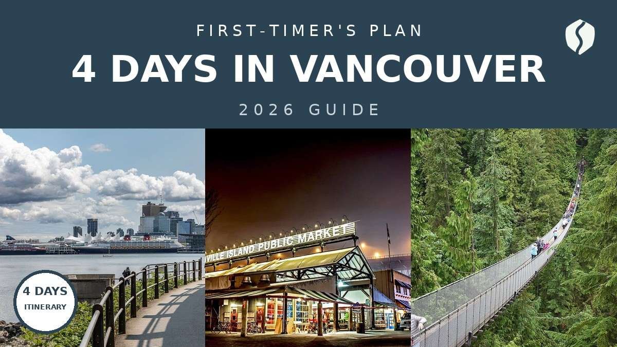
Here’s the thing about Vancouver: it looks like a small city on a map, and then you arrive and realize the “city” is a harbour, three municipalities, a mountain range, and a rainforest peninsula — all within about twenty kilometres. I’ve planned this city more times than I can count, for friends and for myself, and the mistake every first-timer makes is the same one: trying to see it all from one hotel corner, crisscrossing back and forth like a pinball.
This 4 days in Vancouver itinerary fixes that. Each day stays in one zone: Day 1 for Stanley Park and the harbour, Day 2 for the markets and the old town, Day 3 for the North Shore mountains, Day 4 for the university’s museums and the city’s best garden. No car required — the whole plan runs on a TransLink Compass card, and I’ve timed the transit legs so you’re not guessing at the bus stop.
Quick honesty note: prices and hours below are planning figures, hedged with a “~” on purpose. I double-checked the moving parts on the official sites as I wrote this — TransLink for transit, Grouse Mountain and the Capilano Suspension Bridge for North Shore tickets. Do the same the week you go. Schedules move seasonally — trust me on this one.
- ✓ The shape: Day 1 is the park-and-harbour wow, Day 2 is markets and old-town food, Day 3 is the North Shore mountains, Day 4 is culture and gardens — each day stays in one zone, so you never backtrack across the city.
- ✓ Transit is the plan, not the backup: SkyTrain, SeaBus, the little Aquabus ferries and regular buses cover every stop on this itinerary. Load a Compass card on arrival and forget rental cars exist.
- ✓ Rain is a feature here, not a deal-breaker: I’ve built rainy-day swaps into every day, because Vancouver’s nickname is Raincouver for a reason — the plan below survives a classic BC downpour.
Day 1: Stanley Park, downtown & the English Bay sunset
Day 1 is the “oh, I get it now” day — the day the photos stop doing the explaining. Stanley Park in the morning, the downtown waterfront at midday, and the sunset at English Bay to close it out. Keep this day gentle: you probably flew in, you’re adjusting, and the best version of Day 1 ends with you sitting on a log at the beach wondering why you don’t live here. (I’ve had that exact thought. Multiple times.)
Morning: Stanley Park’s seawall loop
Start early at Stanley Park — a 400-hectare rainforest peninsula that is, pound for pound, the best urban park in Canada. The move is the seawall loop: ~9 km of flat waterfront path circling the park, with the city on one side and the North Shore mountains on the other. Here’s my confession: the first time, I walked it. All of it. It took me most of the morning and I arrived at lunch hobbling. Rent a bike — rental shops cluster along Denman Street at the park’s edge — and the loop becomes a breezy ~1-hour ride with stops.
The two stops I’d never skip: the Brockton Point totem poles, the most-visited attraction in all of BC — nine poles telling the stories of the Haida, Gitxsan, Kwakwaka’wakw and other coastal nations. Give the park a full morning: 3–4 hours, unhurried, with a coffee stop at the park’s café near Second Beach.
Rent the bike for the full day, not the hour. It’s only a little more, and you’ll want it again for the evening ride down to English Bay. Also: ride the seawall counterclockwise (the marked direction) so you’re on the water side the whole way — trust me, the views land better.
Afternoon: downtown waterfront, easy
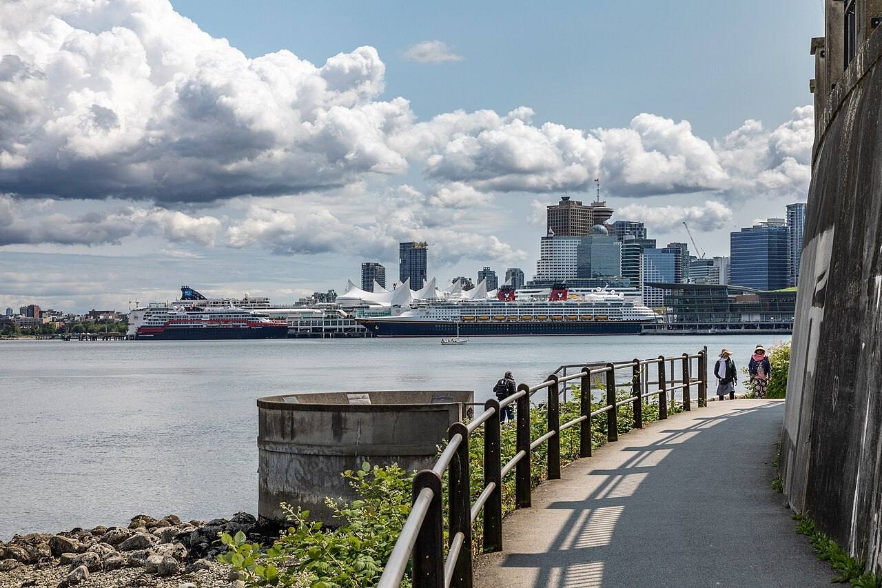
From the park’s east edge you’re ten minutes from downtown on foot. Keep the afternoon light: stroll Canada Place (the white-sailed convention centre on the harbour — it’s the cruise-ship terminal, and the promenade views across Burrard Inlet are free), then wander up to Robson Street for the people-watching and an early snack. This is not a sightseeing afternoon; it’s a recovering-from-travel afternoon.
Evening: English Bay sunset
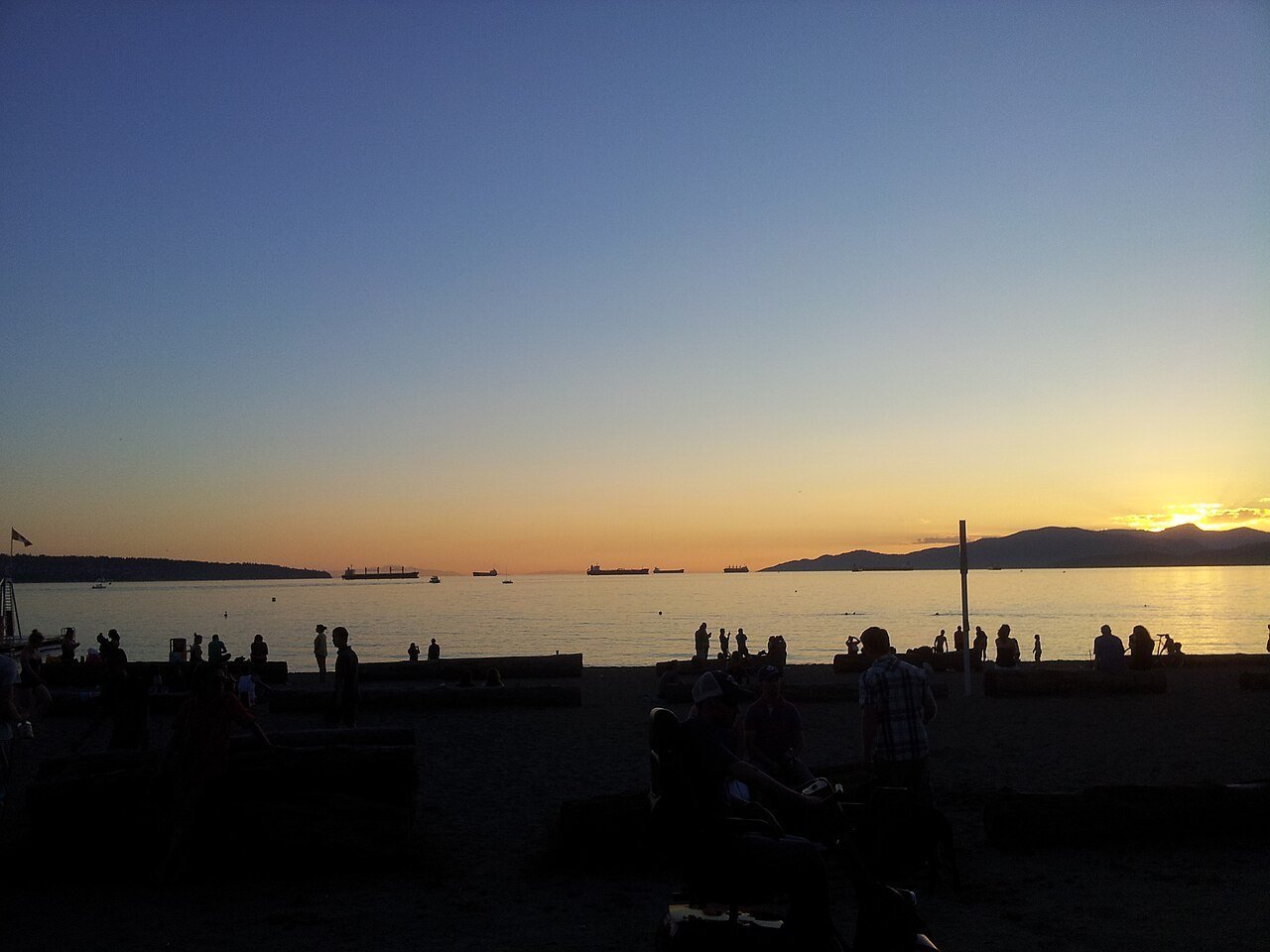
Now the non-negotiable part of Day 1. Ride or walk down Denman Street to English Bay Beach in the West End for sunset — Vancouver’s front-row seat to the sun dropping behind Vancouver Island. In summer this is a proper event: locals bring picnics, someone is always playing guitar badly, and the sky does the rest. Grab dinner on Denman afterwards (the West End has the city’s best cheap eats — sushi, ramen, and a legendary cheap-pizza slice window) and you’ve closed the day perfectly. Honest downside: on a grey day there is no sunset to speak of — the rainy-day swap below moves the evening to the Vancouver Art Gallery’s late-night hours instead.
Day 2: Granville Island, Gastown & Chinatown
Day 2 is the food-and-neighbourhoods day: a market morning, an old-town afternoon, and dinner in Chinatown.
Morning: Granville Island
Catch the tiny Aquabus ferry from Hornby Street (by the Yaletown Roundhouse) across False Creek to Granville Island — the crossing takes ~5 minutes and costs a few dollars. I timed it once because I’m like that: door to Public Market, 25 minutes from downtown, including the wait.

The Public Market is the star: a big, glorious, slightly chaotic food hall of produce, cheese, seafood and baked goods. Go before noon, when the stalls are fully stocked and the tour buses haven’t arrived. My ritual: a coffee from the market’s roaster and a still-warm pastry, then a slow lap. The island’s back lanes are full of artists’ studios and a very good brewery — Destination Vancouver’s official site keeps a current list of what’s open. Budget ~3 hours here; you’ll use them.
Afternoon: Gastown
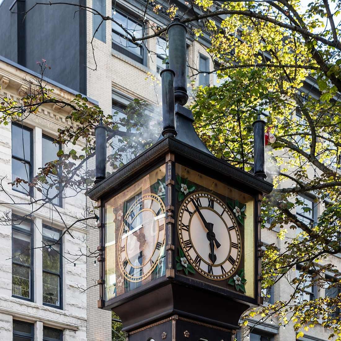
Bus or a short SkyTrain hop to Gastown, Vancouver’s oldest neighbourhood — Victorian brick, cobblestone Water Street, and the steam clock that puffs its little whistle on the quarter hour. Yes, it’s touristy. Go anyway: the architecture is genuinely lovely, the independent shops are worth the browsing, and the clock is one of those things that’s cheesier in theory than in person.
Wander from Water Street up through Maple Tree Square and into the Victory Square area — this is the Gastown locals actually use, all coffee bars and design shops. Honest downside: the blocks east of Gastown, around Main and Hastings, are where the city’s homelessness and drug crises are most visible — it’s confronting, and I’d rather say it plainly than have you stumble into it unprepared. Stay on the well-travelled streets (Water, Carrall, Cordova west of Main), don’t wander east after dark, and you’ll be fine.
Gastown’s steam clock draws a crowd on the quarter hour in summer — and the tour buses idle on Water Street around midday. Do Gastown before 11 AM or after 3 PM and it feels like a neighbourhood, not a set. And on Granville Island, Sunday afternoons are the island’s busiest window; Saturday morning is the sweet spot for the market.
Evening: Chinatown dinner
End Day 2 in Chinatown, a 10-minute walk east of Gastown — one of North America’s oldest Chinatowns, anchored by the Millennium Gate at Pender and Taylor. Dinner here is the move: dim sum houses, hand-pulled noodle shops, and bakeries selling buns I still think about. Look for the line of aunties, and join it.

Day 3: the North Shore — Capilano Suspension Bridge & Grouse Mountain
Day 3 is the “wait, mountains are just THERE?” day. The North Shore sits directly across Burrard Inlet, and getting there is one bus ride across the Lions Gate Bridge. Start early and spend freely: it earns it.
Morning: Capilano Suspension Bridge Park
Take the bus up Capilano Road to the Capilano Suspension Bridge — the 137-metre bridge swaying 70 metres above the Capilano River. In peak season a free shuttle runs from downtown (confirm it’s operating on the official Capilano site before you plan around it); otherwise the TransLink bus drops you at the park gate. Here’s the thing I wish someone had told me: go at opening. My first visit was midday in August and the bridge was a slow conga line of phones; I went back at 9 AM on a weekday and had it nearly to myself for twenty minutes.
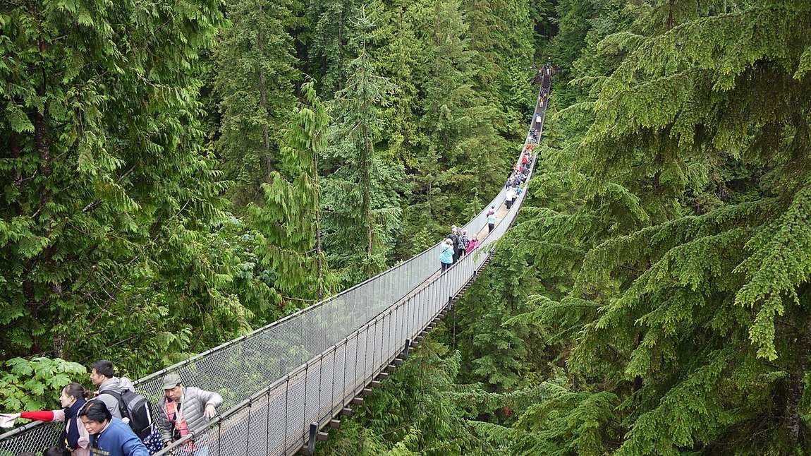
The bridge is the headline but the park is the value: the Cliffwalk (a glass-floored walkway bolted to the granite cliff), the Treetops Adventure (suspension bridges between old-growth Douglas firs), and the storytelling centre on the area’s Indigenous history. Budget ~2.5–3 hours, more if you’re a photographer.
After Capilano, walk ten minutes down Capilano Road to the Capilano Salmon Hatchery — free, quiet, and weirdly fascinating, with fish ladders you can watch through underwater windows. Almost nobody goes, because everybody’s still queueing for the bridge gift shop. Salmon season (roughly August–November) is the show, but it’s interesting year-round.
Afternoon: Grouse Mountain
One bus (or a short taxi hop) east along the North Shore and you’re at the base of Grouse Mountain — the Skyride gondola up, the city spread out below, the whole “Peak of Vancouver” thing. At the top: the lumberjack show, the grizzly bear habitat (two rescued grizzlies, Grinder and Coola, living better than most of us), and in winter, actual skiing 15 minutes from downtown. I checked what’s open and the current ticket options on grousemountain.com before my last visit — do the same, because the mountain’s seasonal rhythm (winter sports, summer alpine experiences) changes what the day looks like.

Honest downside: Grouse is weather-dependent — a socked-in summit is just an expensive cloud. Check the mountain webcam the morning you go, and if it’s white up there, flip the day: do the Lynn Canyon forest walk (free suspension bridge, a short bus ride east) instead and save Grouse for a clearer afternoon. The views are the whole point; don’t pay for them blind. For the full breakdown of getting to all three without a car — Capilano, Grouse and Lynn Canyon — my day trips from Vancouver without a car guide covers the North Shore corridor in detail.
Day 4: Museum of Anthropology & Queen Elizabeth Park (or the Steveston swap)
Day 4 is the “there’s more to this city than the postcard” day. The main plan: one of Canada’s great museums in the morning, the city’s best garden in the afternoon. And if museums aren’t your thing, I’ve built you a full alternative — the Steveston swap — because a good itinerary has an escape hatch.
Morning: Museum of Anthropology at UBC
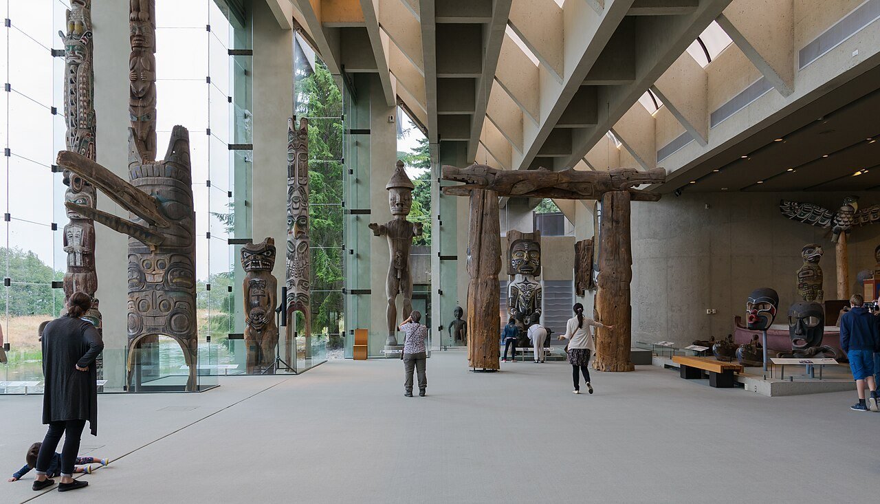
The Museum of Anthropology (MOA) at the University of British Columbia is the museum I send people to when they say they don’t like museums. The Great Hall alone is worth the trip: floor-to-ceiling glass, a wall of totem poles and house posts from Haida, Gitxsan and other Northwest Coast nations, and a view over the water that’s almost unfair to the art. Don’t miss the Bill Reid Gallery’s Raven and the First Men carving. I double-checked hours and admission on the official MOA site before my last visit; the museum is closed some Mondays, so confirm your day lines up. Take the bus out to UBC’s Point Grey campus (~30–40 minutes from downtown on the 99 B-Line or the 4) and give it a full morning.
Afternoon: Queen Elizabeth Park
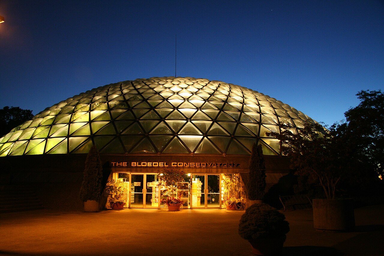
Head back toward the city to Queen Elizabeth Park — 52 hectares on Little Mountain, the highest point in Vancouver, with the whole downtown-and-mountains panorama laid out in front of you. The gardens are the draw: the sunken Quarry Garden (a former rock quarry turned into something out of a fantasy novel), rose gardens in summer, and the Bloedel Conservatory, a domed glasshouse of tropical plants and free-flying birds. Here’s my personal moment for this one: I got caught in a proper downpour crossing the park, sprinted for the conservatory, and spent an accidental hour in warm humid air watching macaws — it ended up being one of my favourite hours of the trip. Sometimes the rain gives you the better day.
The Steveston swap (full alternative)
Not a museum person? Swap the whole of Day 4 for Steveston, the fishing village in Richmond: Canada Line SkyTrain to Richmond–Brighouse, then a local bus down to the river (~50–60 minutes from downtown). The Gulf of Georgia Cannery is a national historic site and a genuinely great tour, the boardwalk fish & chips are the real thing, and the main street of bakeries and bookshops is an easy half-day stroll. It’s flat, walkable, and completely car-free friendly. Honestly, if you’re travelling with kids, I’d make Steveston the main plan and the museum the swap — the cannery’s interactive exhibits beat quiet galleries for anyone under twelve.

Where to base yourself: downtown vs the West End
Stay downtown or in the West End and everything above works. Downtown (around Robson, Burrard, or the waterfront) puts you on the SkyTrain and the SeaBus — fastest for Day 2 and Day 3. The West End (Denman Street, English Bay) is quieter, cheaper, and you’re already at Stanley Park and the sunset — my pick for first-timers who want the beach-town feel. Either way, book near a SkyTrain station: Waterfront, Burrard or Granville. For what the days actually cost including hotels, my Vancouver travel cost breakdown shows where the money goes, and the Canada trip cost guide zooms out to the whole country.
Getting around: the Compass card
The entire itinerary runs on TransLink: SkyTrain, SeaBus, buses, and the little Aquabus ferries. Buy a Compass card at the airport SkyTrain station on arrival and load it as you go — or buy day passes for the transit-heavy Days 2 and 3. Tap in, tap out, done. Total transit cost for four days runs roughly ~$10–15/day — a rounding error next to a rental car. Only here for two days instead of four? My 2 days in Vancouver itinerary compresses the highlights.
Rainy-day swaps (because Raincouver)
Vancouver gets ~160 rainy days a year, so build the backup into the plan: Day 1: swap the seawall loop for the Vancouver Art Gallery’s late hours and the FlyOver Canada ride at Canada Place (indoor, and the “flying over the Rockies” film is a genuine crowd-pleaser). Day 2: Granville Island’s market is covered, so keep it — just move Gastown’s wandering to the covered Dr. Sun Yat-Sen Classical Chinese Garden in Chinatown instead. Day 3: Capilano and Grouse in real rain are miserable — this is the day to flip, and do Day 4’s museum morning instead. Day 4: MOA is indoors already; swap Queen Elizabeth Park for the Vancouver Aquarium (inside Stanley Park, full afternoon). The golden rule: decide over breakfast, not the night before.
Where everything sits
Tap a stop to jump the map. Days 1 and 2 cluster around downtown and False Creek; Day 3 jumps across the inlet to the North Shore; Day 4 heads west to UBC and south to Queen Elizabeth Park — with Steveston sitting further south as the swap. That clustering is the whole strategy: one zone a day, no crisscrossing.
Map data © OpenStreetMap contributors. Open the full map
What 4 days in Vancouver costs
This calculator covers the days themselves: food, sights, transit and the little treats. Pick your style, set your days. The sights line is doing the heavy lifting on Day 3 — Capilano and Grouse are the two big tickets — which is exactly why a mid-range Vancouver budget lands where it does.
Budget calculator
Per person, in Canadian dollars. Excludes accommodation.
Budget ≈ $80/day · Mid-range ≈ $155/day · Luxury ≈ $265/day. Per person, excludes accommodation. Prices checked October 2026.
FAQs
Is 4 days enough for Vancouver?
Yes — four days is the sweet spot for a first visit. Three days forces you to drop the North Shore or the UBC/museum day, and both are worth keeping; five days lets you add Whistler or Victoria as a day trip. The plan above is paced for real humans: one zone per day, built-in sunset and coffee stops, and nothing that requires a 6 AM alarm.
Where is the best area to stay in Vancouver — downtown or the West End?
Both work for this itinerary. Downtown (Robson, Burrard, waterfront) is best for transit connections — the SkyTrain and SeaBus make Days 2 and 3 fastest. The West End (Denman Street, English Bay) is quieter, slightly cheaper, and puts you at Stanley Park and the sunset already — my pick for first-timers who want the beach-town feel. Either way, book near a SkyTrain station: Waterfront, Burrard or Granville.
What if it rains the whole time I’m in Vancouver?
Then you’re getting the authentic experience — Vancouver gets ~160 rainy days a year. Every day above has a rainy-day swap: the Art Gallery and FlyOver Canada on Day 1, the covered Public Market and Sun Yat-Sen Garden on Day 2, the MOA on Day 3, and the Aquarium on Day 4. Pack a real rain jacket (umbrellas are a tourist tell here) and decide each morning over breakfast, not the night before.
Should I skip Whistler on a 4-day Vancouver trip?
On four days, yes — skip it. Whistler is a full day trip (~2 hours each way by coach), and squeezing it in means dropping the North Shore or the museum day, which are both excellent. If you have five days, add Whistler as Day 5: book the coach ahead in ski season and on summer weekends. In winter, Grouse Mountain on Day 3 already gives you the mountain fix without the extra travel day.
Do I need a car for 4 days in Vancouver?
No — a car is actively worse for this itinerary. Downtown parking is expensive, the North Shore buses are frequent, and every stop above is on TransLink: SkyTrain, SeaBus, buses and the Aquabus. A Compass card and ~$10–15/day of transit covers all four days. The only scenario where I’d rent one is if you’re adding a Sea to Sky or Whistler self-drive day beyond the four days.
What is the best month to visit Vancouver?
May to September, with July and August the driest and warmest — long evenings, the English Bay sunset at its best, and the North Shore at full operation. Late May and June bring the gardens into bloom with thinner crowds; September is the local secret (warm water, fewer tourists, harvest season on Granville Island). October onwards is rain season: still very visitable with the swaps above, but this itinerary shines in summer.
Bottom line: four days, one zone a day, no car, and a sunset you’ll remember longer than the flight home. Rent the bike on Day 1, go to Capilano at opening on Day 3, eat dinner in Chinatown on Day 2, and let Day 4 surprise you — mine did, in a downpour, inside a tropical greenhouse. I’ve made the mistakes (the walked seawall, the midday bridge conga line) so your version runs smoother than mine did. You’ve got this. — Sarah