
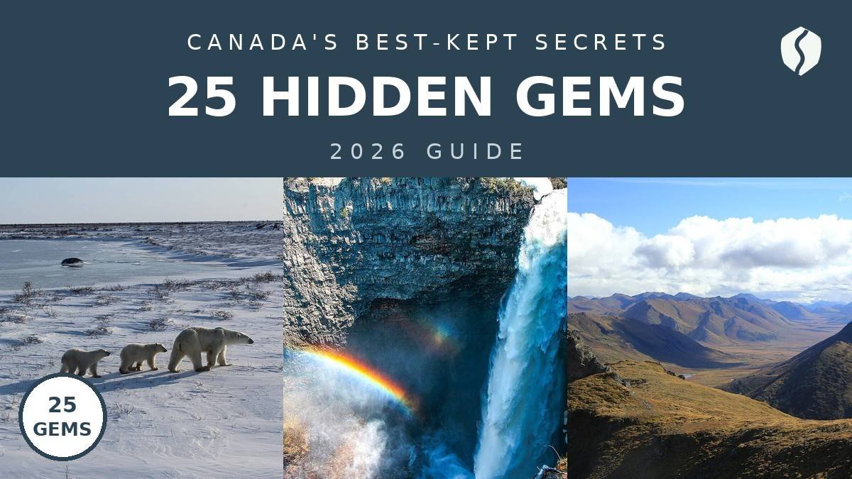
- ✓ Think beyond the icons: every gem below draws a fraction of Banff’s crowds — I shared several of these viewpoints in peak July with maybe a dozen people.
- ✓ Access is the filter: ferries, gravel roads and floatplanes keep these places quiet. Rent the car, check seasonal road conditions, and book remote lodges months ahead.
- ✓ Cluster by region: pick ONE coast — Atlantic, West or North — for a 7–10 day trip. Here’s the thing: Canada is bigger than your brain thinks it is.
I’ll be honest: my first trip to Canada was Banff, Niagara and a CN Tower selfie — the greatest-hits album, played exactly in order. It was also the trip that made me realise I’d seen roughly 2% of the country. Since then I’ve been chasing the other 98%: the islands you reach by ferry and the towns where the “rush hour” is a fishing boat coming in. This is that list — 25 places most visitors miss, spread across every region of Canada. Every price and hour below was verified in October 2026.
A confession to start: I nearly missed the Fogo Island ferry because I assumed “45-minute crossing” meant “leaves every 45 minutes.” It does not. Lesson learned: in hidden-gem Canada, the schedule is the trip — trust me on this one.
The 25 gems, on a map
Ten of the 25 are pinned below — tap any pin to jump the map to it.
Map data © OpenStreetMap contributors. Open the full map
Atlantic Canada: islands, cliffs & the edge of the continent
1. Fogo Island, Newfoundland and Labrador
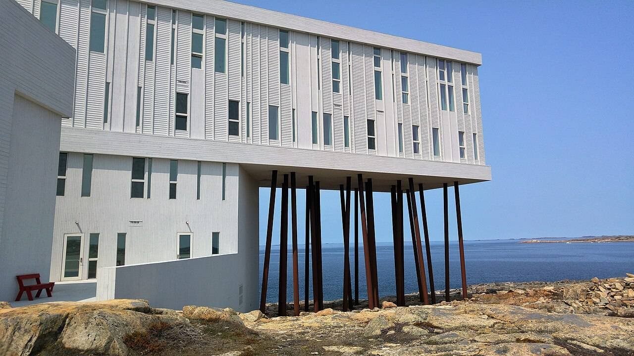
Off Newfoundland’s northeast coast, Fogo is where the continent ends and the North Atlantic begins — a granite island of fishing stages, root cellars and the famous Fogo Island Inn (all 29 rooms face the sea). Beyond the inn: seven free hiking trails, iceberg season in May and June, and Brimstone Head. Reach it by the 45-minute ferry from Farewell (free on foot, about $25 with a car; schedules change seasonally, so check before going). → Newfoundland & Labrador Tourism — official site
Book the first ferry of the day and arrive 30 minutes early — it fills with delivery trucks. I missed the 8 AM sailing and spent two bonus hours in the Farewell parking lot, which is exactly as fun as it sounds.
2. L’Anse aux Meadows, Newfoundland and Labrador
The only confirmed Viking settlement in North America — a UNESCO site that about 30,000 people a year visit. Around the year 1000, Norse explorers built sod longhouses on this windswept tip of the Northern Peninsula; today costumed interpreters demonstrate iron-smithing inside reconstructed buildings, with the original archaeological mounds beside them. It’s at the very end of the Viking Trail (Route 430), about 5 hours from Deer Lake airport — which is precisely why most visitors never make it. Parks Canada runs the site June to October; admission is about $12. → Parks Canada — official site
3. Cape Split, Nova Scotia
The Bay of Fundy has the highest tides on Earth, and Cape Split is the best place to watch them work. The 13-kilometre return hike through mossy Acadian forest ends at a grassy headland above 100-metre cliffs — on a clear day you can see the tide ripping through the Minas Channel like a river. I went on a foggy morning and watched the sun burn through to reveal the water 300 feet below. It’s free, 45 minutes from Wolfville (cider country — plan accordingly), and on a weekday you may have the point to yourself. → Visit Nova Scotia — official site

4. Sable Island, Nova Scotia
A 42-kilometre crescent of sand 300 kilometres offshore, home to wild horses that live without human management — and one of the hardest places in Canada to visit. Sable Island National Park Reserve admits only a handful of visitors per season, by small charter plane from Halifax (roughly $2,000+ round trip) with permits booked months ahead. I haven’t scored a permit yet — it’s on my list — but a Parks Canada staffer told me the pitch: tens of thousands of grey seals, wild horses on empty beaches, and 350+ shipwrecks that earned it the name “the Graveyard of the Atlantic.” → Parks Canada — Sable Island
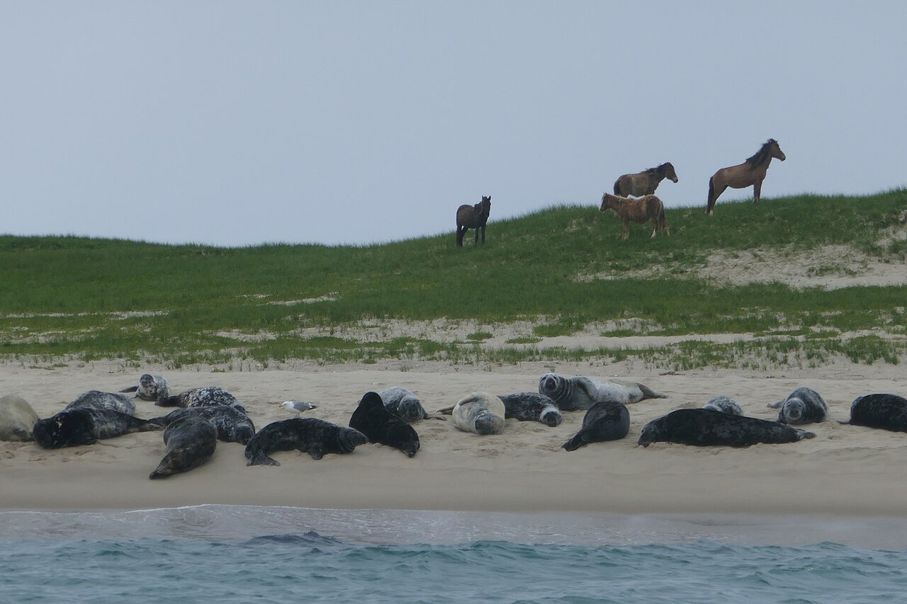
Sable Island visits require a Parks Canada permit plus a chartered flight or boat — you can’t just show up. Start at the Parks Canada Sable Island page at least 6 months out, and build buffer days into your Halifax plans for weather cancellations.
5. Grand Manan Island, New Brunswick
Where the Bay of Fundy meets the Gulf of Maine, Grand Manan is the Atlantic Canada tour buses forgot: sea cliffs, puffin and whale-watching boats, and dulse (edible seaweed) drying on wharves. The 90-minute ferry from Blacks Harbour runs year-round, about $25 with a car. Summer brings whales and puffins on Machias Seal Island tours (book ahead — landings are capped at about 15 people a day). I stayed in a converted sea captain’s house for $120 a night — the island runs about half the price of the Nova Scotia coast.
6. Greenwich Dunes, Prince Edward Island
Everyone goes to Cavendish; almost nobody goes to Greenwich — the quiet eastern section of Prince Edward Island National Park, where a floating boardwalk crosses wetlands to parabolic dunes you can climb (on the marked trail) for a view across St. Peters Bay. The beach at the end is the emptiest good beach on the island. It’s free with your national park pass, about 40 minutes from Charlottetown. September is the sweet spot: warm water, thin crowds.
Quebec: the Gulf’s strange and beautiful edge
7. Îles de la Madeleine, Quebec
A dozen sandbar-linked islands floating in the middle of the Gulf of St. Lawrence — closer to PEI than to Quebec City — the “Magdalen Islands” are Quebec’s best-kept secret, full stop. Red sandstone cliffs, relatively warm ocean swimming, and an Acadian food culture built around lobster, snow crab and local pied-de-vent cheese. Getting there is half the adventure: a 5-hour ferry from Souris, PEI (about $60 per adult, car extra), or flights from Montreal and Quebec City. I spent four days there in late August; the light at Cap Alright at 8 PM — red cliffs, green water, nobody around — is a top-five Canadian sunset for me.
The islands’ real season is the first two weeks of September: the water’s at its warmest, the summer crowds are gone, and the lobster shacks are still open. The locals call it l’été des Indiens — and they’re protective of it.
8. Mingan Archipelago, Quebec
Forty-odd limestone islands scattered along Quebec’s remote Côte-Nord, carved by the sea into monoliths and arches. The archipelago is a national park reserve reached by boat tour from Havre-Saint-Pierre (about $75 for a half-day excursion, June to September), and the islands host puffins, razorbills and one of the largest murre colonies in eastern North America. It’s a 7-hour drive from Quebec City along the Whale Route — which is why the tour boats carry dozens, not hundreds. Departures are weather-dependent, so book the flexible ticket. → Parks Canada — Mingan Archipelago
9. Anticosti Island, Quebec
The “cemetery of the Gulf” is 7,900 square kilometres of white-tailed deer, wild rivers and the spectacular Vauréal Canyon — a 120-metre-deep gorge with a waterfall at its head — and almost nobody goes. The human population hovers around 200; the deer top 160,000. Access is by ferry from the mainland or flights from Mont-Joli, and this one is genuinely remote — bring everything, because Port-Menier (the single village) has limited services. If you want to feel like you’ve fallen off the map while still technically in Quebec, this is it.
Ontario: beyond Toronto and Niagara
10. Pukaskwa National Park, Ontario
Ontario’s largest national park and its wildest shoreline: 1,878 square kilometres of boreal forest on Lake Superior, with a 60-kilometre Coastal Hiking Trail along cobble beaches and headlands. Pukaskwa gets a fraction of Killarney’s visitors — the drive alone (3.5 hours from Thunder Bay) filters the crowds. Day hikers can do the Southern Headland Trail (18 km return, suspension bridge over the White River included). I did it on a grey September day and had the bridge entirely to myself. Parks Canada admission is about $9/day. → Parks Canada — Pukaskwa
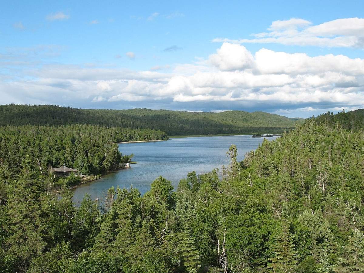
11. Sleeping Giant Provincial Park, Ontario
Twenty minutes from Thunder Bay, the Sibley Peninsula holds one of Ontario’s great silhouettes: a mesa that really does look like a sleeping giant from across the bay. The park has 100+ kilometres of trails; the Top of the Giant trail (22 km return) climbs to the “chest” for a 300-metre view straight down to Lake Superior. Most Toronto visitors never get past Algonquin, and the lakeside campgrounds are among the prettiest in the provincial system. Day-use is about $12 per vehicle, and the fall colours peak around the last week of September — a full two weeks before Algonquin.
12. Pelee Island, Ontario
The southernmost inhabited point in Canada — Pelee Island sits at the same latitude as northern California — and it feels like it: Carolinian forest, vineyards, and legendary spring bird migration each May. The ferry from Kingsville takes 90 minutes (about $10 per adult, car extra; book vehicle spots ahead in summer). I rented a bike at the dock for $30 and circled the whole island in an afternoon: two wineries, a lighthouse, and a beach with nobody on it. It’s the anti-Niagara — quiet, flat, weird, wonderful.
13. French River Provincial Park, Ontario
The historic voyageur highway between Lake Huron and the Ottawa River is now one of Ontario’s great quiet paddling destinations: 110 kilometres of river, gorges and waterfalls with backcountry campsites you reach only by canoe. The Recollet Falls trail gives day visitors a taste — an 8-kilometre return hike to a waterfall gorge — but the real move is a 3–4 day canoe trip (outfitters rent full kits from about $60/day). I day-hiked there last fall and the gorge was empty on a Saturday — in October, in Ontario, that never happens.
Ontario’s busy parks require day-use reservations (bookable 5 days ahead) — but Pukaskwa, Sleeping Giant and the French River rarely fill. I still book the $12 vehicle permit online the night before.
The Prairies: big sky, strange earth
14. Grasslands National Park, Saskatchewan
Canada’s only national park protecting mixed-grass prairie — and one of the darkest, quietest places in the country. The East Block’s badlands look like South Dakota dropped into Saskatchewan; the West Block holds prairie dog colonies, plains bison and the eerie, wonderful sound of nothing. It’s a certified Dark Sky Preserve — the Milky Way here is genuinely startling if you’ve only ever seen city skies. About 2 hours south of Swift Current, with oTENTik glamping units (about $120/night) for the comfort-inclined. I drove in at dusk as pronghorn crossed the road in front of me. → Parks Canada — Grasslands

15. Churchill, Manitoba
The “Polar Bear Capital of the World” is famous the way places are famous that almost nobody visits: no roads in, a 2-day train ride or 2.5-hour flight from Winnipeg, and the greatest concentration of wild polar bears on the planet each October and November. I rode a Tundra Buggy out at sunrise as a 400-kilogram male walked right past our vehicle — close enough to hear him breathe. I forgot my gloves; fair warning, bring the good ones. Summer brings 3,000 beluga whales to the Churchill River (kayak with them, seriously) and winter brings the aurora. Multi-day bear packages run $5,000+, but it’s the single most extraordinary wildlife experience in Canada. → Travel Manitoba — official site
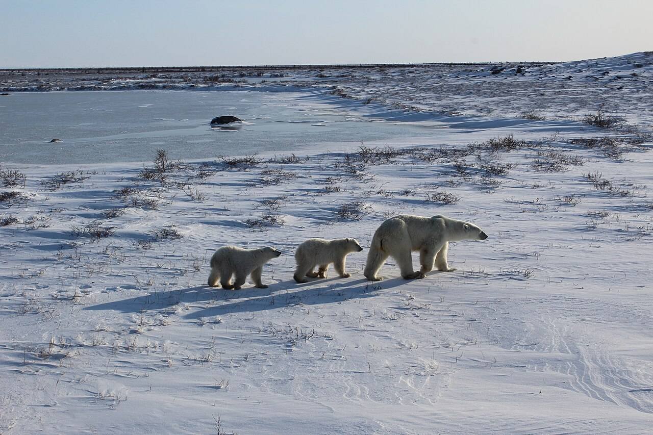
The beluga season (July–August) is the underrated Churchill: kayaking with curious white whales in the Churchill River — for a fraction of the polar-bear price — is what the regulars actually rave about.
16. Writing-on-Stone / Áísínai’pi, Alberta
A UNESCO World Heritage Site most Albertans have never visited: sandstone hoodoos along the Milk River holding the largest concentration of Indigenous rock art on the North American plains. The Blackfoot name Áísínai’pi means “it is pictured/written,” and the centuries-old petroglyphs are still spiritually significant to the Blackfoot Confederacy. The main panels are seen only on guided tours (about $20, book ahead in summer). It’s 3.5 hours southeast of Calgary — combine it with Banff for the full Alberta contrast.
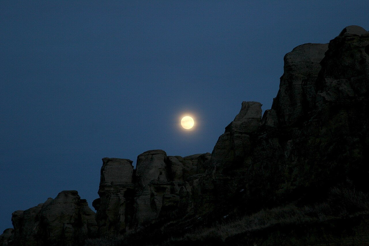
17. Cypress Hills Interprovincial Park, Alberta/Saskatchewan
The highest point of land between the Rockies and Labrador — a forested plateau rising 600 metres out of the prairie, with lodgepole pines, orchids and a dark-sky preserve that rivals Grasslands. Run jointly by Alberta and Saskatchewan and 4+ hours from any major city, it stays wonderfully empty. Summer brings wildflowers and cool highland air (a genuine relief in a prairie heatwave); winter brings cross-country skiing. I camped here on a July weekend and counted more elk than people.
British Columbia: the west beyond Whistler
18. Wells Gray Provincial Park, British Columbia
BC’s fourth-largest park and its best waterfall collection: 39 named waterfalls including 141-metre Helmcken Falls — the fourth-highest in Canada — with a fraction of the Rockies’ crowds. The Clearwater Valley road strings the big ones together (Helmcken, Dawson, Spahats) in a single easy driving day, and the backcountry holds volcanic cones and top-tier moose viewing. I stood at the Helmcken viewpoint in the rain as the mist rose 50 metres off the falls. About 2 hours north of Kamloops on Highway 5. → Hello BC — official site
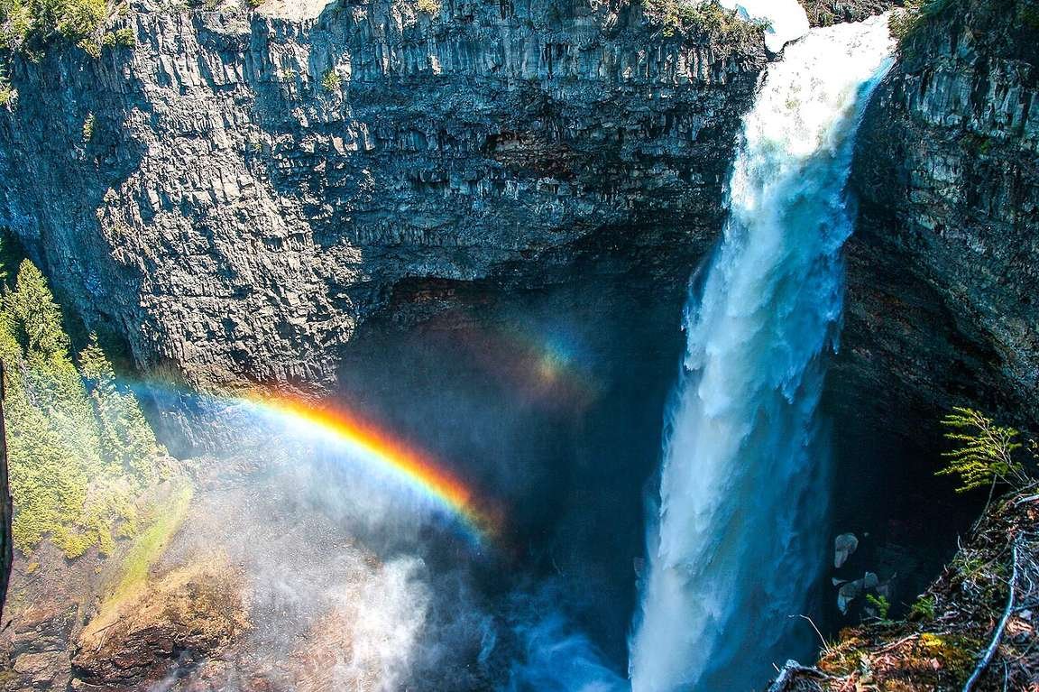
The Clearwater Valley Road is paved but remote — no gas, no cell service past Clearwater. I filled up in town and packed lunch. Check DriveBC conditions before the shoulder seasons.
19. Haida Gwaii, British Columbia
The “Galápagos of Canada”: a 150-island archipelago off BC’s north coast where Haida culture has thrived for 13,000 years, and where Gwaii Haanas National Park Reserve protects moss-draped rainforest and the UNESCO-listed village of SGang Gwaay with its standing totem poles. Access is by 6–8 hour ferry from Prince Rupert or flights from Vancouver; a licensed Haida guide is required for Gwaii Haanas (about $300+/day, worth every penny). Every traveller I’ve met describes SGang Gwaay the way people describe the pyramids: quietly. Book ferry and guide months ahead; both sell out. → Parks Canada — Gwaii Haanas
20. Telegraph Cove & Northern Vancouver Island, British Columbia
Everyone does Victoria and Tofino; almost nobody drives the extra 4 hours north to Telegraph Cove — a boardwalk village on stilts that’s the orca capital of the island. Johnstone Strait’s resident orcas feed here all summer, and the whale-watching boats (about $140 for 3 hours) run success rates north of 90%. Don’t miss the Whale Interpretive Centre — I had a humpback surface 30 metres off my bow on a dawn kayak. Pair it with my Vancouver Island road trip itinerary — just keep driving past Campbell River.
21. Liard River Hot Springs, British Columbia
On the Alaska Highway near the Yukon border — kilometre 799 — Canada’s second-largest natural hot springs bubble out of the boreal forest at 42–52°C, ringed by orchids that survive winter on the springs’ warmth. After 10 hours of Alaska Highway driving, the Alpha Pool at dusk is one of North America’s great road-trip payoffs. The provincial park campground ($35/night, first-come) sits right at the springs, and moose wander through regularly. The perfect overnight stop on any cross-country road trip heading north.
The North: the last great elsewhere
22. Tombstone Territorial Park, Yukon
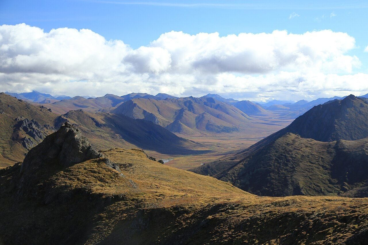
An hour north of Dawson City on the Dempster Highway, Tombstone’s jagged granite peaks rise out of the tundra — locals call it the Patagonia of the North, and for once the nickname undersells it. No roads beyond the highway pullouts, no services, and some of Canada’s finest tundra hiking: the Grizzly Lake trail (11 km one-way) climbs through three ecosystems to a cirque lake under Mount Monolith. In late August the tundra turns red and gold — I timed my visit for it. Start at the Interpretive Centre at kilometre 71.5. → Travel Yukon — official site
23. Dawson City, Yukon
The Klondike Gold Rush town that time forgot — in the best way. Dawson’s boardwalks, false-front buildings and dirt streets look like a film set, but it’s a living town of about 1,400 with can-can shows at Diamond Tooth Gertie’s (Canada’s oldest casino), the Sourtoe Cocktail at the Downtown Hotel (I’ll let you look that one up), and free gold-panning at Claim 33. It’s 6 hours from Whitehorse on the Klondike Highway. I arrived at midnight in June to full daylight and stood on the boardwalk utterly disoriented by the sun. Go in summer for the Midnight Sun; in February for the Yukon Quest and aurora.
24. Nahanni National Park Reserve, Northwest Territories
Virginia Falls is twice the height of Niagara and almost nobody has heard of it — that’s Nahanni in one sentence. This UNESCO site protects 30,000 square kilometres of deep canyons, hot springs and a legendary wilderness paddling river. No roads: you fly in by floatplane from Fort Simpson (day trips to the falls run about $1,000+). The park sees only a few thousand visitors a year — grizzlies, Dall’s sheep, canyons deeper than the Grand Canyon in places. If you splurge on one northern expedition, make it this one. → Parks Canada — Nahanni
Nahanni pairs naturally with the Yukon gems: fly into Whitehorse, drive the Dempster to Tombstone and Dawson, then hop to Fort Simpson for the Nahanni flight. I priced this 10-day loop for a friend’s honeymoon — about $6,500 per person all-in.
25. Tuktoyaktuk & the Inuvik–Tuk Highway, Northwest Territories
Since 2017 you can drive to the Arctic Ocean: the 138-kilometre Inuvik–Tuk Highway is Canada’s only all-season road to the Arctic coast, ending in Tuktoyaktuk — an Inuvialuit community of about 900 on the Beaufort Sea. The ritual: drive the gravel highway (2–3 hours, watch for muskox), dip your toes in the Arctic Ocean, buy a print from a local carver. The pingos — giant ice-cored hills found almost nowhere else on Earth — rise out of the flat tundra like something alien. The cheapest Arctic Ocean access in North America, and it still feels like the end of the world. For aurora season instead, see my northern lights guide.
What does a hidden-gems trip cost?
Prices below are what I paid across these regions, framed as a per-person day plan for a 7–10 day regional loop (one coast, not all 25). Pick your travel style, set your days, and the calculator does the rest — accommodation excluded, see the table.
Budget calculator
Per person, in Canadian dollars, excluding accommodation.
Budget ≈ $110/day · Mid-range ≈ $195/day · Luxury ≈ $350/day. Fares and admission checked October 2026.
| Expense (per person / day) | Budget | Mid-range | Luxury |
|---|---|---|---|
| Accommodation | $40 (campground / hostel) | $170 (inn / B&B) | $350+ (lodge / Fogo Island Inn) |
| Food & drink | $40 | $70 | $130 |
| Sights (park passes, boat tours…) | $20 | $40 | $70 |
| Getting around (rental + fuel) | $35 | $60 | $110 |
| Coffee, treats & souvenirs | $15 | $25 | $40 |
| Daily total | ~$150 | ~$365 | ~$700 |
The budget-killers on a hidden-gems trip aren’t hotels — they’re ferries, floatplanes and remote lodges. My renting a car in Canada guide covers the insurance and one-way-fee math.
FAQs about hidden gems in Canada
What are the best hidden gems in Canada?
The standouts: Fogo Island (Newfoundland) for art and icebergs, Churchill (Manitoba) for polar bears, Haida Gwaii (BC) for Indigenous culture and rainforest, Tombstone Territorial Park (Yukon) for tundra hiking, and Wells Gray Provincial Park (BC) for crowd-free waterfalls.
What is Canada’s best-kept secret?
My vote: Wells Gray Provincial Park — 39 waterfalls including 141-metre Helmcken Falls, two hours from Kamloops, with a tenth of the Rockies’ crowds. Runners-up: Grasslands (Canada’s darkest skies) and Anticosti Island (a Gulf island the size of a small country with 200 residents).
When is the best time to visit Canada’s hidden gems?
June through September for most of the list — ferries, boat tours and park roads run full schedules. Exceptions: Churchill’s polar bears peak October–November, the northern lights are best September–March, and the Maritimes are loveliest in September. Winter unlocks a different list: frozen waterfalls, aurora, empty hot springs.
How do you get to remote places like Churchill or Haida Gwaii?
Churchill has no road access: take the 2-day VIA Rail train from Winnipeg or a 2.5-hour flight. Haida Gwaii is a 6–8 hour ferry from Prince Rupert or a flight from Vancouver, plus a licensed Haida guide for Gwaii Haanas. Nahanni and Sable Island need chartered floatplanes. Budget extra days for weather delays and book transport months ahead.
How many of these hidden gems can I visit in one trip?
Realistically, 3–5 per 7–10 day trip if you cluster by region: the six Atlantic gems make a superb 10-day loop, and Wells Gray + northern Vancouver Island fill a week in BC. Trying to “collect” all 25 in one go means spending the trip in airports. For the truly ambitious, my one-month cross-Canada road trip strings several together.
Are Canada’s hidden gems expensive to visit?
Most are cheaper than the famous sights: park passes run $9–12/day, the best hikes are free, and small-town inns cost half of Banff hotels. A mid-range regional loop runs about $195/day per person excluding accommodation. The exceptions are the fly-in gems — Churchill bear packages ($5,000+), Nahanni floatplane trips ($1,000+) and Sable Island charters ($2,000+).
Keep exploring
Hidden gems mix best with a few classics — where I’d go next:
- 15 best national parks in Canada — the famous parks, ranked honestly
- 15 best places to visit in Canada — the big picture
- Where to see the northern lights in Canada — 7 best places
- Vancouver Island road trip itinerary — extended north to Telegraph Cove
- 7 best road trips from Halifax — the Nova Scotia gems, done properly
- One month in Canada: the ultimate road trip — the epic version
You’ve got this. The best of Canada isn’t hiding — it’s just a ferry ride further than most people bother to go.