

- ✓ One direction, no backtracking: this plan runs west to east — Vancouver to Halifax — so you never drive the same road twice. One-way rental drop-off fees are real; budget for them (see below).
- ✓ Driving days stay human: most legs land between 200 and 500 km, with full rest days built in. The only genuinely long grind is the Thunder Bay → Ottawa stretch — I’ll warn you when it arrives.
- ✓ Fuel will run you roughly $1,000 for the month: 7,700 km at 8 L/100 km and ~$1.60/L. Split two ways, that’s the cheapest cross-country transport in the country.
Here’s the deal: Canada is too big to see in a week, and the only honest way to cross it in a month is a car. I drove Vancouver to Halifax over 30 days — 7,700 km, four provinces of prairie, five of everything else — and this is the itinerary I’d hand a friend. Buckle up: the plan is broken into four weekly legs, every driving day has a real distance attached, and the rest days are non-negotiable. I made a few mistakes so you don’t have to. They’re in here.
One honest note: I’m a driver, not a transit guy. This itinerary assumes your own wheels or a rental. If you’re allergic to highways, stop reading now.

The route: 30 days, 7,700 km, coast to coast
Vancouver → Kamloops → Banff → Lake Louise → Jasper → Regina → Winnipeg → Thunder Bay → Ottawa → Montreal → Quebec City → Fundy National Park → PEI → Cape Breton → Halifax. Fifteen stops, all geocoded and pinned. Tap any stop to jump the map to it.
Map data © OpenStreetMap contributors. Open the full map
Week 1 — Vancouver to the Rockies (Days 1–7)
Start easy. Days 1–2 are for landing, picking up the rig, and shaking off jet lag around Stanley Park and the seawall — you’ll want fresh legs for what’s coming. I double-checked the park closure dates on Parks Canada’s site before booking, and June through September is the sweet spot for the whole week: the Icefields Parkway services are all open and the passes are snow-free. → Parks Canada — official site
Day 3: Vancouver → Kamloops, 355 km (about 3.5 hours). Your first real leg, and a gentle one — Highway 1 through the Fraser Canyon, then the Coquihalla. Kamloops is a dinner-and-sleep stop; don’t overthink it. Day 4: Kamloops → Revelstoke, 215 km, then Day 5: Revelstoke → Banff, 300 km over Rogers Pass. This is where the country starts looking like the postcards.
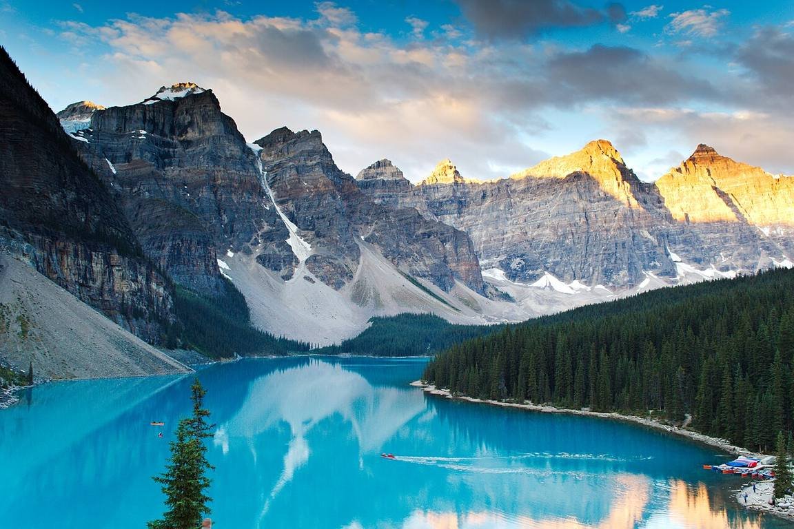
Days 5–6: Banff. Sulphur Mountain, the Banff Upper Hot Springs, and a full morning at Moraine Lake. I’ll be straight with you: I rolled into the Moraine Lake road at 7 AM thinking I was early. The lot was full by 5:30. Book the Parks Canada shuttle or take Roam transit from Banff — I learned this the sweaty way, idling at a roadblock while a ranger waved me off. Day 6 afternoon: Banff → Lake Louise, 60 km. Short leg. Rent the canoe or don’t; the lake is free to stare at either way.
Buy the Parks Canada Discovery Pass (about $75/adult, good for a year) before you enter Banff — it pays for itself by day three of the Rockies and covers Fundy too at the end of the trip. I double-checked the price on Parks Canada’s official passes page; they adjust it most years.

Day 7: Lake Louise → Jasper, 230 km — the Icefields Parkway, Highway 93. Best 230 km of driving in the country, no joke. Allow the whole day: Peyto Lake, the Columbia Icefield, Sunwapta Falls. Here’s my confession — I watched my fuel gauge do something scary past Saskatchewan Crossing and coasted into Jasper on fumes. Gas up in Lake Louise. There is one station between there and Jasper, and you do not want to learn its hours the hard way.
Want to linger in the Rockies? My Banff to Jasper road trip guide stretches this week into a full trip of its own — and 3 days in Banff plus 2 days in Jasper break both towns down in detail.

Week 2 — Across the Prairies (Days 8–14)
Day 8 is a rest day in Jasper — Maligne Lake, the boat to Spirit Island, a long breakfast. You’ve earned it, because Days 9–11 are the prairie transfer: Jasper → Edmonton, 360 km (Day 9); Edmonton → Saskatoon, 525 km (Day 10); Saskatoon → Regina, 260 km (Day 11). No sugarcoating this: these are distance days. Podcasts, audiobooks, cruise control.
The Yellowhead between Edmonton and Saskatoon is a long, straight, featureless two-lane with crosswinds that shove the steering wheel — especially in an empty SUV. Fill the tank at every decent-sized town, and don’t let the gauge dip below a quarter. I watched a guy thumbing at a Saskatchewan pullout with a gas can. Don’t be that guy.
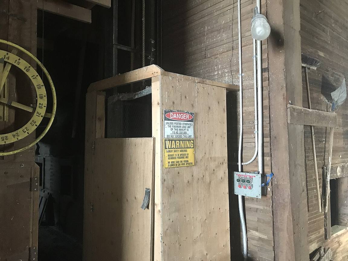
But here’s what surprised me: the prairie isn’t boring if you stop. I pulled off at a small-town grain elevator outside of Watrous just to stretch my legs and ended up talking harvest with a farmer for forty minutes. Big sky, zero traffic, towns that feed you pie at the rink-side cafe. Day 12 is a full rest day in Regina — the RCMP Heritage Centre is genuinely good — then Day 13: Regina → Winnipeg, 575 km (about 5.5 hours on the Trans-Canada). Day 14: rest in Winnipeg. The Forks, Exchange District, and the Canadian Museum for Human Rights if museums are your thing.
Every Saskatchewan local I asked said the same thing: stop at the small-town bakeries, not the chain stops. I got a Saskatoon berry pie in a town I can’t even name from a rink-side cafe for nine bucks. Best nine bucks of Week 2.
Week 3 — The Great Lakes and the Capital (Days 15–21)
This is the grind week. Northern Ontario is enormous and there’s no way around it — but the payoff is Lake Superior’s shoreline, one of the best drives on earth. Day 15: Winnipeg → Kenora, 210 km (short leg, stock up on snacks). Day 16: Kenora → Thunder Bay, 495 km (5 hours through the bush). Day 17: Thunder Bay → Sault Ste. Marie, 700 km — this one hugs Lake Superior the whole way and it’s the reason you’re here. Pull off at every lookout. No joke, I stopped six times. You’ll stop more. → Destination Canada — official trip-planning site
Day 18: Sault Ste. Marie → Ottawa, 800 km. The longest single leg of the whole trip. Start before dawn, rotate drivers if you have them, and plan nothing else that day. If this looks cruel, break it with a night in Sudbury — but every extra night is one less somewhere else, so your call. For general driving strategy on long legs like these, my Canada road trip tips cover fuel stops, wildlife, and cell-dead zones.

Day 19: Ottawa rest day — you’ve done 1,700 km in four days, your back deserves it. Parliament Hill, the Rideau Canal locks, the ByWard Market. I double-checked the canal boat cruise schedule on the city’s official tourism site before going — it’s seasonal, so don’t wing it. Day 20: Ottawa → Montreal, 200 km (two hours, the shortest leg of the week). Day 21: full day in Montreal.

Montreal rewards walkers: Old Montreal’s cobblestones, the Plateau’s murals, smoked meat on Saint-Laurent Boulevard. Here’s the deal with Montreal traffic — the highway interchanges are genuinely chaotic (the locals call them “spaghetti junctions” for a reason). Park the rig at the hotel for the day and take the metro. I took the “scenic route” around the Turcot interchange. It added forty minutes. Zero regrets, but you’ve been warned.
Cell service dies for long stretches between Thunder Bay and Sault Ste. Marie — I had dead air for nearly three hours. Download offline maps for Days 15–18 before you leave Winnipeg, and tell someone your rough schedule. Old-school, but it works.
Week 4 — French Canada and the Atlantic (Days 22–30)
Day 22: Montreal → Quebec City, 255 km (three hours). Day 23: full day in the old city. Quebec City is the prettiest urban stop on this trip, no contest — walk the ramparts, eat on Rue Saint-Jean, and stand on the Terrasse Dufferin staring at the river at dusk.

You don’t need to sleep at the Château to see it — the Terrasse Dufferin boardwalk behind it is free, and the view down the river is the same one the guests pay for. I stood up there for twenty minutes doing absolutely nothing. Money can’t buy that, but it turns out not paying does.
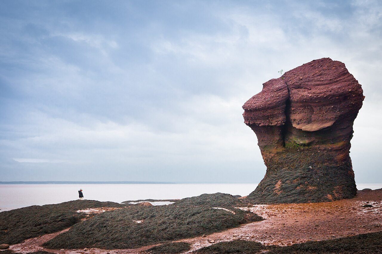
Day 24: Quebec City → Alma, New Brunswick, ~480 km (5.5 hours through the Gaspé Peninsula’s back door). Day 25: Fundy day — drive the Fundy Trail Parkway, walk the ocean floor at the Hopewell Rocks at low tide, and be back at high tide to watch your footprints vanish. I double-checked the tide tables on the Hopewell Rocks official site before going — the 12-metre swing is the whole point, so time it. My Fundy Trail Parkway guide has the stop-by-stop version.
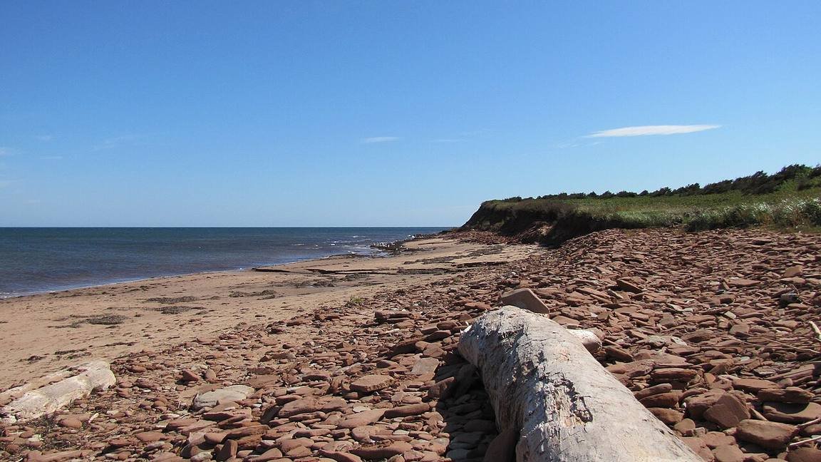
Day 26: Alma → Charlottetown, PEI, 260 km via the Confederation Bridge — 12.9 km of engineering over the Northumberland Strait. Toll is about $50 per car, charged leaving the island (PEI side), so the drive over is free. Day 27: full PEI day — Cavendish Beach, red cliffs, a lobster roll. → Tourism PEI — official visitor site
The Confederation Bridge toll is collected eastbound only (leaving PEI). I blew an hour at the wrong end trying to pay going in. Just drive across — you’ll pay on the way back to the mainland.
Day 28: Charlottetown → Baddeck, Cape Breton, 390 km (5 hours). Day 29: the Cabot Trail — 300 km of switchbacks over the Highlands. Drive it clockwise (Baddeck → Ingonish → Chéticamp) to keep the pullouts on your side of the road. I nearly missed sunset over the Gulf of St. Lawrence at Pleasant Bay because I stopped for every single moose sign. Worth the detour. Every one of them. → Visit Nova Scotia — official visitor site
A Baddeck dockhand told me the Cabot Trail’s best hour is before 9 AM — the tour buses roll later, and you get the North Mountain switchbacks nearly to yourself. Set the alarm. I grumbled. Then I went. He was right.
Day 30: Baddeck → Halifax, 360 km (4 hours). Drop the rig, walk the harbour boardwalk, eat something fried with salt. You just drove the country. No joke — you did.
What does a month on the road cost?
Fuel math first: 7,700 km at roughly 8 L/100 km and ~$1.60/L lands near $1,000 for the car — split it between two people and transport costs about $500 each for the month. Pick your travel style and the calculator below does the rest. Accommodation not included — see the table.
Budget calculator
Per person, in Canadian dollars. Excludes accommodation and the car itself.
Budget ≈ $120/day · Mid-range ≈ $185/day · Luxury ≈ $290/day, per person. Fuel based on 7,700 km at 8 L/100 km and $1.60/L. Prices checked October 2026.
| Expense (per person / day) | Budget | Mid-range | Luxury |
|---|---|---|---|
| Accommodation | $35 (hostel / tent) | $140 (motel / mid hotel) | $280+ (full-service hotels) |
| Food & drink | $45 | $75 | $130 |
| Sights (park passes, museums) | $15 | $25 | $40 |
| Getting around (fuel, tolls) | $50 | $65 | $85 |
| Coffee, treats & souvenirs | $10 | $20 | $35 |
| Daily total | ~$155 | ~$325 | ~$570 |
For the full breakdown of how far money goes in Canada, my Canada trip cost guide covers prices beyond the road.
The one-way rental situation
Driving one way means the car doesn’t come home with you, and rental companies charge for that: expect a one-way drop-off fee of roughly $300–800 on top of the monthly rental, depending on the company and how much they actually want the car in Halifax. Book the one-way explicitly at reservation time — showing up in Halifax with a Vancouver contract is a bad conversation.
The good news: most major Canadian rentals include unlimited kilometres, which this itinerary will use every bit of. I double-checked the unlimited-km terms on a couple of major rental company sites before writing this — confirm yours in writing at pickup. For the full run-through of insurance, credit cards, and winter tires, see my renting a car in Canada guide. And a final word: a month of Canadian highways wants a vehicle you trust at 120 km/h with cruise control and decent tires. I’ve made this mistake so you don’t have to.
FAQs about a one-month Canada road trip
Is 30 days enough to drive across Canada?
Yes — this itinerary does Vancouver to Halifax in 30 days with real rest days, and no driving day exceeds 800 km (most stay under 500). You won’t see everything; nobody does in a month. What you get is the full arc: Pacific coast, Rockies, prairies, Great Lakes, French Canada, and the Atlantic. If you want the trip in reverse, it works identically east to west.
What is the best month for a cross-Canada road trip?
June through September. The Icefields Parkway is fully open, Fundy and PEI are at their best, and the northern Ontario legs are snow-free. July and August are peak season — book Banff, Lake Louise, and the Cabot Trail lodging early. I’m partial to September: fall colour in Quebec and the Maritimes, thinner crowds, and the roads are still clear.
How much does it cost to drive across Canada for a month?
For the driving itself: about $1,000 in fuel (7,700 km at 8 L/100 km, $1.60/L) plus park passes and the Confederation Bridge toll (~$50). Per person all-in, budget roughly $155/day at the cheap end, $325/day mid-range, $570/day luxury — run the calculator above. The one-way rental drop-off fee ($300–800) is the extra line item most people forget.
Can I do this route with a one-way car rental?
Yes, and it’s the intended way. Book a one-way reservation Vancouver → Halifax explicitly, and confirm unlimited kilometres in writing — most major Canadian rentals include it. Expect a one-way drop-off fee of $300–800. Full details in my renting a car in Canada guide.
What’s the longest driving day on this itinerary?
Sault Ste. Marie → Ottawa, 800 km (Day 18) — the only leg over 700 km, and the one I’d split with a night in Sudbury if your schedule allows. The Winnipeg → Thunder Bay leg (705 km) is second, split over two days. Everything else stays at 500 km or under, with full rest days in Banff, Regina, Winnipeg, Ottawa, Montreal, Quebec City, Fundy, PEI, and Cape Breton.
Do I need park passes for this route?
Yes — Banff, Jasper, and Fundy are all national parks. The Parks Canada Discovery Pass (~$75/adult, valid a year) covers all three and pays for itself by the third park day. I double-checked the current price on Parks Canada’s official site; it changes most years. Provincial parks (and the Moraine Lake shuttle) are separate but cheap.
Keep exploring
Thirty days is just one way to do this country — here’s where I’d go next:
- Banff to Jasper road trip itinerary — the Rockies week in full detail
- Canada road trip tips — fuel stops, wildlife, and dead zones on long legs
- Renting a car in Canada — insurance, unlimited km, and one-way fees
- Fundy Trail Parkway guide — the Atlantic week, stop by stop
- How much does it cost to visit Canada? — the full 2026 price guide
- 3 days in Banff itinerary — stretch the Rockies stop
- 2 days in Jasper itinerary — stretch the Jasper stop
You’ve got 7,700 km of road ahead. Gas up in Lake Louise. Buckle up.