
- ✓ The tides run the show: check the tide tables before you go — the St. Martins sea caves and Long Beach are different planets at low tide versus high.
- ✓ It’s a one-way drive, not a loop: 30 km from the St. Martins gate to the east end at Walton Glen, about 45–60 minutes of actual driving. Plan 4–6 hours with stops, or a full day if you hike.
- ✓ Two things changed recently: the famous Flowerpot Rock sea stack collapsed in a 2022 storm, and the Big Salmon River suspension bridge is closed this season for renovations. Both worth knowing before you build the day around them.
Here’s the deal with the Fundy Trail Parkway: I drove it twice in two days, and the first drive was a total write-off. Fog. The kind of thick, white, Bay of Fundy fog where the lookouts might as well have been wallpapered over. I stopped at every pullout, stared into the grey, took a heroic photo of nothing, and drove the whole 30 km seeing exactly one waterfall and a gift shop. No joke — the second morning was clear and it felt like a different planet. Lesson one of this guide, learned the hard way so you don’t have to: do not drive this road in fog. Check the forecast, and if it’s soup, go tomorrow.
When the sky cooperates, this is one of the great short drives in Atlantic Canada. Thirty kilometres of paved parkway along the Bay of Fundy coast, more than 20 lookouts, five beaches, four waterfalls, a gorge they call the Grand Canyon of New Brunswick, and — at either end — a fishing village with sea caves and the back door into Fundy National Park. I did the whole thing: every lookout with a name, both covered bridges in St. Martins, the cable stairs at Fuller Falls, and one ill-advised sprint down to the Eye of the Needle viewpoint that my knees are still filing complaints about. Here’s the full route, stop by stop, with the driving times I actually logged.
Before you go: fees, hours, and one closure to know about
The parkway is a provincial park operation, so there’s an admission fee at the gate. The published 2026 rates run $12.17 per adult, $10.43 for seniors 65+, $6.96 for youth aged 5–18, and kids under 5 are free — there’s also a family rate (two adults plus up to five youth) at $37.39. I double-checked the numbers against the parkway’s published 2026 info before writing this; they can shift year to year, so give fundytrailparkway.com a glance before you roll. Parking at the lookouts is included — no extra fees once you’re in.
The parkway is seasonal and open daily 9 AM to 5 PM during the operating season — roughly summer through fall, with the gates closed for winter. Exact opening and closing dates move around, so confirm on the official site rather than trusting last year’s memory.
As of the 2026 season, the Big Salmon River suspension bridge is closed for renovations — that’s the notice posted on the parkway’s official site right now. The bridge is the famous 60-metre span over the river and the start of the Fundy Footpath, so if it was on your must-do list, adjust expectations. The Mitchell Franklin Bridge (the road bridge you drive over), the Hearst Lodge trail, and the interpretive centre are all still open. Footpath hikers are being directed to park at P9 instead.
Getting there: which end to start from
There are three ways onto the parkway, and your choice depends on where you’re coming from:
- West gate (St. Martins): the classic start. St. Martins is about 45 minutes east of Saint John on Route 111, and the parkway gate is roughly 15 minutes past the village. If you’re doing the sea caves at low tide first — and you should — this is your entrance.
- East gate (Walton Glen / Sussex side): reachable via Little Salmon River Road from the Sussex area. Handy if you’re coming from Moncton (about 1 hour 45 minutes to the east entrance).
- Via Fundy National Park (Alma): the parkway’s eastern section now connects through to Fundy National Park and the road to Alma. This is the move if you’re pairing the drive with the national park — more on that below.
It’s not a loop, so you’ll either drive it one way and backtrack, or arrange your route so the parkway sits in the middle of a bigger day — St. Martins to Alma via the parkway and the national park makes a clean one-way line. Gas up before you enter. There’s no fuel on the parkway itself, and I watched my gauge do something mildly alarming between Big Salmon River and the east gate. I’ve made this mistake so you don’t have to: fill the tank in St. Martins or Sussex.
The 10 stops, on a map
Ten stops, west to east, in the order you’ll hit them driving from St. Martins. Tap any stop to jump the map straight to it. Driving times between stops are what I logged — roughly, on a clear day, no dawdling.
Map data © OpenStreetMap contributors. Open the full map
1. St. Martins Sea Caves — time this with the tide

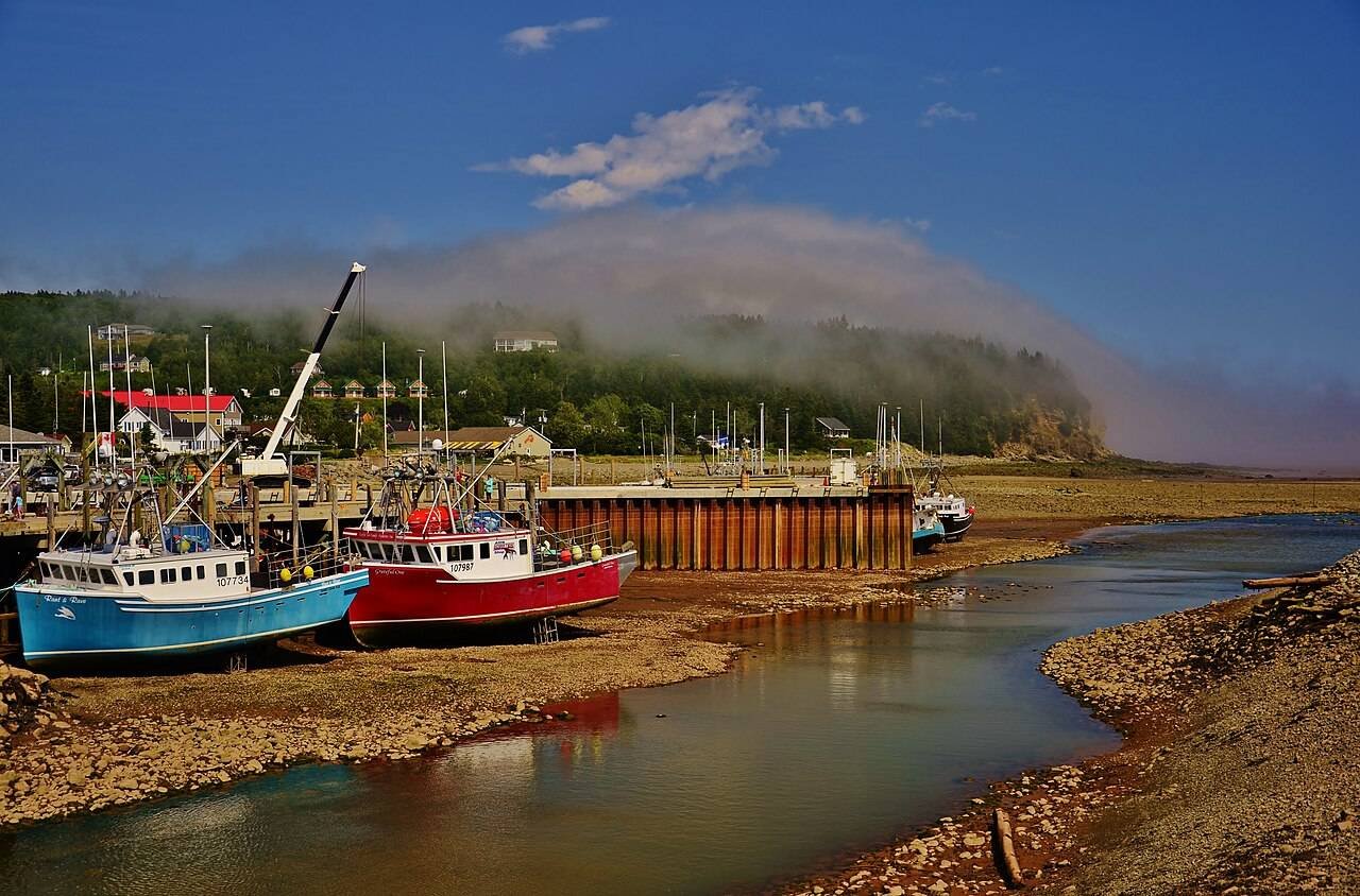
The village of St. Martins sits about 15 minutes west of the parkway gate, and the sea caves here are the reason to build your morning around a tide table. At low tide you can walk right out across the ocean floor and into the caves carved into the red cliffs — at high tide the whole thing is underwater and you’ll be staring at a wall of water wondering what the fuss is about. I know this because I did it backwards the first time: showed up at the wrong end of the tide, admired the cliffs from the parking area, and left. Worth the detour, but only on the right clock.
Give it 60–90 minutes. Walk the beach, duck into the caves, watch the fishing boats in the harbour. The village itself is worth a slow loop: two covered bridges (Vaughan Creek and Hardscrabble), the old shipbuilding harbour, and a couple of seafood spots for lunch. Tide times are posted on the parkway’s official site in Atlantic Time — check them the night before and plan the caves for the low-tide window.

Do the caves before you enter the parkway, not after. Low tide in the morning means caves first, then the gate at 9 — the order lines up perfectly with the parkway’s opening hours. I reversed it once and spent the whole drive doing tide math in my head. Don’t be me.
2. Quaco Head Lighthouse — the quiet detour
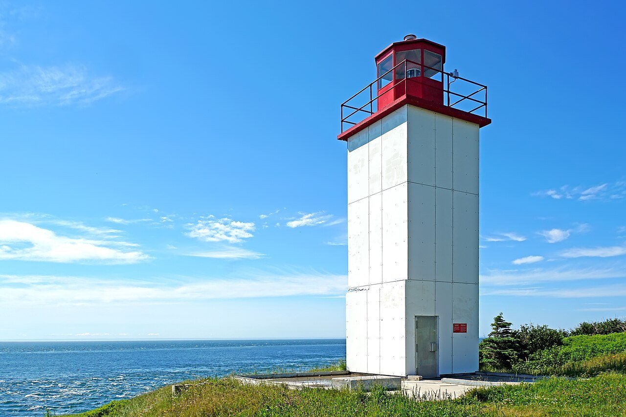
West Quaco is the little community between St. Martins and the parkway gate, and the Quaco Head Lighthouse sits at the end of a short trail past the harbour. It’s not a big-production lighthouse — no tours, no gift shop, just a white tower on a rocky headland with the Fundy doing its thing below. That’s exactly why I liked it. Twenty minutes, maybe thirty if you sit on the rocks. The trailhead is right in West Quaco; follow the signs from the main road.
3. Fownes Head Lookout — the Flowerpot Rock trail (read this first)
First stop inside the gate, about ten minutes in. The Flowerpot Rock Scenic Trail leaves from P1 and drops down toward Fownes Head, and for years the draw was Flowerpot Rock itself — a sea stack with trees growing on top, the parkway’s answer to the Hopewell Rocks. Here’s the honest part: the rock collapsed during a winter storm in February 2022. I double-checked this on Wikipedia before writing — CBC covered it at the time. The stack is gone.
So should you still do the trail? I did, and I’d say yes with managed expectations. The lookout over Fownes Head is a fine view in its own right — cliffs, open water, the headland curving away — and the walk down is short. Just don’t promise the kids a flowerpot. If sea stacks are the whole point of your trip, the Hopewell Rocks are a separate park about an hour east, and those are still standing.
4. Fuller Falls — the cable stairs
Five minutes past Fownes Head. Fuller Falls is a short, steep one: park up, take the cable stairs down, and you’re at the base of the falls in about half an hour round trip. The stairs are the memorable part — they drop you down the gorge wall with the falls getting louder the whole way. Wear shoes with actual grip; the steps were slick when I did it and I saw at least one person doing the penguin shuffle. This is a solid 30-minute stop and one of the easiest waterfall payoffs on the whole drive.
Fuller Falls is the stop I’d hand to someone with bad knees who still wants a waterfall. The stairs are short and railed, the view from the lower observation deck is the full falls, and you’re back at the car in half an hour. The Eye of the Needle trail at the other end of the parkway is the opposite of this — choose accordingly.
5. Big Salmon River — the heart of the parkway
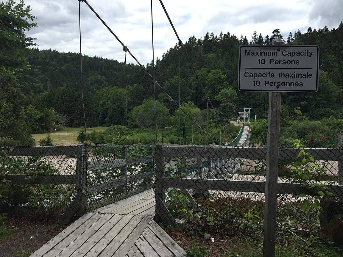
About ten minutes past Fuller Falls the road drops to the Big Salmon River, and this is the parkway’s main event cluster. The Mitchell Franklin Bridge carries the road over the river — you’ll drive it, which counts as a stop in my book because the view from the deck is the whole valley at once. Park at P8 on the far side and you’ve got three things within walking distance: the interpretive centre, the Hearst Lodge trail, and the suspension bridge trailhead.
The Big Salmon River Interpretive Centre covers the logging history of the river — this was a working log-driving river, and the exhibits do a decent job of making 19th-century timber interesting. The Pioneer Loop Trail starts right across the road from the building: a short loop with a small cable ladder and stairs, good for stretching the legs. Thirty to forty-five minutes, easy.
The suspension bridge — 60 metres across the gorge, the classic photo — is closed this season for renovations, per the notice on the parkway’s official site. I’m flagging it twice because it’s the single most photographed thing on the parkway and the disappointment is real if you don’t know. The Hearst Lodge trail still runs from the same parking area: a narrow footpath along the river to the old lodge site, roots and rocks underfoot, wooden bridges over the wet bits. It’s the wilder-feeling walk of the two, and honestly it was my favourite hour on the whole drive. Slippery when wet — the official trail notes say so, and they’re not kidding.
This is also where the Fundy Footpath begins — the 4-to-5-day wilderness coastal trail to Fundy National Park, recently listed among the world’s best hikes by Explore Magazine. Different trip entirely. If you’re just here for the drive, file it under “someday” and keep moving.
With the suspension bridge closed, the crowds thin out past the interpretive centre — most people turn around at the river. Keep driving east. Long Beach and Martin Head were nearly empty on a clear Saturday, and the light on the water past 4 PM was the best of the day.
6. Long Beach — walk the ocean floor

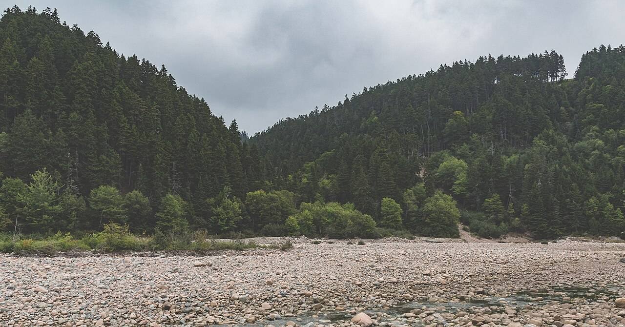
Eight minutes east of Big Salmon River. Long Beach is the parkway’s biggest beach — about 2.5 km along the coast, and at low tide the water pulls back roughly half a kilometre, leaving you walking on the ocean floor. This is the Bay of Fundy’s whole trick and it never gets old: stand on sand at noon where there was fifteen feet of water at breakfast. The Long Beach Brook Falls loop leaves from P13 and follows the brook upstream about a kilometre to a waterfall through mossy forest — combine it with the beach for a 60–90 minute stop.
7. Martin Head Lookout — the horizon stop
Five minutes past Long Beach, and the simplest stop on the list: a lookout, a horizon, and not much else. No trail, no stairs, no interpretive panel demanding your attention. On a clear day it’s the widest open-water view on the parkway. I spent twenty minutes here doing absolutely nothing, which after Fuller Falls and the gorge stairs felt like the correct decision. Worth the detour in the sense that it costs you five minutes and gives you the whole bay.
8. Walton Glen Gorge — the east-end finale
The last big stop, about twenty minutes past Martin Head near the east gate. Walton Glen Gorge is the one they call the Grand Canyon of New Brunswick — a deep, forested river canyon with an observation deck looking straight down it. The Walton Glen Gorge Observation Deck trail leaves from P15 near the reception centre: a wide trail, then a narrow path to the deck. There’s also a shortcut with 65 steps behind the reception building if you’re in a hurry.
The Eye of the Needle trail drops 180 metres into the gorge itself — chains on a cliff edge, steep switchbacks, proper hiking boots mandatory, sandals explicitly not recommended. It’s 2.4 km round trip and it’s genuinely technical. I looked at the chains, looked at my knees, and took the observation deck. No regrets. If you do go down, remember what goes down comes back up.
The McCumber Brook Wetlands trail (observation decks, 1.2 km) and the McLeod Brook Falls loop (3.8 km with the gorge detour) also leave from P15. If you’ve only got one more hour, do the gorge deck and skip the wetlands — the wetlands are pleasant, the gorge is the point.
The east end of the parkway is also where cell signal gets thin. Download the tide tables and your maps before you leave St. Martins — the parkway’s official site posts tide times in Atlantic Time, and you do not want to be doing tide math on a dead phone at Long Beach.
9. Shepody Mountain — the landmark across the water
Not a stop so much as an orientation point. Shepody Mountain rises on the Albert County shore, across the bay system from the parkway, and it’s the big landmark that anchors the whole Fundy shoreline — sailors and Fundy old-timers use it the way the rest of us use street signs. On the clearest days from the eastern lookouts you can pick out the far shore it sits on. I include it here because half the place names on this coast only make sense once you know what’s across the water.
The tides: the one thing you must get right

The Bay of Fundy has the highest tides in the world — up to 16 metres — and the whole parkway is a tide machine. The sea caves at St. Martins are only walkable for the few hours around low tide. Long Beach doubles in size. The Flowerpot trail and the beach access points all read differently depending on the water. And the tide shifts about an hour later every day, so yesterday’s timing is useless today.

Check the tide tables on the parkway’s official site (Atlantic Time) the night before, and build the day around the low-tide window: caves first if the tide’s out in the morning, Long Beach at the bottom of the tide if you can swing it. This is the single highest-leverage planning move on the whole drive. Everything else is details.
How much it costs: the budget breakdown
Prices below are what the 2026 season looks like, per person per day. Pick your travel style, tell the calculator how many days you’re staying, and it does the rest. (Accommodation not included — see the table below for that.)
Budget calculator
Per person, in Canadian dollars. Excludes accommodation.
Budget ≈ $70/day · Mid-range ≈ $120/day · Luxury ≈ $210/day. Fees and fuel checked October 2026.
| Expense (per person / day) | Budget | Mid-range | Luxury |
|---|---|---|---|
| Accommodation | $60 (campground / hostel) | $140 (St. Martins B&B) | $260+ (waterfront inn) |
| Food & drink | $35 | $60 | $110 |
| Sights (parkway admission) | $15 | $25 | $40 |
| Getting around (fuel, shared) | $10 | $15 | $30 |
| Coffee, treats & souvenirs | $10 | $20 | $30 |
| Daily total | ~$130 | ~$260 | ~$470 |
This is a cheap day by road-trip standards. The parkway admission is the only real ticket — everything else is fuel and food. The budget-killer is trying to do it as a rushed add-on to a Saint John day trip with a rental car sitting in a paid lot; base yourself in St. Martins the night before and the whole thing relaxes. If you’re weighing whether you need a car for the wider trip, my do you need a car in Canada guide breaks it down — for this drive specifically, yes, you need the car. No transit, no shuttles, no way around it.
The plan: half day vs. full day
| Time | Half day (4 hrs) | Full day (6–8 hrs) |
|---|---|---|
| Morning | Sea caves at low tide, covered bridges, through the west gate | Sea caves at low tide, Quaco Head Lighthouse, covered bridges, west gate by 9:30 |
| Midday | Fownes Head, Fuller Falls, Big Salmon River cluster (skip the long trails) | Fownes Head, Fuller Falls, interpretive centre + Pioneer Loop, Hearst Lodge trail, picnic at Big Salmon River |
| Afternoon | Long Beach at low tide, then turn around | Long Beach + brook falls, Martin Head, Walton Glen Gorge deck, out the east gate toward Fundy National Park |
What to skip (the honest list)
Every guide tells you what to do. Here’s what I’d cut if the day gets tight:
- The Eye of the Needle trail — unless you’re properly equipped and actually want a technical descent. The observation deck gives you 90% of the gorge for 10% of the effort.
- Backtracking the whole parkway — if you came in the west gate, exit east and loop back via Sussex or through Fundy National Park to Alma. The parkway is prettier one way.
- A foggy-day attempt — I burned a whole morning on this. If you can’t see the water from the first lookout, the rest of the lookouts won’t improve. Go tomorrow.
- McCumber Brook Wetlands — pleasant boardwalks, but if you’re choosing between this and the gorge deck, the gorge wins every time.
Pairing it with Fundy National Park
The parkway’s east end connects through to Fundy National Park and the road to Alma — and this is the pairing that turns a good day into a great two days. The national park has the deeper trail network (100+ km), the waterfalls, the campgrounds, and the town of Alma with its lobster boats and sticky buns at the park entrance. Do the parkway on day one, sleep in Alma or St. Martins, and do the national park’s Dickson Falls and Third Vault Falls trails on day two. I double-checked the park’s current info on Parks Canada’s Fundy page before writing — separate admission from the parkway, separate gates, worth every cent of both.
Coming from the Halifax side and building a bigger Atlantic loop? My best road trips from Halifax guide slots the Fundy coast into a wider Maritimes route, and the Gaspé Peninsula road trip is the other great eastern-Canada drive if you’ve got a week.
FAQs about the Fundy Trail Parkway
How long does it take to drive the Fundy Trail Parkway?
About 45–60 minutes of actual driving for the 30 km, gate to gate, without stopping. With stops, plan 4–6 hours for the highlights or a full day if you’re hiking the gorge trails and walking the beaches. I logged roughly ten minutes between the western stops and twenty from Martin Head to the east end — the road is slow by design, with a low speed limit and constant pullouts.
How much does the Fundy Trail Parkway cost?
The published 2026 admission is $12.17 per adult, $10.43 for seniors 65+, $6.96 for youth 5–18, with kids under 5 free and a family rate of $37.39. Parking at all the lookouts is included. There’s no fuel or food for sale on the parkway itself, so budget a tank of gas and a packed lunch on top.
When is the Fundy Trail Parkway open?
It’s a seasonal operation, open daily 9 AM to 5 PM during the season — roughly summer through fall, closed in winter. Exact opening and closing dates shift year to year, so check the official site before you plan around it. June through October is the safe window.
Do I need to check the tide tables?
Yes — this is the single most important planning step. The St. Martins sea caves are only accessible for the few hours around low tide, and Long Beach transforms completely between tides. The tide shifts about an hour later each day, so check the tables the night before on the parkway’s official site (times are in Atlantic Time) and build your day around the low-tide window.
What happened to Flowerpot Rock?
The famous sea stack at Fownes Head collapsed during a winter storm in February 2022 — CBC covered it at the time, and I confirmed it on Wikipedia before writing this guide. The Flowerpot Rock Scenic Trail and the Fownes Head Lookout are still open and still worth the stop for the coastal views, but the rock itself is gone. If standing sea stacks are the goal, Hopewell Rocks is a separate provincial park about an hour east.
Can you drive from the parkway into Fundy National Park?
Yes — the parkway’s eastern section connects through to Fundy National Park and the road on to Alma, so you can run the whole thing as a one-way drive: St. Martins gate in, national park out. They’re separate parks with separate admission, and the national park is where the deeper hiking and campgrounds are. It’s the natural two-day pairing.
Keep exploring
The Fundy coast is just one leg — here’s where I’d point the rig next:
- Best road trips from Halifax — the wider Maritimes loop this drive slots into
- Gaspé Peninsula road trip itinerary — the other great eastern-Canada drive
- Do you need a car in Canada? — for this one, yes — here’s the full breakdown
Check the forecast, check the tides, gas up in St. Martins — and don’t drive it in the fog. You’ve been warned, twice, by a guy who learned it the hard way.