
Last updated: October 14, 2026
- ✓ The loop runs on one road. Route 132 circles the whole peninsula — you start at Matane, point the rig east, and the sea is on your left until it’s suddenly on your right. You cannot get lost. I tried.
- ✓ Four days is a drive-through; seven days is a trip. Four works if you skip the summits and accept the windshield is your main viewpoint. Seven gives you Forillon, the island, and the Chic-Chocs without rushing.
- ✓ July through September. June is fine but buggy, October is gorgeous and half the park services are closed. I ran the foggy version so you don’t have to.
I took the wrong turn at 11 PM outside Sainte-Anne-des-Monts and it added forty minutes and a moose sighting, so technically it was the best wrong turn of my year. That’s the Gaspé Peninsula in one anecdote: the scenery keeps rewarding your bad decisions. This is one of the great road loops in Canada — roughly 900 km of Route 132 curling around a peninsula that juts into the Gulf of St. Lawrence. Sea cliffs, a national park where the Appalachians meet the ocean, a 1,270-metre summit above the treeline, the tallest lighthouse in Canada, a rock with a hole in it, and an island with over a hundred thousand screaming gannets. Buckle up.
A note on how I did it: I ran the loop counterclockwise starting at Matane, and that’s what this itinerary follows. You save the best coastline for the end. Every fee, distance and opening date below was checked in October 2026.
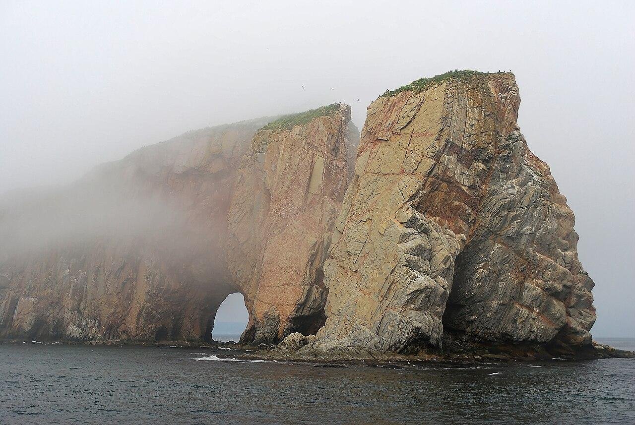
Fog is a feature of this trip, not a bug. I hit Forillon in a whiteout so complete that Cap Bon-Ami — the single most photographed beach on the peninsula — was a parking lot and a rumor. Build slack into the Forillon day so you can come back in the afternoon if the morning is socked in. Here’s the deal: the coast almost always clears by mid-afternoon.
The 8 stops, on a map
Matane to Percé along the north shore, then the island and the rock. Tap any stop to jump the map straight to it.
Map data © OpenStreetMap contributors. Open the full map
The 4-day express version
Four days means the rig moves every morning and you see the highlights through the windshield. It’s a great trip anyway. Total driving: roughly 900 km, and no leg is longer than about two hours except the last one.
Day 1 — Matane to Sainte-Anne-des-Monts (~90 km, ~1h15)
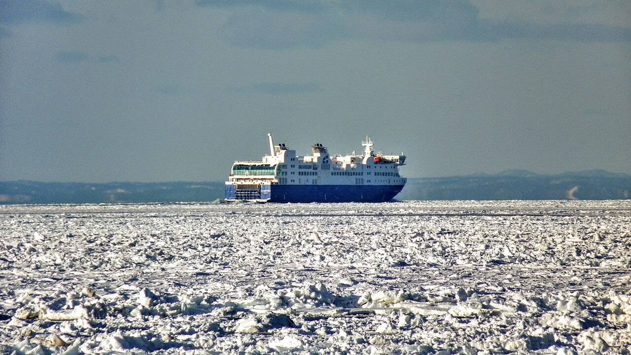
Start at Matane, the self-declared shrimp capital. Breakfast is a shrimp omelette at a diner on the main drag — they don’t ask if you want shrimp in it, it’s Matane. Matane is also where the ferry comes in from Baie-Comeau, so if you’re coming from the north shore, you can roll off the boat and straight onto 132. Then it’s a short, easy leg east along the river to Sainte-Anne-des-Monts, the last real town before the coast goes quiet. Sleep here.
Ask in Matane where the shrimp boats are selling today. The northern shrimp (crevettes de Matane) get processed and sold fresh at the wharf when the boats are in, and it’s the cheapest bag of shrimp you’ll buy on this trip. A cook at the diner told me she buys hers there every week — and honestly, it was the best thing I ate for four days.
Day 2 — Parc national de la Gaspésie detour + push east (~150 km with the detour)
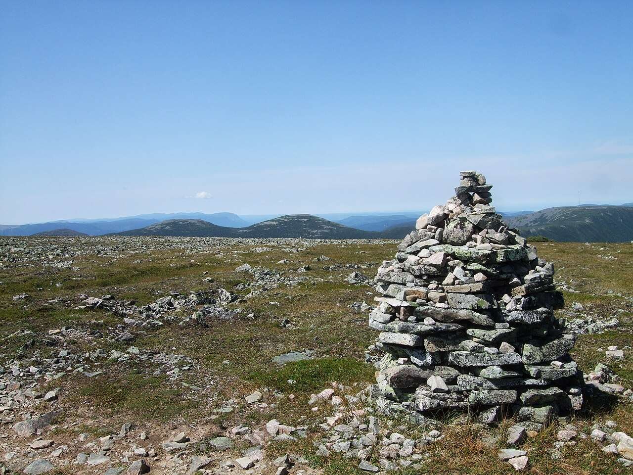
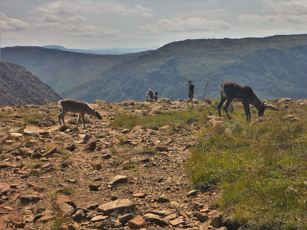
Turn south off 132 onto 299 and climb into the Chic-Chocs. The park’s Discovery Centre sits about 50 km inland, and the trailhead for Mont Jacques-Cartier is right up the road. Here’s the deal: the summit is 1,270 metres, the highest peak of the Appalachians in Quebec, and the alpine tundra up top looks like somewhere much farther north than Quebec. On the four-day version you hike it or you don’t — I hiked the first half, turned around for time, and still called it the best two hours of the day. → Sépaq — Parc national de la Gaspésie, official page
Drive back down to 132 and keep going east past Mont-Saint-Pierre. That town is famous for the hang gliders that launch off the mountain over the river — worth a pullout stop even if you don’t fly. Sleep in Gaspé town, the loop’s natural resupply base: your last easy grocery run before the Forillon leg.
Gas up in Sainte-Anne-des-Monts. Full. I’ve made this mistake so you don’t have to — my gauge said half and the next stations on 132 are farther apart than they look, with long gaps between Mont-Saint-Pierre and Gaspé. Fill the rig and then stop reading the gauge.
Day 3 — Forillon National Park (the peninsula’s tip)
From Gaspé town it’s about 45 km to the park’s north area. Forillon is the smallest park with the biggest scenery on this list: sea cliffs, the Cap-Bon-Ami beach, and the Mont Saint-Alban tower hike (about 35–45 minutes one way, ~283 m of stairs, and a 360-degree payoff). Entry runs about $9 per adult per day. I double-checked the 2026 season dates on Parks Canada’s official Forillon page — toll booths staffed roughly late June to mid-October, whale-watching cruises out of Grande-Grave June through late October.
Walk the Les Graves trail at the very tip of the peninsula. You’re standing at the end of the Appalachians, where the water has finished being a river and started being the Gulf of St. Lawrence.
Day 4 — Percé Rock, then the long leg home (~85 km to Percé, then ~455 km to Matane)
Morning drive south from Cap-des-Rosiers to Percé, about 85 km of the prettiest road on the loop. Percé Rock is a ~90-metre limestone stack with a sea arch, and it does not look real the first time you see it. Walk the waterfront, take the boat around the rock, then settle into the long drive home: Percé to Matane is about 455 km, six hours plus stops. Split it with a night in Carleton-sur-Mer if the sun is out.
The 7-day full version
Seven days is the trip this loop deserves. Same eight stops, but now you hike the summit, do the island, and sleep in places long enough to eat two meals there.
Day 1 — Arrive Matane (~0 km of loop, all shrimp)
Don’t drive today. Land, eat, and walk off the travel. Breakfast at the diner (the shrimp omelette, obviously), poke around the wharf, and do the unglamorous jobs: top up the tank, buy snacks, check your wiper fluid. If you’re renting the rig, Matane or Rimouski are the last places with real rental offices — after this it’s all 132. My renting a car in Canada guide covers the insurance question people always forget to ask. Sleep in Matane.
Day 2 — The Chic-Chocs: Mont Jacques-Cartier (~190 km with the detour, ~2h30 driving)
East on 132 to Sainte-Anne-des-Monts (~90 km), then south on 299 to the park. Buy your Sépaq access online before you go — daily access is about $10 per adult for 2026, and the park caps daily visitors. The Mont Jacques-Cartier hike is the full commitment: 12.6 km round trip, 850 m of climbing, trail season roughly mid-June to mid-October (I checked the 2026 dates on Tourisme Gaspésie’s official page). → Tourisme Gaspésie — official trip planning
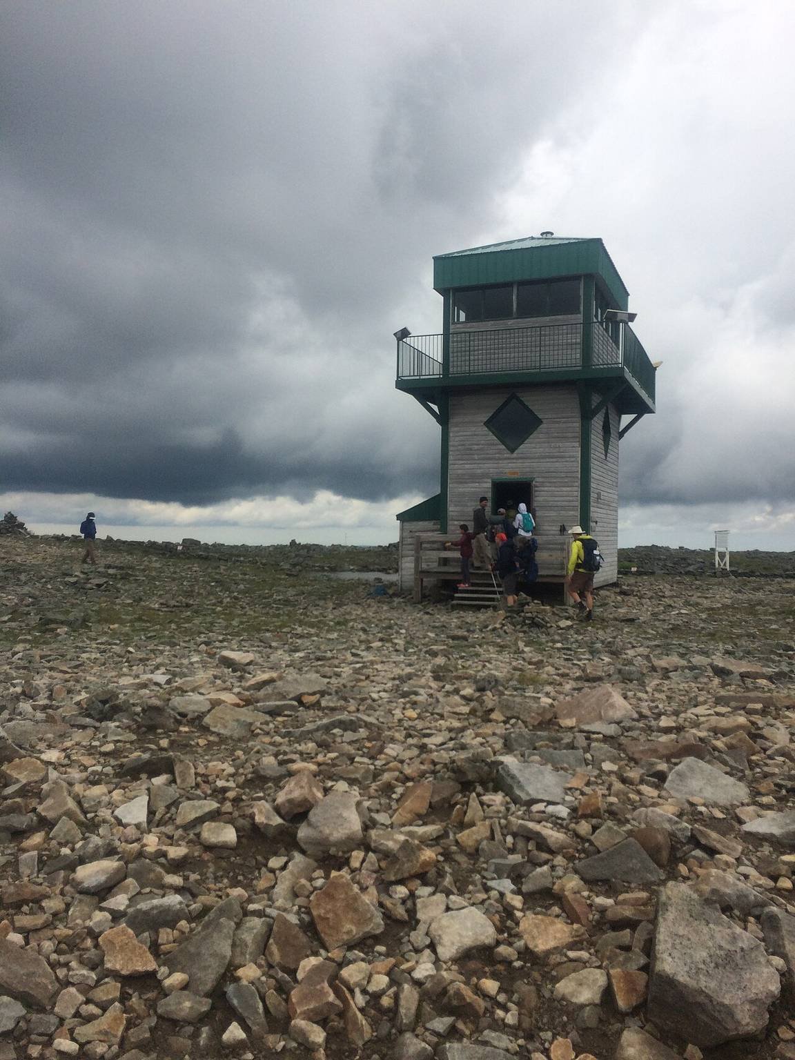
The summit is tundra: caribou country. I shared the last kilometre with a mother caribou and her calf, both of whom ignored me with professional discipline. This is Quebec’s only woodland caribou herd south of the St. Lawrence. Drive back out to 132 and sleep in Sainte-Anne-des-Monts again or push on to Mont-Saint-Pierre — about 75 km east.
Drive 132 at dusk like the moose have a reservation. I came around a bend near Mont-Saint-Pierre and had one standing in the oncoming lane at 9 PM — a full-grown bull, enormous, unimpressed. Dawn and dusk are their hours, and this stretch of 132 is thick with them. High beams on, cruise off, and no phone.
Day 3 — The north coast to Gaspé town (~205 km, ~3h driving)
The leg from Mont-Saint-Pierre to Gaspé is the windshield day: sea on the left, the Chic-Chocs on the right, fishing villages close enough to count the lobster traps. Stop at the Cap-Chat pullouts for the wind turbines up on the ridge — they look like something from a sci-fi set. Roll into Gaspé town by mid-afternoon, resupply groceries, and walk the waterfront where Jacques Cartier landed in 1534. Sleep in Gaspé.
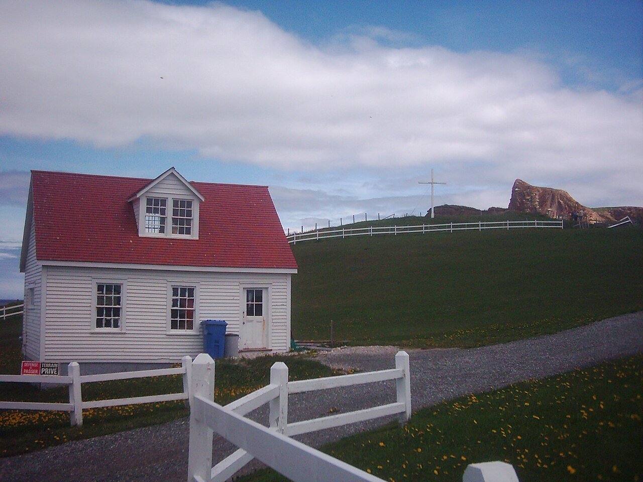
The Grande-Grave heritage site inside Forillon’s south area — white clapboard fishing houses on the cliffs — is the loop’s best free detour. Most people blow past the south entrance for the north side. I went in for twenty minutes and stayed two hours reading the Hyman & Sons store exhibits.
Day 4 — Forillon day (full day in the park)
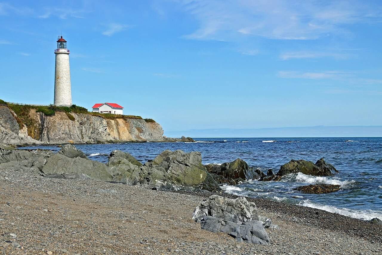
This is the day you don’t drive except inside the park. Start at the north area: Cap-Bon-Ami beach, then the Mont Saint-Alban tower hike. Then swing to the Cap-des-Rosiers lighthouse — 34.1 metres, built in 1858, the tallest lighthouse in Canada, open for tours in summer. I checked the current season dates on Parks Canada’s official Forillon page before I went — they shift year to year, so do the same. → Parks Canada — Forillon dates, hours & whale season
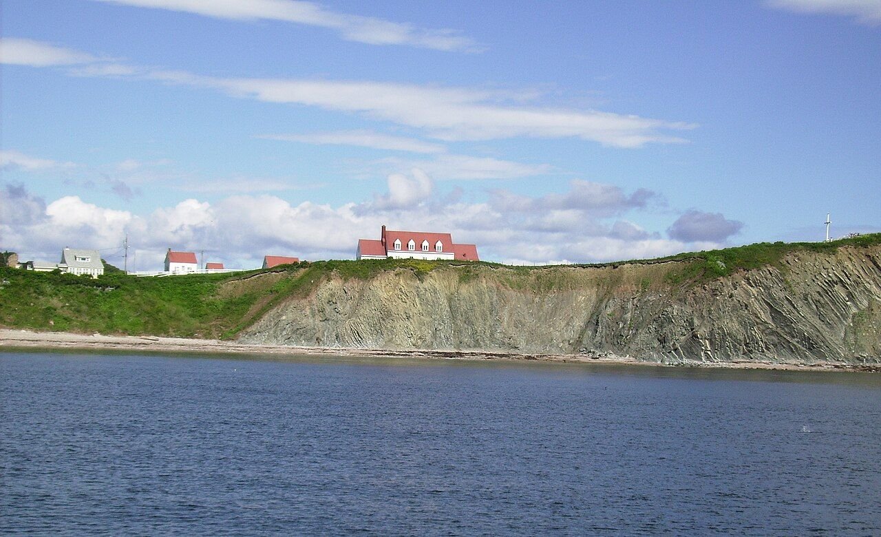
Afternoon: the Les Graves trail at the tip. Then the whale question. The whale-watching boats run out of Grande-Grave from June through late October. Entry is about $9 a day; the whale cruise is separate. Sleep in Gaspé again, or push to Percé for tomorrow’s early boat.
Day 5 — Down the coast to Percé (~85 km, ~1h15)
The short leg that feels long, because you stop six times. The road from Cap-des-Rosiers to Percé is cliff-top driving the whole way. Percé itself is a proper tourist town — souvenir shops, lobster everything, and the rock sitting offshore like it was placed there for the postcards. Book your Bonaventure Island boat for tomorrow morning today; the sailings sell out in July and August. The rock glows orange at golden hour, and every local I asked said the same thing: it never gets old.
Day 6 — Bonaventure Island + Percé Rock
The boat leaves Percé wharf early and takes you around the rock first — seeing Percé Rock from the water is a different animal than from the shore — then lands on the island. The trail across the island to the gannet colony is about 7 km round trip, mostly easy, and then you round a corner and the cliff top is simply white. Living white. Over 110,000 northern gannets, the largest colony in North America and the second-largest in the world, nesting two metres from the trail rope. The noise is a low roar. I stood there for an hour and missed my planned lunch. Zero regrets.
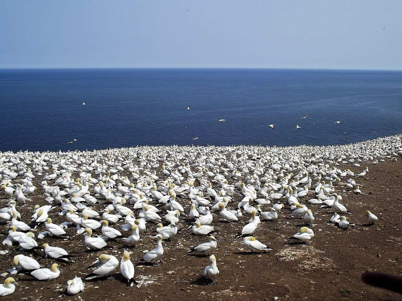
The island is part of the Sépaq-run Parc national de l’Île-Bonaventure-et-du-Rocher-Percé: your day’s costs are the boat plus the park access (~$10). Back in Percé for the night. If your legs still work, the sunset viewpoint at Cap-Mont-Joli is worth the drive-up.
Book the island boat online, not at the wharf. I watched a family of four get turned away at 9 AM on a Tuesday in August while I walked on with my phone ticket. The boats are small, the gannet season is short, and everyone wants the 10 AM sailing. Morning light on the colony is also the better photo.
Day 7 — The long leg home via the south shore (~455 km, ~6h)
Head west along Baie-des-Chaleurs — the warmest salt water in Quebec. Carleton-sur-Mer and New Carlisle are slow-lunch towns. Then 132 turns north through the Matapédia valley — river, forest, covered bridges — and spits you out at Matane. Six hours of driving is a lot, so leave by 9 AM and split the leg with a swim or a long lunch. You’re home where you started, the tank is empty, and you know exactly where the shrimp boats are.
Where to sleep and where to gas up
Sleep is easy on this loop; gas is the thing you plan around. Motels and auberges in Matane, Sainte-Anne-des-Monts, Gaspé, and Percé run ~$120–200 a night in season, and camping at Forillon and the Sépaq sites runs ~$25–40 a site. Book the Percé and Forillon nights first — those are the two that sell out. My rule of thumb: never pass a gas station on 132 with less than half a tank. I gassed up in Matane, Sainte-Anne-des-Monts, Gaspé, and Percé and never stressed about it — after the time I did.
If you’re pricing the whole trip, my Canada trip cost guide runs the same daily math for a cross-country road trip, and the summer packing list is worth a read before the Chic-Chocs — the summit can be 15 degrees colder than the coast.
What does the Gaspé loop cost?
Per person, from what I actually spent, with the rig’s gas split two ways. Pick a style, set your days, and the calculator does the rest. (Accommodation not included.)
Budget calculator
Per person, in Canadian dollars. Excludes accommodation. Gas split between two travellers.
Budget ≈ $70/day · Mid-range ≈ $120/day · Luxury ≈ $210/day. Excludes accommodation. Fares and park fees checked October 2026.
| Expense (per person / day) | Budget | Mid-range | Luxury |
|---|---|---|---|
| Accommodation | $25–40 (campsite) | $140–200 (auberge/motel) | $280+ (gîte/hotel) |
| Food & drink | $25 | $50 | $95 |
| Park fees & tours | $10 | $20 | $40 |
| Gas (split two ways) | $25 | $35 | $50 |
| Coffee, treats & souvenirs | $5 | $15 | $25 |
| Daily total | ~$95–110 | ~$260–330 | ~$490+ |
FAQs about the Gaspé Peninsula road trip
How many days do you need for the Gaspé Peninsula?
Four days minimum, seven days properly. Four covers the loop’s highlights if you drive every morning and skip the summit hikes and Bonaventure Island. Seven gives you Forillon, the island, Mont Jacques-Cartier, and Percé without rushing.
Is there cell coverage on the Gaspé Peninsula?
Spotty. You’ll have signal in Matane, Sainte-Anne-des-Monts, Gaspé, and Percé, and dead zones along the north-shore cliffs and inside the parks. Download offline maps before you leave Matane. I lost signal for about two hours between Mont-Saint-Pierre and Gaspé — which was honestly fine, since the only thing I needed the phone for was photos.
How far apart are the gas stations?
Farther apart than feels comfortable. The rule is simple: never pass a station on 132 with less than half a tank. Village stations close early — sometimes at 6 PM. Gas up in Matane, Sainte-Anne-des-Monts, Gaspé, and Percé and you’ll never think about it.
Is the Gaspé Peninsula French-only? Will I manage in English?
The peninsula is French-first — menus, signage, and most locals speak French first. Tourist-facing staff in Percé, Forillon, and the parks usually speak English, and a few basics (bonjour, merci) go a long way. I’d call my French embarrassing and I ate very well for seven days. Point, smile, and don’t start the conversation assuming English.
Can I do this loop in winter?
Not the way it’s written here. Most park services, the Bonaventure Island boats, and the lighthouse tours close around mid-October, and parts of 132 get serious snow. This itinerary is a June-to-October trip, best in July through September.
Can I rent a car one-way — say, fly into one end and out the other?
Yes, but it costs extra. The major rental companies allow one-way rentals with a drop fee that often runs $150–300 on top of the weekly rate. The practical combos: fly into Montreal or Quebec City, rent, return the car there — or take the year-round Baie-Comeau–Matane ferry and start at Matane. Compare the one-way fee against just driving the return leg; 132 westbound has different light and it’s honestly half the trip.
Keep exploring
The loop’s done, the tank’s empty — here’s where I’d go next:
- Renting a car in Canada — the insurance and one-way-fee details, before you book the rig
- Canada trip cost guide — the same daily math, scaled up to a cross-country road trip
- Canada summer packing list — the summit can be 15 degrees colder than the coast on the same day
Drive it counterclockwise. Gas up in Sainte-Anne-des-Monts. Watch for moose at dusk. And when the fog eats Forillon — because it will — get lunch and come back in the afternoon.
1 comment