
Last updated: October 3, 2026
The short answer
- Days 1–2: Sea to Sky Highway to Whistler (125 km), then the long interior leg to Kelowna — 7 days, ~2,100 km total.
- Days 3–4: Okanagan wine country and the short hop over to Revelstoke, with Mount Revelstoke’s alpine meadows.
- Days 5–7: Rogers Pass and Yoho National Park (Emerald Lake, Takakkaw Falls), then the long haul home down the Fraser Canyon.
Here’s the deal: this is the greatest-hits loop of British Columbia. One rig, seven days, roughly 2,100 km of the best pavement in Canada — ocean fjords, a desert valley full of wine, alpine passes, and a turquoise lake that doesn’t look real. I drove the whole loop in September 2026, notebook on the dash, fuel receipts in the glovebox, and this is the version with the bad decisions edited out.
Buckle up. This one’s a driver’s trip.
A note before you turn the key: this itinerary assumes you’re behind the wheel of your own rig or a rental with decent mileage, and it assumes summer driving conditions — late June through September. I priced everything below in October 2026 dollars, and I marked estimates with a ~ so you know what I actually paid for versus what I’m guessing.
Before you turn the key: the boring stuff that saves the trip
The trip is seven days. The paperwork takes twenty minutes. Don’t skip it.
- When to go: Late June to September. The Yoho Valley Road to Takakkaw Falls — one of the headline stops on Day 6 — is only open roughly mid-June to mid-October, and Mount Revelstoke’s alpine road usually doesn’t open until late June. July and August are busiest; September is the sweet spot for thinner crowds and golden larches.
- National park passes: You’ll cross four Parks Canada parks (Mount Revelstoke, Glacier, Yoho, plus the option of Kootenay). An adult Discovery Pass is $83.50 for 12 months; daily admission runs about $12.25/adult. Two adults doing this loop for even four park days break even on the annual pass — I bought mine at the first gate and was ahead by day five. → Parks Canada — Yoho visitor info & fees
- BC Parks day-use passes: Garibaldi Provincial Park (on the Day 1 corridor) needs a free vehicle day-use pass at the Cheakamus, Rubble Creek, and Diamond Head trailheads, Friday–Monday and holidays through October 12. Passes are released at 7:00 AM two days ahead, and as of fall 2026 you need a BC Parks account to grab one. I double-checked this on the BC government release before my trip — do the same, because it changed this year. → BC Gov — day-use pass system for 2026
- Fuel: BC averaged about 197¢/litre in September 2026. This loop runs ~2,100 km; in a compact SUV at 8 L/100 km that’s roughly 170 litres, or ~$330 in gas. Gas up in the big towns — Kelowna, Kamloops, Golden — because the passes have long gaps between pumps. I left Kelowna on a quarter tank once with a plan to “gas up in Merritt.” Merritt was 130 km of headwind away. I’ve made this mistake so you don’t have to.
- Winter tires: Legally required on most BC highways — including the Sea to Sky and the Coquihalla — from October 1 to March 31. Minimum M+S marking, 3.5 mm tread. If you’re driving this loop in late September, check the forecast before you go. → BC Gov — winter tire & chain requirements
Day 1: Vancouver → Whistler on the Sea to Sky (125 km, ~2 hours)
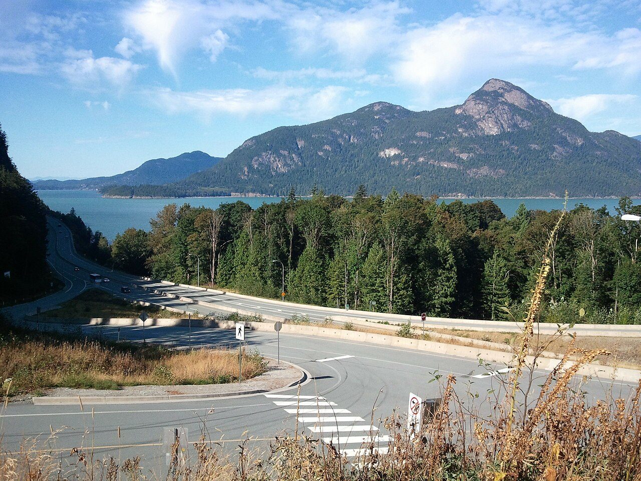
Day 1 is the easy leg. Highway 99 north from Vancouver hugs Howe Sound for 125 km, and the whole drive is basically one long excuse to pull over. I once tried to cram Shannon Falls, the Sea to Sky Gondola, and a detour to Joffre Lakes into this same day. The trailhead parking gods laughed. Pick two stops, tops.
8:30 AM — Wheels up from Vancouver
Get out of the city before the morning crush. Grab fuel and coffee in the city — the Sea to Sky has services but everything costs more north of Horseshoe Bay. Sit whoever’s riding shotgun on the right side heading north. Water views. No charge for that advice.
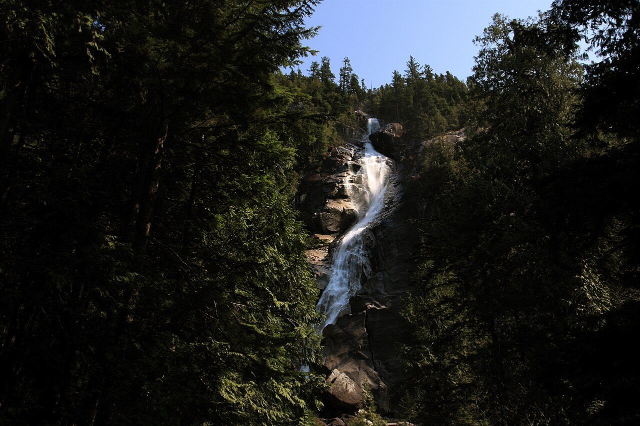
10:00 AM — Shannon Falls (free)
Twenty minutes south of Squamish, the boardwalk to the main viewpoint is a 10-minute stroll from the day-use area. 335 metres of water coming off a cliff face — the third-tallest falls in BC. Allow an hour, stand in the mist for a minute, keep moving. Free entry, and the parking lot clears out by mid-morning if you’re late. For the full Whistler playbook, see our 3-day Whistler itinerary.
12:30 PM — Sea to Sky Gondola, optional (~$73.95 online adult)
If you skipped Whistler sightseeing time and want your altitude fix here: the gondola climbs 885 m above Howe Sound with the Sky Pilot Suspension Bridge and the Summit Lodge restaurant up top. I checked the current hours on the official site before I went — summer hours run 9:00 AM–8:00 PM, and they tighten up from mid-September. Book online to save a few bucks. → Sea to Sky Gondola — official hours & prices
4:00 PM — Whistler Village
Roll in, drop bags, and stretch your legs on the Village Stroll. If you want a ride to altitude, the PEAK 2 PEAK Gondola’s 2026 summer season ran about $110/adult — check current dates on Whistler Blackcomb’s hours page, because the summer season was already over when I drove through in late September. Overnight in Whistler. Day 1 spending: gondola ~$74 (optional) + food ~$40 ≈ ~$115.
Day 2: Whistler → Kelowna — the long leg (~590 km, 7 hours)
This is the big one. The longest drive of the trip, and the one that makes the itinerary work. Two routes:
- The fast way: Sea to Sky south to Vancouver, then the Coquihalla (Hwy 5) through Merritt to Kelowna. About 590 km, 6.5–7 hours. Divided highway, good speeds, boring in places. This is what I did.
- The scenic way: Hwy 99 north through Pemberton and Lillooet, then the Duffy Lake Road to the Coquihalla junction. Adds about an hour, and the Duffy Lake stretch — one turquoise lake after another with a 1,200 m pass — is worth the detour on a clear day. No joke, it’s some of the prettiest pavement in the province.
8:00 AM — Leave Whistler with a full tank
Seriously. Gas up before you leave. The Coquihalla climbs to 1,244 m at the Coquihalla Summit and there are long stretches between services. A guy at the pump in Merritt told me the tow bill from the summit starts around $300 — I believed him enough to top up in Merritt too, even though I didn’t need it.
12:30 PM — Lunch in Merritt (~$20)
Halfway mark. Country-music capital of Canada, and the diners along Voght Street know their audience: big plates, fast service, pie. Gas up again here if you’re nervous. I wasn’t, and I should have been.
4:00 PM — Drop into the Okanagan
The Coquihalla descent into West Kelowna is the moment the trip changes personality: the forest gives up, the sagebrush starts, and suddenly it’s 30°C and everything smells like pine resin and heat. Overnight in Kelowna — our 3-day Kelowna itinerary has the full breakdown if you want to linger. Day 2 spending: gas ~$70 + food ~$50 ≈ ~$120.
Day 3: Okanagan wine country (0 km of driving, if you’re smart)
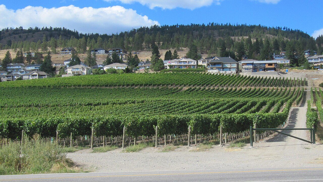
The Okanagan is Canada’s Napa — 185+ wineries strung along 200 km of lakes in a desert microclimate. After yesterday’s 7-hour haul, park the rig. This day runs on your feet and other people’s vans.
10:00 AM — Myra Canyon trestles (free)
Start moving before it gets hot. The Myra Canyon section of the Kettle Valley Rail Trail crosses 18 wooden trestles and two tunnels high above Kelowna, and it’s flat enough to bike or walk. Rent a bike in town (~$40 half-day) or just walk the first few trestles. I walked in running shoes, felt virtuous, and was back in town by lunch.
1:00 PM — West Kelowna wineries (tastings ~$15–25 each)
Pick a cluster and stay put: the West Kelowna Wine Trail or the Naramata Bench across the lake. Most wineries charge a tasting fee that’s waived with a bottle purchase. Book a wine tour van or designate a driver — the RCMP runs checkstops on the wine routes in summer, and they’re not kidding around.
Personal confession: at the second winery I bought six bottles and left them in the trunk through a 35-degree Okanagan afternoon. Cooked wine. Six bottles of expensive vinegar. Bring a cooler. I’ve made this mistake so you don’t have to.
7:00 PM — Sunset at the lake
Okanagan Lake hits 24°C in August. Swim off any city beach, grab dinner downtown. Overnight in Kelowna again. Day 3 spending: bike rental ~$40 + tastings ~$50 + wine ~$60 + food ~$50 ≈ ~$200.
Day 4: Kelowna → Revelstoke (205 km, ~2.5 hours)
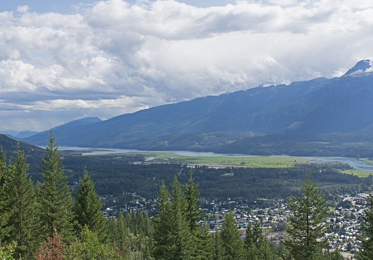
Short leg, big payoff. Highway 97A north along Okanagan Lake to Sicamous, then the Trans-Canada east into the Monashees. Watch the roadside signs: you’re entering serious mountain country now.
9:00 AM — Easy departure
Sleep in a little. Stop in Sicamous — houseboat capital of the world — for coffee if you want. The Shuswap Lake overlooks are worth one pullout. Just one. This is a short day; the point is arriving in Revelstoke with hours to burn.
1:00 PM — Mount Revelstoke National Park
The Meadows in the Sky Parkway climbs 26 km from the Trans-Canada right into subalpine wildflower meadows. In July the hillsides are red paintbrush and white glacier lilies; by September it’s golden larch time. Your Discovery Pass covers entry. Park at the top lot and walk the short summit trails — the views run all the way down the Columbia River valley.
4:00 PM — Giant Cedars Boardwalk (free)
Twenty minutes east of town, a 500-metre boardwalk loops through 500-year-old cedars. It’s a 30-minute stop and it smells like the inside of a cedar chest. Worth the detour. No joke — some of these trees were saplings when Shakespeare was alive.
Overnight in Revelstoke. Day 4 spending: gas ~$25 + food ~$45 ≈ ~$70.
Day 5: Revelstoke → Golden via Rogers Pass (150 km, ~2 hours)
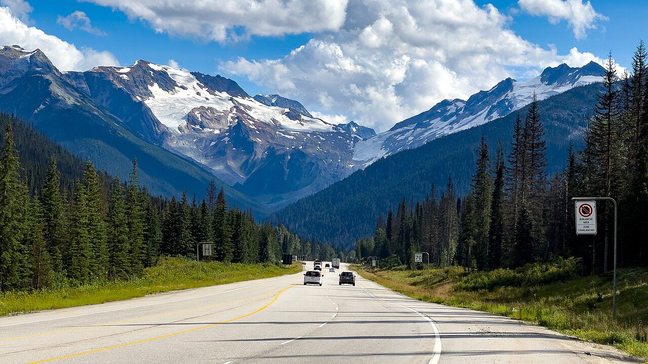
This is the drive the whole trip was built around. The Trans-Canada threads Glacier National Park over Rogers Pass (1,327 m), past avalanche sheds, snowsheds, and the stone monument to the railway workers who died building the line. Every local I asked in Revelstoke said the same thing: drive it in daylight, and stop at the summit.
9:00 AM — Rogers Pass Discovery Centre
Free with your park pass, and genuinely worth 45 minutes: the exhibit on avalanches and the railway history of the pass is excellent, and the staff will tell you the current wildlife sightings. I learned from a parks interpreter there that the pass averages over 10 metres of snow a year — standing in the parking lot in September sunshine, I still couldn’t quite believe it.
11:30 AM — The descent to Golden
The east side drops through the Beaver Valley — keep an eye out for bears on the avalanche slopes in September, when they’re bulking up on berries. Golden sits at the confluence of the Columbia and Kicking Horse rivers, and the downtown has the best burger-per-capita ratio of any town on this loop. That’s not a stat I verified. But I stand by it.
3:00 PM — Kicking Horse rest stop, literally
If you’ve got energy: the Golden Skybridge (Canada’s highest suspension bridges, ~$40) or a float down the Kicking Horse. If you don’t: nap. Tomorrow’s an early one. Overnight in Golden. Day 5 spending: gas ~$20 + activities ~$40 (optional) + food ~$45 ≈ ~$105.
Day 6: Yoho National Park — Emerald Lake & Takakkaw Falls
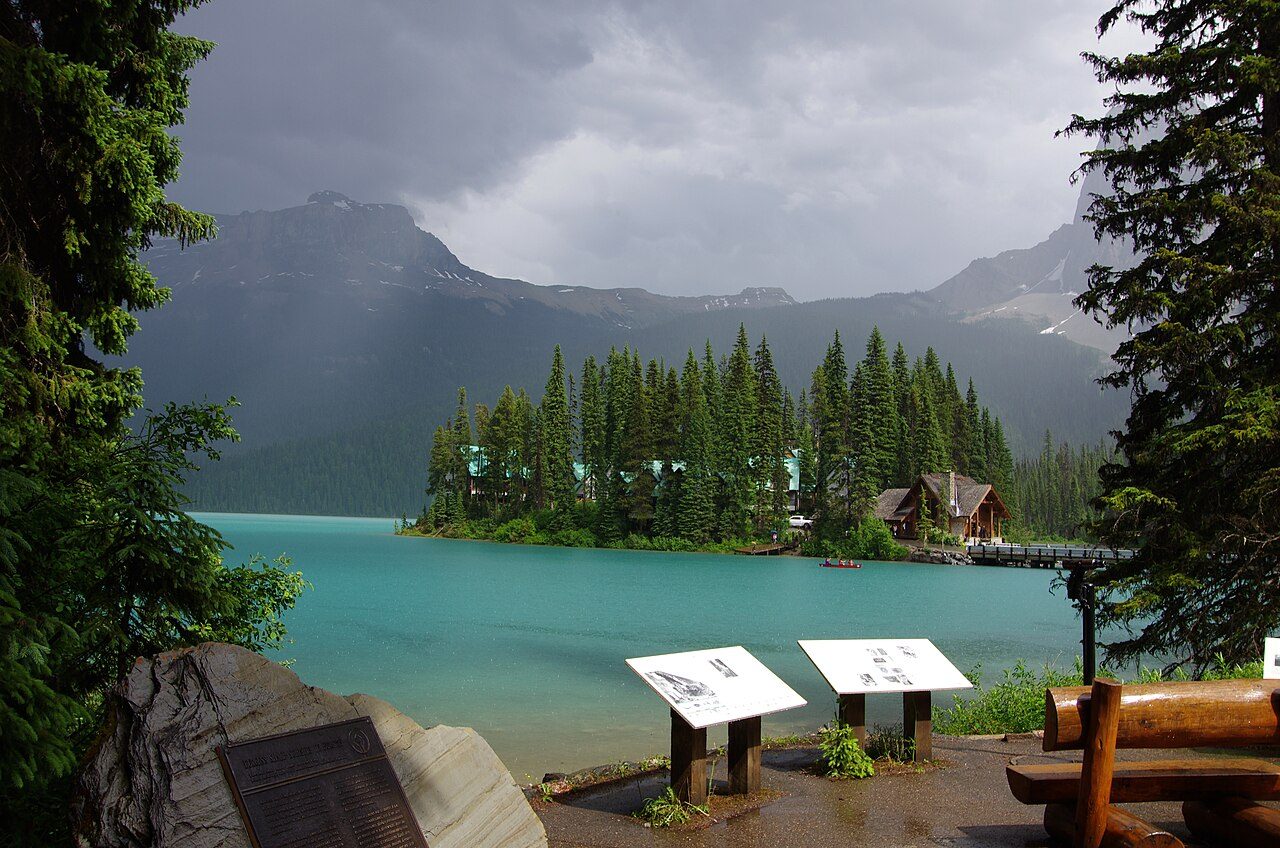
Yoho is the quiet one of the mountain parks — half the crowds of Banff, and it’s entirely in BC. The whole day runs out of Golden or the tiny village of Field, and the whole day is worth it.
8:00 AM — Emerald Lake (arrive early or don’t arrive)
Here’s the deal: the parking lot is small and the lake is famous. I rolled in at 9:30 on a Tuesday and got one of the last spots; the car circling behind me wasn’t so lucky. The 5.2 km lakeside trail takes about 2 hours and the far side is empty even when the lodge dock is packed. Canoe rentals run ~$90/hour if you want the full postcard.
11:30 AM — Natural Bridge & the Spiral Tunnels viewpoint
Both are 10-minute roadside stops on the way east. The Natural Bridge is a rock arch the Kicking Horse River carved for itself; the Spiral Tunnels viewpoint looks down at the railway engineering that replaced the infamous Big Hill. Read the interpretive sign. It’s a good story.
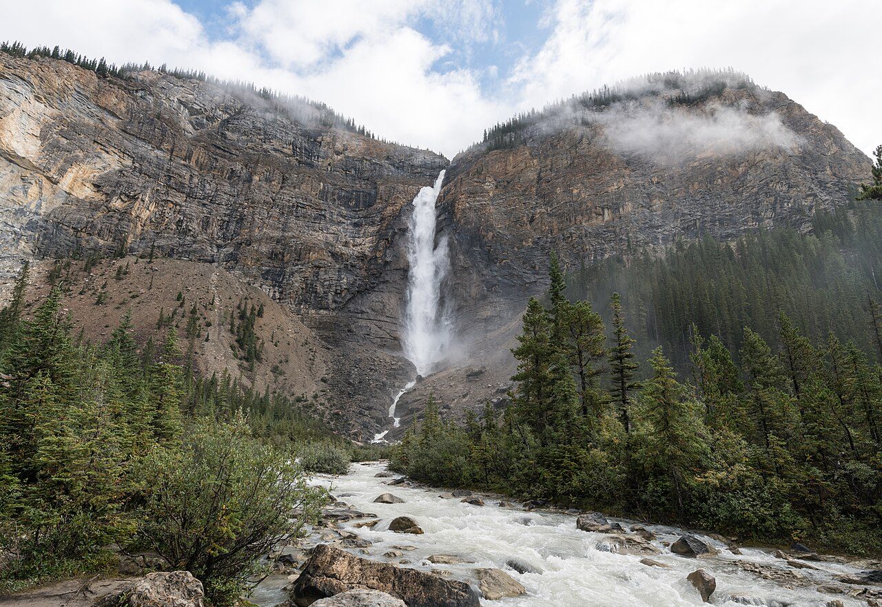
2:00 PM — Takakkaw Falls
The 13 km Yoho Valley Road climbs to the base of one of Canada’s tallest waterfalls — 302 metres of meltwater, and the spray at the viewpoint will soak you on a windy day. I walked to the base in running shoes and came back with squelching socks and zero regrets. I double-checked the road dates on Parks Canada’s Yoho page before I went: it’s typically open mid-June to mid-October only, and trailers aren’t allowed past the tight switchbacks — leave anything over 7 metres at the drop-off. → Parks Canada — Yoho visitor info
Overnight in Golden again. Day 6 spending: canoe ~$90 (optional) + food ~$45 ≈ ~$135.
Day 7: Golden → Vancouver down the Fraser Canyon (~800 km, 9 hours)
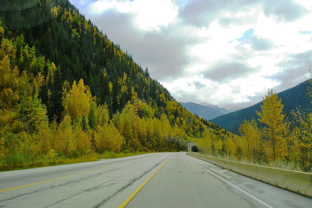
The long haul home. Buckle up: 800 km, and the honest version is that this is a driving day, full stop. Leave Golden by 7:00 AM.
7:00 AM — Wheels up, coffee in the cupholder
Trans-Canada east back over Rogers Pass (drive it again, opposite direction, new views), through Revelstoke, and down to Kamloops by late morning. This is the stretch to double-check DriveBC for construction delays before you leave — the canyon highways love a good lane closure.
11:00 AM — Kamloops pit stop
Fuel, food, stretch. Kamloops sits at the junction where you choose your weapon: the Coquihalla (Hwy 5, ~355 km, 3.5 hours, fast and high) or the Fraser Canyon (Hwy 1, ~400 km, 5 hours, slower and spectacular). If you’re not wrecked, take the canyon.
1:00 PM — The Fraser Canyon (Hwy 1)
Seven tunnels blasted through solid rock, the river boiling below, and Hell’s Gate — where the entire Fraser squeezes through a 35-metre gap. The airtram across the gorge runs ~$35 and the ride down puts you at river level where the water sounds like a jet engine. I stopped. Worth the detour.
You roll into Vancouver by early evening, ~2,100 km on the odometer, dust on the windshield, and the best week of driving in Canada behind you. Day 7 spending: gas ~$95 + Hell’s Gate ~$35 (optional) + food ~$40 ≈ ~$170.
Got 10 or 14 days? Stretch the loop.
Seven days is the tight version. If you’ve got more time:
- +3 days: Vancouver Island. Ferry from Horseshoe Bay to Nanaimo (Departure Bay) — about $17.20 per adult passenger plus $57.50 for the vehicle, 1h40 across, and you must book and pay in advance now. Saver fares from ~$49 for car and driver on select sailings. Then Victoria and the Butchart Gardens (adult $44.25 in summer → butchartgardens.com), and the long haul up to Tofino for the surf and the storm beaches. See our Vancouver Island road trip itinerary and 2-day Victoria itinerary. → BC Ferries — advance booking at Horseshoe Bay
- +4 days: the Rockies & Kootenays. From Golden, push east into Banff and up the Icefields Parkway to Jasper — the single best driving day in North America, and I’ve driven most of the contenders. See our Banff–Jasper road trip itinerary, then loop home through Radium and the Kootenays.
What does the BC road trip cost?
Sample budget per person (two sharing), prices checked October 2026; items marked ~ are estimates:
| Item | Cost (CAD) |
|---|---|
| Fuel, ~2,100 km (~170 L at ~$1.97/L) | ~$330 |
| Parks Canada Discovery Pass (adult, annual) | $83.50 |
| Accommodation, 6 nights mid-range (~$150–250/night, shared) | ~$450–750 |
| Food & drinks, 7 days (~$50/day) | ~$350 |
| Attractions (Sea to Sky Gondola, bike rental, tastings, Hell’s Gate airtram) | ~$200–250 |
| Total per person | ~$1,415–1,765 |
The single biggest variable is where you sleep. Golden and Revelstoke have solid motels in the $130–180 range; Whistler and Kelowna in August will punish procrastinators. Book the first and last nights early; the middle you can play by ear.
Timeline at a glance
| Day | Drive | Highlights | Overnight |
|---|---|---|---|
| Day 1 | Vancouver → Whistler (125 km) | Shannon Falls (free), Sea to Sky Gondola (~$74) | Whistler |
| Day 2 | Whistler → Kelowna (~590 km) | Coquihalla or Duffy Lake Road, Merritt lunch | Kelowna |
| Day 3 | Local only | Myra Canyon trestles, Okanagan wineries, lake swim | Kelowna |
| Day 4 | Kelowna → Revelstoke (205 km) | Mount Revelstoke parkway, Giant Cedars boardwalk | Revelstoke |
| Day 5 | Revelstoke → Golden (150 km) | Rogers Pass, Glacier National Park, Golden Skybridge | Golden |
| Day 6 | Golden → Yoho (local) | Emerald Lake, Natural Bridge, Takakkaw Falls | Golden |
| Day 7 | Golden → Vancouver (~800 km) | Kamloops, Fraser Canyon, Hell’s Gate airtram | — |
FAQs about the British Columbia road trip
How many days do you need for a BC road trip?
Seven days is the minimum for this loop — Vancouver, Whistler, the Okanagan, Revelstoke, and Yoho — at roughly 2,100 km. Any fewer and you’re just collecting windshield time. Ten days lets you add Vancouver Island (see our Vancouver Island road trip itinerary), and fourteen stretches into Banff and Jasper via our Banff–Jasper itinerary.
What is the best month for a BC road trip?
Late June through September. The Yoho Valley Road to Takakkaw Falls and Mount Revelstoke’s alpine parkway don’t reliably open until mid-to-late June, and September brings thinner crowds and golden larches. October is a gamble — winter-tire rules kick in October 1 on the mountain highways, and high-country snow can close things early.
How much does a 7-day BC road trip cost?
Budget roughly $1,400–1,800 CAD per person sharing (October 2026 prices): about $330 in fuel for the ~2,100 km loop, $83.50 for an annual Parks Canada Discovery Pass, $450–750 for six nights of mid-range accommodation, ~$350 for food, and ~$200–250 for attractions like the Sea to Sky Gondola, winery tastings, and the Hell’s Gate airtram.
Do I need a national park pass for this route?
Yes — the loop crosses Mount Revelstoke, Glacier, and Yoho national parks, all of which charge Parks Canada admission. An adult Discovery Pass is $83.50 for 12 months (a family/group pass $167.50); daily admission is about $12.25/adult. For two adults spending four-plus days in parks, the annual pass pays for itself. Buy it at the first park gate you reach.
Can I do this road trip in an EV?
Increasingly, yes. BC Hydro’s fast-charging network now covers the main corridors — the Coquihalla, the Trans-Canada through Revelstoke and Golden, and the Okanagan all have DC fast chargers. Plan charging stops like fuel stops and you’ll be fine in summer. In winter, range drops and some chargers are exposed to the weather, so this loop is really a June-to-September proposition for EVs too.
Is the Sea to Sky Highway scary to drive?
No — and I say that as someone who white-knuckled it the first time. It’s a modern divided highway for most of its length, well-maintained, with guardrails and wide shoulders. The “scary” reputation is a leftover from the pre-2010 two-lane days. Drive it in daylight, watch for rockfall signs near Porteau Cove, and you’ll wonder what the fuss was about.
3 comments